fbpx

Simulating Thunderstorm Convection Craziness

Pilots can explore flying in massive and lightning-laden downpours in Microsoft Flight Simulator 2020, which offers convection realism.

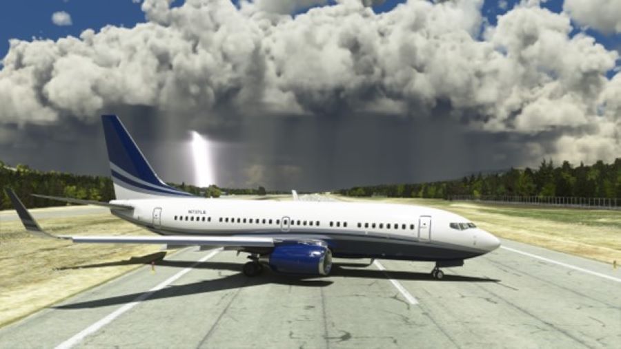
Thunderstorm season is in full swing nationwide and around the globe. Nothing could strike more fear in an experienced pilot than accidentally straying into a monster storm. 

Yet every year we see news stories about airliners that have their noses punched in by hail or cockpit window layers shattered and cracked. In June 2009, Air France Flight 447, an A330, was destroyed during severe storms over the Atlantic after stalling and plummeting to the ocean. Faulty pitot units and inexperienced relief pilots at the controls were also considered factors in the incident, according to French civil aviation safety investigators.

Pilots can explore flying in thunderstorms in Microsoft Flight Simulator 2020 (MSFS), which offers convection realism.

MSFS’ default weather does a pretty good job of interpolating where thunderstorms are located. For this example, I flew a morning trip from the Southern California/Los Angeles area over to the Palm Springs region as actual live thunderstorms were expanding. 

With ForeFlite running, I headed right for the convective area. My weapon of choice was the A319 corporate jet available from the sim marketplace online—the “Latin VFR” Airbus series, or LVFR.

Heading from the Palm Springs International Airport (KPSP) area east-northeast to the convection in the A319, I cruised toward it at 17,000 feet—a dangerous altitude for storm investigation. [Image courtesy of Peter James]
Radar shows the core of the storm in the same approximate place as the actual radar on ForeFlite. The detail is amazingly realistic as the yellows didn’t really start to pop until I got close—very much like real life. Here, I am 7 miles out. [Image courtesy of Peter James]
View out of the cockpit looking toward the storm cell that onboard radar was painting. The billowing clouds were located right on target with what the radar showed. [Image courtesy of Peter James]
Plunging straight in, I slowed to 250 knots and decided to see what the middle of the storm would be like. [Image courtesy of Peter James]

The view out of the window as we aim straight for the middle of the storm. [Image courtesy of Peter James]

As we entered the core of the storm, a brief, loud smashing sound of rain occurred for about 10 seconds. [Image courtesy of Peter James]

Some run-back water effect was noted too, although it’s difficult to see in this screenshot. This was all very spot on and pretty realistic, but without any added turbulence. Autopilot was on, so the aircraft held steady.

Other widely scattered  simulated storms were pulsing up around the desert areas and looked like broccoli with virga hanging down. [Image courtesy of Peter James]

Even though they were funny looking, I appreciated the fact that if you were to fly under them, you would definitely encounter rain in those precise areas.

Virga bursts from the local live convection are easily seen. It’s a great visual effect that is pretty spot on with actual live radar updates. [Image courtesy of Peter James]

In battling the live weather phenomenon, I had not seen any lighting at all. I am sure if it’s there, it would be hard to see during the daytime, just as in real life. 

MSFS includes a built-in powerful manual weather tool. Let’s build up our own convection, the stuff real photos are made out of. 

For this example, I started at Lake Tahoe Airport (KTVL) in South Lake Tahoe, California, up high in the Sierra Nevada Mountains. I am imitating realistic spring and summer storms forming over the high country with great visibility around the cells. 

Users can unclick live weather, and you’re brought to the menu that allows the option to create weather conditions. [Image courtesy of Peter James]

I “stretched” the cloud bottoms and tops to realistic values around 5,000 feet AGL, with tops over 30,000 feet. I then moved the precipitation slider to near max rainfall rates of 1-plus inches per hour. The lightning slider went up to 88.53 percent. 

For this demo, I decided to “rent” a nearby Boeing Business Jet (BBJ) courtesy of PMDG Simulations.

The visual effects were stunning! As I rotated the camera to the north, my jaw dropped. [Image courtesy of Peter James]
Looking north toward Lake Tahoe, powerful random lightning strikes were occurring with the distant rumble and bangs you’d expect. How menacing could this be, right? [Image courtesy of Peter James]
Flying northbound out of Runway 36 at KTVL and heading up over the lake, climbing to about 12,000 feet. [Image courtesy of Peter James]
The intense storm and its associated rain curtain was evident. [Image courtesy of Peter James]

One part really looks like a tornado, although I believe it’s a virga burst instead. I plunged under it in the thick of the rain. It was loud and clattering, but only for a few seconds, then we continued inbound to Truckee, California, a place I have flown a Falcon 2000 into in real life. It’s big enough to handle the BBJ. 

The mountain valley is tight, so a “crank-and-bank” turn was necessary. [Image courtesy of Peter James]

I also had a good visual on the runway, with the storm just off to the left, not quite blocking the final but almost to the centerline. 

The KTRK runway is in sight just to the right of the microburst. [Image courtesy of Peter James]
An incredible lightning strike, which brilliantly lit up the entire area. It was very realistic and a rare catch on camera. [Image courtesy of Peter James]
The landing rollout at KTRK with the active cumulous over the ridge, making for an incredible sky. [Image courtesy of Peter James]
A second circuit into KTRK for visual effects and photo taking as the storm continued to rage next to the field. [Image courtesy of Peter James]
Heading back to South Lake Tahoe, now with much better weather allowing a visual approach. Though I’m not sure how long that will hold. [Image courtesy of Peter James]
Flying southward back to KTVL over the lake with towering cumulus building again everywhere. The visual effects of the clouds reflecting on the water is quite stunning. [Image courtesy of Peter James]
Short final on Runway 18 at KTVL. [Image courtesy of Peter James]
Backtracking after landing on Runway 18, with a threatening sky behind me looking westward. I can’t believe this isn’t a real photo. [Image courtesy of Peter James]

I feel the visual quality of the skies can’t be beat in MSFS2020. The ability to manually produce the weather you’re looking for is easy and fun to tinker with. Moving cloud bases up or down, and stretching the tops and sliders for density, percent coverage, and lightning, provides endless possibilities for visual clarity and screenshot capturing. 

By using live weather, you’re pretty much guaranteed a realistic skyscape worldwide, with much being supplied via satellite and data updates in the real world from meteorological sources. It’s a true weather engine and simulation. But something more magical, more graphically enhancing results from manually adjusting the weather.

Some Tips

Be sure to use the “realistic turbulence” option selected via the in-game menus. Access this option by toggling to: ASSISTANCE OPTIONS/PILOTING/TURBULENCE to REALISTIC. Not doing this means the turbulence effects are far too muted. 

I also recommend the Honeycomb quality flight controls available from Sporty’s. FSRealistic is a must as well, a wonderful add-on of turbulence, head sway, and sound effects so necessary for immersion, no matter what you’re flying.

Login

New to Flying?

Register

Already have an account?