fbpx

Rain Falls, Rivers Rise, and Pilots Head to the Rescue

Volunteers scramble to protect aircraft from potential flooding in southwest Washington State.

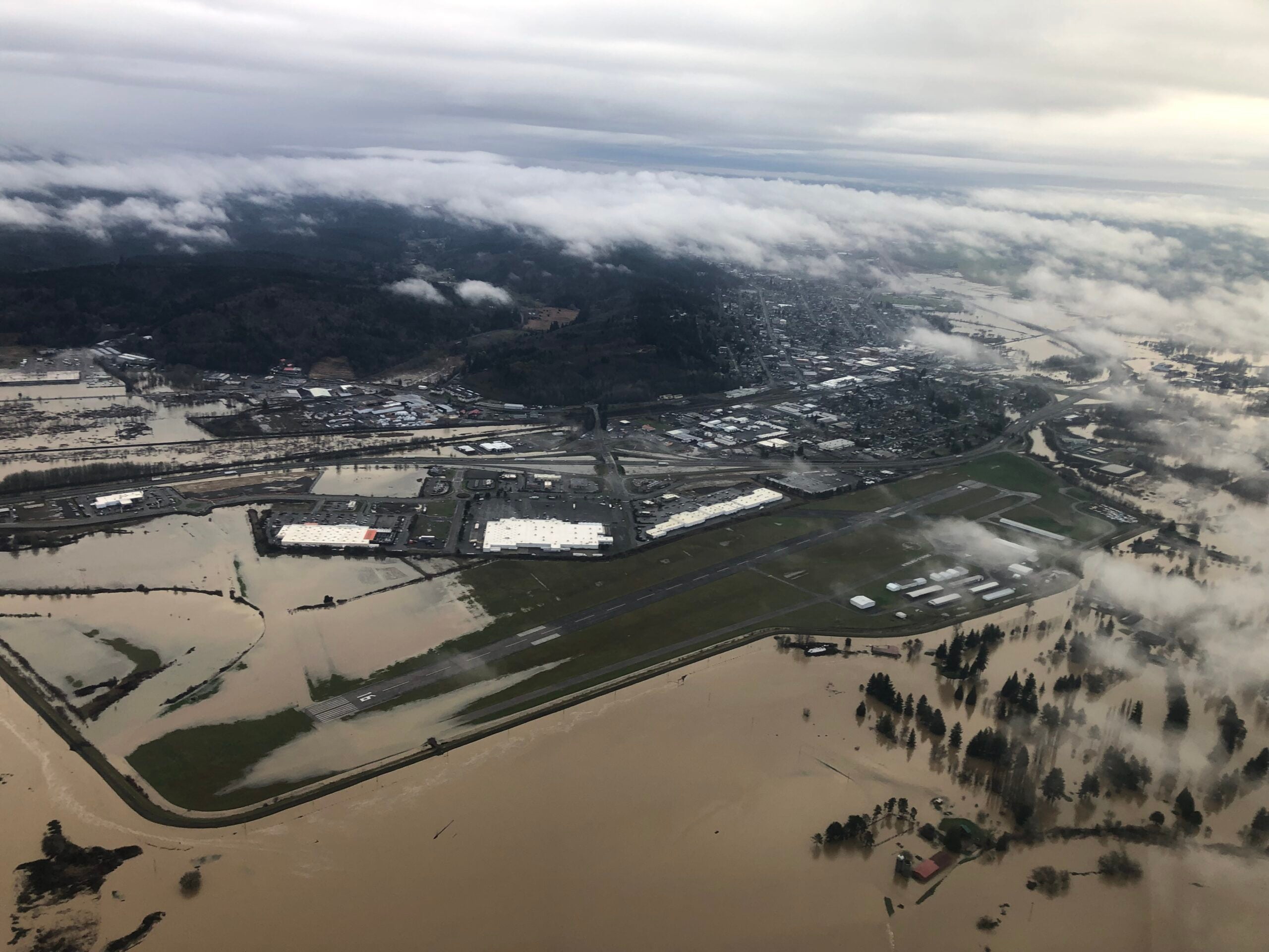
Brandon Rakes, airport operations coordinator at Chehalis-Centralia Airport (KCLS) south of Olympia, Washington, knows just how bad recent flooding in his state threatened his airport.

“We dodged a bullet with this one.”

KCLS is a non-towered airport located in the Chehalis Basin at the confluence of the Chehalis, Newaukum, and Skookumchuck rivers. For the past two weeks, Washington has been getting hammered with snow and heavy rain. The rivers, along with the many creeks that feed into them are running high and fast, several past historical flood stages.

Homes and businesses in several communities are underwater. 

“We dodged a bullet with this one.”

Brandon Rakes, airport operations coordinator at Chehalis-Centralia Airport (KCLS)

The airport has flooded before. In 2007, several hangars were filled with water. The aircraft were moved to a berm located on the corner of the airport property. Although it was at the highest point on the airport, several of the aircraft still had their tires in the water. 

Last Thursday when it became clear that the combination of heavy rain, snow, and snowmelt was putting the airport in peril, a call was put on social media, asking for volunteers to come to the airport to move aircraft to higher ground. A small army showed up and either taxied, tugged, towed, or pushed some 58 airplanes onto the berm on the southeast corner of the property.

Through the weekend, a close eye was kept on the rivers and the levee that protects the airport. If the levee was breached, it was understood the airport would be inundated. Fortunately, that did not happen.

“We had a little bit of water on the south end, but all the hangars stayed dry,” said Rakes, sounding understandably relieved.

According to Rakes, the water did pool in a few places, and it’s likely that some taxiway lights and possibly the runway end identification lights (REILs) will have to be replaced because of the water damage. 

But considering what could have happened, the airport was very lucky.

In this picture, you can see the dozens of airplanes that were moved to higher ground. [Courtesy: Washington State Patrol]

Pilots Helping More 

The airport is not the only place facing flooding. The office of Washington State Emergency Management has been relying on pilots from the Washington State Patrol to fly aerial cover to assess the flooding threat. During the week and most of the weekend Interstate 5, the main north to south road in Washington State was covered in parts with flood waters. I-5 runs parallel to the Chehalis-Centralia airport. For a time, the state was nearly cut off from the rest of the country because of flooding to the north and south and landslides and snow avalanches to the east.

Airport History

Chehalis-Centralia Airport began as a turf runway in the 1920s. During World War II, Uncle Sam took over the facility and poured some $798,799 into the development of two 5,000-foot runways, as well as a drainage system and a levee to protect the property from the nearby rivers. 

Today, only one runway remains, Runway 16/34, measuring 5,000 feet by 140 feet.

Login

New to Flying?

Register

Already have an account?