
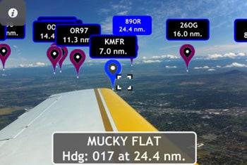


Symbolic Flight has introduced an app called ARPort, which uses GPS and the view through the iPhone’s or iPad’s camera to combine the outside view with the locations of the closest 20 airports within 25 nm through what the company calls “augmented reality.”
The app displays a tag for each airport in the viewing area and overlaps the airports that are closest. If the camera is aimed just below the tags, the identifier and distance to each airport will be displayed above the tag.