Embraer delivered its first Praetor 600E to Flexjet, the first of 12 jets the operator expects to receive this year. [Credit: Embraer]
Embraer delivered its first next-generation, super-midsize Praetor 600E to launch customer Flexjet, which expects to receive a dozen aircraft in 2026.
The 600E was unveiled in February alongside the Praetor 500E and received triple certification from the FAA, European Union Aviation Safety Agency (EASA), and Brazil’s ANAC in April. The 500E received the same certifications in July.
Also in February, Flexjet announced a firm order for 182 Praetor 600Es, 500Es, and Phenom 300Es, with options for an additional 30 aircraft, in a deal valued at up to $7 billion. Embraer said the operator will also be the 500E’s fleet launch customer and take its first delivery of the next-generation midsize jet in the fourth quarter of 2026. Flexjet said Friday it is already taking deliveries of the Phenom 300E.
Flexjet was the fleet launch customer for the first-generation Praetor 500 and 600 jets in 2019. It also launched Embraer’s Legacy Executive in 2003, Phenom 300 in 2010, and Legacy 450 in 2016.
The Praetor 600E is the first certified jet equipped with Embraer’s Smart Window. The 42-inch 4K OLED monitor, which replaces a portion of the aircraft’s interior sidewall, is supported by Starlink WiFi and supports video conferencing and high-resolution video streaming and gaming. It can also serve as a virtual window, providing a real-time view via three externally-mounted cameras.
Flexjet’s first Praetor 600E includes Embraer’s optional Smart Window upgrade. [Credit: Embraer]
Embraer said Flexjet selected the Smart Window, one of several optional upgrades, for its inaugural 600E delivery.
“Flexjet’s aircraft owner demographic has been trending younger, and they want the cabin to become part of the experience,” Michael Silvestro, Flexjet’s CEO, said in a statement. “The Smart Window will be integral in enhancing the enjoyment of the in-cabin journey. This technology is a perfect expression of our commitment to delivering the next generation of luxury private aviation today.”
Praetor 600E Comes With New Upgrades
Like the first-generation Praetor 600, the 600E has an intercontinental range of 4,018 nm with 4 passengers and NBAA IFR reserves, far enough for nonstop New York-to-London trips. Embraer bills it as the farthest-flying super-midsize jet.
The type also retains its predecessor’s two Honeywell HTF7500E engines that allow it to operate from challenging airports such as Santa Monica (KSMO). But it comes packed with plenty of new features.
The 600E’s six-foot-tall cabin was redesigned to include more ergonomic lie-flat seats, with expanded headroom and a new lounge position. An advanced Cabin Management System (CMS) has controls for lighting, temperature, entertainment, and connectivity. Other features include stone flooring, enhanced galley, and optional technology upgrades such as the SmartWindow, voice commands, Bluetooth audio, wireless charging, and mood lighting.
It retains the Praetor 600’s best-in-class baggage compartment size and 5,800-foot cabin altitude.
The 600E’s avionics suite includes fly-by-wire technology with active turbulence reduction as well as Embraer’s Enhanced Vision System (E2VS) and Runway Overrun Awareness and Alerting System (ROAAS).
Jack is a staff writer covering advanced air mobility, including everything from drones to unmanned aircraft systems to space travel—and a whole lot more. He spent close to two years reporting on drone delivery for FreightWaves, covering the biggest news and developments in the space and connecting with industry executives and experts. Jack is also a basketball aficionado, a frequent traveler and a lover of all things logistics.
In this episode of the ‘Aviation Start’ podcast, a FLYING production, host Jamail Larkins sits down with Michael Goulian, national aerobatic champion and Red Bull Air Race pilot, to lay out the real pathway into airshow flying. [Credit: FLYING]
The third episode of Aviation Start, FLYING’s career-focused video podcast hosted by Jamail Larkins, pulls back the curtain on one of aviation’s most visible and least understood careers: professional airshow flying.
“Without sponsors and partners, the airshow business is a hobby,” said guest Michael Goulian, a national aerobatic champion, Red Bull Air Race pilot, and one of the most recognized airshow performers in the world.
Goulian grew up working at his family’s flight school and soloed on his 16th birthday. A 1980 film about aerobatic competition, Cloud Dancer, set him on the path to aerobatics, and he never stopped.
Today his operation runs like a small race team, with a season stretching from late March to mid-November, roughly 15 shows a year, and a staff of about eight handling the airplane, logistics, social media, merchandise, and sponsorships. Goulian compared it to a miniature NASCAR team.
“We are a marketing company,” Goulian said. “We just happen to use an airplane to do it.”
His long-term partners, including Whelen Aerospace Technologies, AeroShell, Bose Aviation, Cirrus, Hartzell, and Lycoming, reflect a philosophy he returned to throughout the episode: sponsorship is earned through years of proven work, not landed with a pitch or a viral video.
“I hear a lot of people say, ‘I want to get a sponsor and fly airshows,'” Goulian said. “You have it backwards. How about you learn to fly, be really good, get a reputation, build a brand, then get a sponsor.”
The 10-Year Runway
For aspiring performers, Goulian laid out a clear starting point: the International Aerobatic Club, a division of EAA that runs competitions around the country across skill categories from primary through unlimited.
About 10 hours of aerobatic instruction is enough to know whether the discipline is a fit, he said, and the stick-and-rudder skills and situational awareness carry over to every other kind of flying, even for pilots who stop there.
Goulian’s own climb followed that ladder. He became the youngest national advanced aerobatic champion at age 22 while working two jobs to cover the airplane and insurance, flew local shows for little more than travel expenses, and earned his first bookings outside his region in Manteo, North Carolina, and Traverse City, Michigan. His estimate for a pilot starting today who wants to perform at Oshkosh: roughly a 10-year, full-time process.
With about 300 airshows held in the U.S. each year, Larkins and Goulian pointed to volunteering as the practical first step, whether with a local airshow organizing committee or on a performer’s crew, where relationships and mentorship open doors that a highlight reel cannot.
“There’s 11 minutes of really fun flying in the sky,” Goulian said, “but you don’t see 25 years behind it.”
Episode 3 of Aviation Start is available now on FLYING’s YouTube channel and all major podcast platforms. Aspiring aviation professionals can get matched with eligible scholarships from a database of more than $20 million at aviationstart.org.
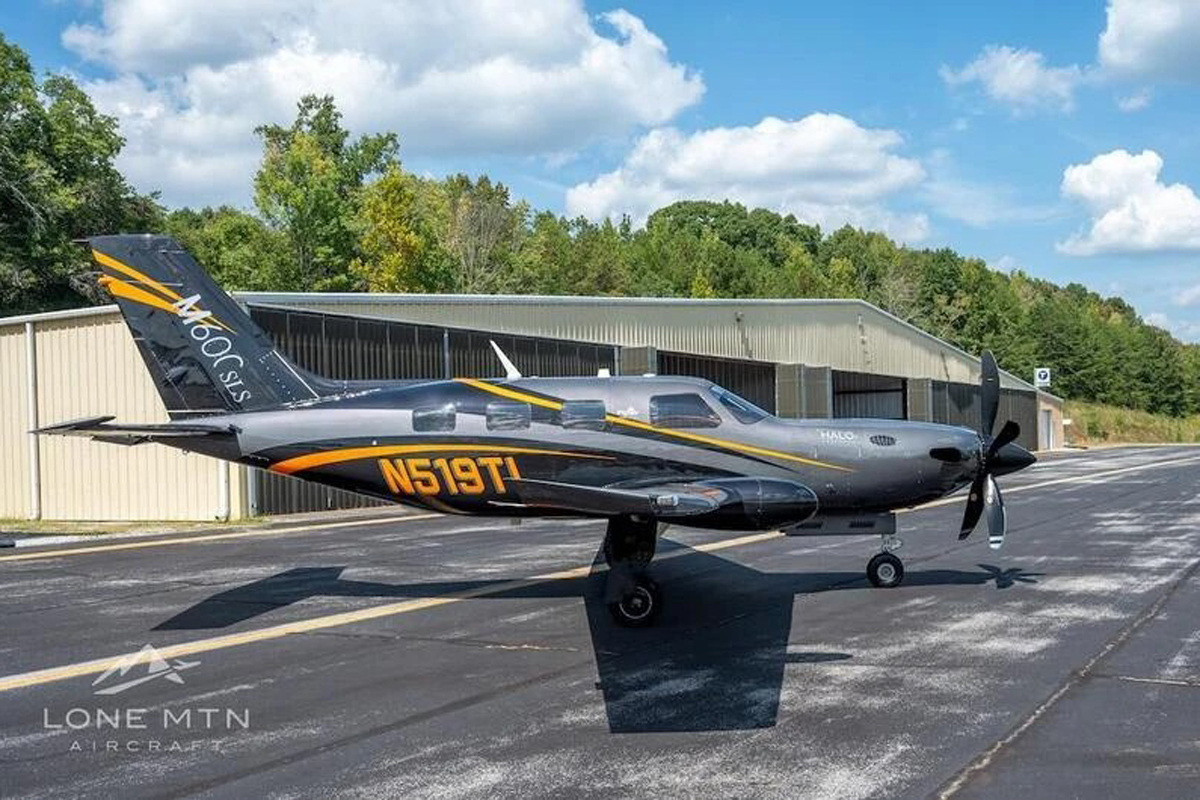
Sitting at the pinnacle of single-engine turboprop ownership, the Piper M600 SLS delivers an uncompromised blend of cross-country performance, comfort, and state-of-the-art protection. With an impressive 2,263-pound useful load and a 260-gallon fuel capacity, this versatile platform allows operators to maximize both passenger payload and range while enjoying exceptional flight characteristics.
With a mere 400 hours on the airframe since new, this 2022 model presents beautifully in a dark gray base with a light gray top and striking orange striping. The pristine exterior is complemented by a sleek, black prop spinner and exhaust stacks, all while remaining under Piper’s comprehensive airframe warranty until December 2027.
Entering the pressurized cabin, occupants are greeted by an elegant, modern environment tailored specifically for long-distance travel. The interior features sophisticated gray leather seating accented with black leather inserts and white stitching, while practical amenities like six USB charging ports, Rosen shades, Piper Aire air conditioning, and factory oxygen system ensure exceptional comfort for every journey.
Providing the muscle for this sleek turboprop is a robust Pratt & Whitney PT6A-42A engine showing 400 hours of total time against a 3,600-hour TBO. This reliable powerplant recently received a light overhaul following an ITT exceedance, carries an engine warranty through December 2029, and turns a Hartzell five-blade composite propeller backed by a warranty valid until December 2027.
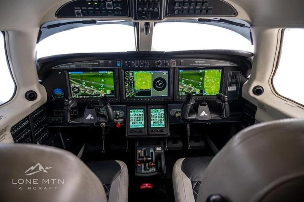
At the flight deck, situational awareness is maximized by a Garmin G3000 Avionics Suite featuring dual 12-inch PFDs, single 12-inch MFD, and revolutionary HALO Safety System. Pilots benefit from cutting-edge features including Garmin Autoland, Auto Throttle, Surface Watch, Synthetic Vision, and fully integrated GFC 700 autopilot, providing unparalleled peace of mind in demanding flight environments.
Listed at $3,100,000, this stellar turboprop comes with an annual inspection completed in July 2026 and IFR certification valid through July 2028. Whether upgrading your corporate fleet or seeking the ultimate owner-flown cross-country machine, this low-time M600 SLS represents exceptional value.
If you’re exploring ownership options, FLYING Finance can help get you airborne. Use our airplane loan calculator to estimate your monthly payments, or connect with an aviation finance expert at flyingfinance.com.
MVFR turning to IFR is serious business, so learning to read a weather report and understanding trends is critical for pilot safety. [Credit: FLYING Archive]
Pretty much every pilot has a “the weather changed on me quicker than expected” story. My first experience was as a student pilot on my first solo flight outside the pattern to the practice area.
My CFI had made it a rule that I had to call him before solo so we could discuss the weather and NOTAMs and also what I intended to do on that flight. The training was Part 61, and we were not using a syllabus, something that I regret in hindsight, although I understood that I needed to practice the skills I had learned.
I was west of the airport in VFR conditions when I noticed the ceiling starting to drop. A check of the automated weather at three airports—one to the south, one to the north, and my home field to the east—revealed the ceilings were dropping, and the altimeter pressure was falling.
Uh-oh. That cold front I learned about that morning that wasn’t supposed to be here until late afternoon had arrived early. I returned to the airport, where my CFI was waiting for me. He was surprised at how quickly the weather dropped and happy I knew enough to return for landing.
I was training in the Seattle area in winter, mostly on afternoons when there was maybe a three-hour window for a VFR pilot before the temperature and dew point spread converged. The limitations on my solo endorsement read “must check ATIS/AWOS each time on downwind” and “flight will terminate when temp/dew point spread closes to within 4 degrees and dropping,” because that means fog, clouds, and mist are on the way.
The CFI made a point of taking me up in Marginal Visual Flight Rules (MVFR) conditions. The purpose of the flight was to pay special attention to the visibility in the pattern. When flying the pattern for each runway, I should be able to see particular landmarks when the visibility is at least 5 miles. If I couldn’t see the landmarks, it was time to return to land.
This technique is useful. I took it one step further, sitting down with a terminal area chart (TAC) and carefully measuring the distance between the airport runway and landmarks 3 and 5 sm away, respectively. When you’re at airport XYZ on downwind, and the water tower disappears, the visibility is below 5 miles. If you can’t see ABC mountain in the distance, the visibility is less than 3 miles, etc.
It can be a challenge to determine visibility from the air unless you are using metrics provided by GPS, so I’m a big fan of the plotter on paper technique.
Rotating Beacon in Daylight
Apparently there are some student pilots that equate the rotating beacon for the aviation version of a street light.
Back when it was socially acceptable to have free-range children, when the street and house lights came on, it was time to go home. The rotating beacon active during daylight means the airport is IFR, and if you’re a student pilot flying solo, you really should be on the ground—and it’s up to you to know that.
I mention this because of a cautionary tale shared by a chief CFI at an instructor meeting. It began with the phrase “teach your students what the rotating beacon means.”
According to the chief, the student was in the pattern practicing touch-and-goes, when the weather deteriorated. At pattern altitude the student could still see the ground around the airport, so he wasn’t too concerned. He figured if it got too bad, the tower controllers would tell him when it was time to come down.
As the story was relayed to us low-time CFIs, someone from the tower called the flight school to report one of our students was up in IFR conditions. One of the more experienced instructors grabbed a hand-held radio and used it to let the student know to make the next landing full stop.
The student was surprised by the commotion he had caused. He said he could see the runway from the pattern, so he didn’t think he was breaking any rules, although he did notice when the runway lights were suddenly lit up in the late afternoon. That was a new experience. He didn’t notice the airport beacon was activated until he landed.
What caused confusion, he said, was that when he called up the Automated Terminal Information Service (ATIS), there was no recording telling him what the weather was. “Because they were updating it!” his CFI told him.
Listen to the Tin Man
Automated weather will often be behind the actual conditions, but it’s better than nothing.
The ATIS is usually recorded and released at the top of the hour unless there’s a significant change in conditions, in which case a special ATIS will be released. Sometimes the updates can be almost comical.
I was in Renton, Washington, the day a significant winter storm was moving in. In between getting all the aircraft we could into hangars and using creative repositioning and extra tie-downs and chocks to secure the rest of the fleet, we listened to the ATIS. There were several “specials” released and on the last one, as the dark purple mass of clouds approached from the north, the person recording it let us know they’d had enough too, concluding the ATIS with “people, keep it on the ground!
Automated Weather Observing System (AWOS) and Automated Surface Observing System (ASOS) are used at nontowered airports or when the tower is closed. There are different levels of AWOS—AWOS-A through AWOS-4. The higher the number, the more information the unit relays. They can be accessed by using a specific radio frequency or by telephone. Smart pilots put that number into their mobile phones for future use and emergency reference.
It’s important that a student pilot understand that MVFR is an advisory category, not a legal restriction. However, the limitations published by the flight school and on its solo endorsements must be respected.
A review of National Transportation Safety Board accident reports show many happen when the VFR weather degrades much faster than the pilot anticipated.
You’ll find this information in Chapter 7, Section 1 of the Aeronautical Information Manual under “Categorical Ceiling and Visibility Conditions”:
VFR: Ceiling greater than 3,000 feet and visibility greater than 5 miles
MVFR: Ceiling 1,000 to 3,000 feet agl, visibility 3-5 miles
IFR: Ceiling 500 feet to less than 1,000 feet and/or visibility 1-miles
Teaching respect for MVFR rests on the CFI. You can work the pattern in MVFR, but heading out of it for maneuvers can be questionable. You don’t want to be the CFI in a VFR-only airplane who scud runs back to the airport.
Allowing learners to solo outside of the pattern on MVFR days comes down to flight school rules. Some prohibit student pilots from flying outside the pattern on MVFR days. No CFI wants to risk their ticket.
Meg Godlewski has been an aviation journalist for more than 24 years and a CFI for more than 20 years. If she is not flying or teaching aviation, she is writing about it. Meg is a founding member of the Pilot Proficiency Center at EAA AirVenture and excels at the application of simulation technology to flatten the learning curve. Follow Meg on Twitter @2Lewski.
FAA Administrator Bryan Bedford (left) and U.S. Transportation Secretary Sean Duffy announced SMART in April at the inaugural Modern Skies Summit in Washington, D.C. [Credit: Jack Daleo]
The Transportation Department said Monday that it and the FAA began rolling out SMART, an AI-based program intended to identify and mitigate potential conflicts in the National Airspace System weeks before they occur.
But the union representing tens of thousands of American air traffic controllers told FLYING that it has had no involvement in the system’s development and initial deployment.
DOT and FAA officials have touted SMART (Strategic Management of Airspace, Routes and Trajectories) as the crux of their multibillion-dollar effort to modernize the nation’s ATC system. They said Monday that the system will synthesize information from hundreds of data streams and use it to make recommendations to controllers, which they could accept or decline.
The DOT’s announcement positions SMART as an enabler of fewer disruptions, more predictable operations, and optimized routing, which could lower ticket prices. However, the National Air Traffic Controllers Union (NATCA) said it has not been “involved in the design, testing, or implementation of SMART and therefore cannot speak to its effect on the air traffic control workforce.”
“NATCA believes any new technology should complement and not replace the experience, training, and professional judgment of air traffic controllers who are responsible for the safety of the National Airspace System,” the union said in a statement.
The FAA and NATCA are contending with a shortage of thousands of certified professional controllers (CPCs), though they disagree on the exact figure. A few months ago, NATCA said it was similarly left out of the agency’s updated ATC staffing blueprint, which targets a headcount of 12,563 CPCs—thousands less than the previous goal of 14,633. In the past, the FAA has calculated targeted headcount with input from NATCA.
Airlines, by contrast, have been heavily involved in SMART’s rollout. In a statement Monday, Delta Air Lines CEO Ed Bastian said the carrier is “actively engaged in the development process.” American Airlines CEO Robert Isom said the airline is “working closely with the FAA on…programs like SMART.”
The New York Times over the weekend reported that SMART is rolling out to the facilities that manage traffic for Ronald Reagan Washington National Airport (KDCA), Dulles International Airport (KIAD), and Baltimore/Washington International Thurgood Marshall Airport (KBWI). Per the Times, it will initially manage only same-day delays rather than identify conflicts days or weeks into the future.
What We Know About SMART
SMART was first announced by federal officials in April, and DOT Secretary Sean Duffy later said a “portion” of the system was targeted to debut in September.
The DOT on Monday described the system as a “cutting-edge tool” that will centralize weather patterns, flight paths, traffic flow, controller staffing levels, and other data to “provide a comprehensive visualization of where planes are going, how much traffic the system can handle, and where congestion or weather could cause challenges.”
The idea is that aviation stakeholders could use the system to identify future issues and accept its recommendations long before conflict arises. FAA Administrator Bryan Bedford said it will do this “all while maintaining our gold standard of safety.”
For example, SMART could identify when demand for airspace exceeds an airport’s capacity and offer scheduling recommendations. These would be reviewed by FAA staff and delivered to ATCs, who could choose whether to accept them.
An executive of Thales—which was snubbed for the 12-year, $875 million SMART contract in favor of startup Air Space Intelligence (ASI)—told FLYING in April that the system would not assume safety-critical functions. Instead, it would “look across the NAS to see which sectors of the airspace may be overloaded throughout the course of the day” and “rebalance traffic.”
NATCA president Nick Daniels similarly said that SMART, as he understands it, is “about preplanning, not about somehow separating airplanes.” Daniels described the union as a “partner” on SMART but added that “we should remain skeptics until it’s actually in our hands.”
“Humans will separate airplanes,” he said. “What we haven’t had is a system that helps us manage the [NAS] before the day even begins.”
Bedford in April said the system would manage trajectories for 55,000 daily IFR flights and eliminate “gridlock” before airlines publish schedules and sell tickets.
More information emerged in June. According to the DOT’s announcement of ASI’s contract, SMART will mitigate potential conflicts “days, weeks, and even months in advance.” ASI CEO Phillip Buckendorf added that it will continually analyze airline schedules, weather, airport capacity, airspace conditions, and operational constraints.
The week before, Aviation Weekreported that Steve Fulton, an FAA senior certification adviser and technical pilot, compared SMART to the agency’s trajectory-based operations (TBO) concept and said it would deconflict “projected trajectories from each aircraft” to provide updated arrival times.
What’s Next?
The DOT said Monday that it began using SMART in a “limited mode…in the airspace around Washington, D.C.,” with “plans to gradually expand it to other parts of the country” in stages over the next few months. It partnered with ASI to build what it called a “state-of-the-art air traffic center” for managing the rollout.
Aviation Week reported that Fulton said the early operational demonstrations would focus on en route airspace 24,000 feet and above. Duffy in August said the FAA would fully deploy SMART by spring 2027 and that it would “slow-roll different aspects” rather than deploy it all at once. He estimated the project’s cost at around $10 billion.
Bedford added that broader efforts to modernize the ATC system with new and upgraded technologies and facilities would “not be successful” unless SMART is rolled out in tandem.
“We can’t control the weather, but we can control the decisions that we make to keep airspace open, or only close airspace when we absolutely have to,” Bedford said. “The primary mission of the air traffic organization is to keep things separated. None of that’s changing…It’s going to create more safe capacity to stop the traffic jams on the airports and get flights moving.”
Despite the administrator’s assurances, not everybody was on the same page leading up to Monday’s rollout.
Politico, citing “multiple people familiar with the situation,” reported that airline industry officials were panicking about the launch in the months leading up to it, privately holding concerns about the AI’s maturity and level of integration. Feelings shifted after a meeting with Bedford earlier this month, during which the FAA apparently confirmed plans to scale back what it had intended to be a much larger rollout.
The Wall Street Journal, which was first to report SMART’s planned deployment Monday, similarly reported that the launch is smaller than what officials had previously anticipated.
“We’re just in the initial stages, but it’s one of the most exciting and bold initiatives taken on by the FAA in decades,” Chris Sununu, president and CEO of Airlines for America, said Monday.
Sununu in June said airlines were “coordinating closely” with the FAA on SMART’s launch.
However, Politico reported that questions remain about how exactly SMART will work, and whether it will be effective. The outlet said that Bedford hopes to roll the system out more widely after about 90 days of testing, during which carriers will determine the reliability of its recommendations.
“If it works as we think it can, it will do more to reduce delays and cancellations than anything that’s happened in decades,” said United Airlines CEO Scott Kirby in a statement Monday.
Jack is a staff writer covering advanced air mobility, including everything from drones to unmanned aircraft systems to space travel—and a whole lot more. He spent close to two years reporting on drone delivery for FreightWaves, covering the biggest news and developments in the space and connecting with industry executives and experts. Jack is also a basketball aficionado, a frequent traveler and a lover of all things logistics.
The National Transportation Safety Board is investigating the fatal crash of a Fly Precision firefighting helicopter that went down in Yosemite National Park while battling the Dome Fire. [Credit: Skyryse]
Two crewmembers were killed in a helicopter crash while battling a wildfire Sunday in California.
According to authorities, the Eurocopter AS332L1 Super Puma was performing water bucket drops on a blaze in Yosemite National Park before it went down around 3 p.m. PST.
Authorities have not released the names of the deceased as of Monday afternoon. The National Transportation Safety Board (NTSB) is in charge of the investigation.
The helicopter was operated by Fly Precision, a full-service aviation company based in McMinnville, Oregon, that offers everything from unmanned drones and aircraft maintenance to firefighting and aircraft charters.
“It is with unimaginable sadness and broken hearts that we share the loss of two beloved members of our team,” a statement on Fly Precision’s website read. “We are devastated by this loss and are struggling to find the words. We ask for privacy and compassion for their families and our team as we grieve this tremendous loss. Please keep their families, loved ones, and our entire team in your thoughts and prayers during this incredibly difficult time.”
The helicopter crew were assigned to the Dome Fire that has been burning in a particularly remote part of Yosemite since last week.
According to Jay Nichols, a spokesperson with the U.S. Forest Service, the fire cannot be reached by ground-based motorized vehicles, so crews must hike in and rely on hand tools and aerial support. Thus far the fire is approximately 15 percent contained and has burned more than 3,023 acres near the Wawona Campground area.
Meg Godlewski has been an aviation journalist for more than 24 years and a CFI for more than 20 years. If she is not flying or teaching aviation, she is writing about it. Meg is a founding member of the Pilot Proficiency Center at EAA AirVenture and excels at the application of simulation technology to flatten the learning curve. Follow Meg on Twitter @2Lewski.
Federal officials are investigating a midair collision between two gliders in upstate New York that killed one of the pilots. The accident happened Friday around 3:15 p.m. EDT.
New York State Police have identified the dead pilot as James Morzillo, 80, of Saratoga Springs, New York.
According to preliminary information provided by the FAA, Mozillo’s aircraft (N61XC), a Schempp-Hirth Ventus-2B glider, “experienced a midair collision when the left wing struck the nose of N404CG, a Schleicher ASW 24 glider.”
The collision caused Morzillo to lose control of his aircraft. The wreckage was found several hours later in a wooded area in the community of Edinburg, New York. Morzillo was pronounced dead at the scene, according to state police.
The other pilot was not injured and was able to land safely at nearby Plateau Sky Ranch Airport (1F2).
According to investigators, both gliders had launched via tow plane out of Saratoga County Airport (5B2) and were scheduled to land at Piesco Airport (K09), approximately 37 nm to the northwest. The aircraft were en route when they collided.
New York State Police, National Transportation Safety Board (NTSB), and FAA are investigating the accident. The NTSB is in charge of the investigation.
Meg Godlewski has been an aviation journalist for more than 24 years and a CFI for more than 20 years. If she is not flying or teaching aviation, she is writing about it. Meg is a founding member of the Pilot Proficiency Center at EAA AirVenture and excels at the application of simulation technology to flatten the learning curve. Follow Meg on Twitter @2Lewski.
The Rockwell Commander provides an excellent cross-country experience with unmatched visibility. This specific model is highly regarded by pilots for its smooth trailing-link landing gear and large dual pilot and copilot doors that allow for remarkably easy access.
Sporting 2,995 total hours on the airframe, this particular Commander has been meticulously equipped with numerous performance and aesthetic modifications. The exterior benefits from an STC’d Aerodyme SuperStream mod, elevator hinge fitting upgrade, NACA dorsal fin, LoPresti hub caps, and flap gap seal kit, while safety is bolstered by 114B-style LED main and nose gear lights.
Settling into the four-seat interior reveals a well-maintained space that prioritizes passenger and pilot convenience. The cabin features upgraded gas door springs, dedicated sound-proofing kit for a much quieter ride, and external power plug to easily accommodate practical on-the-ground power needs.
Generating the thrust for this solid cruiser is a dependable 260 hp Lycoming IO-540-T4B5 engine showing 1,267 hours since a factory overhaul. It spins a McCauley propeller with 776 hours since its own major overhaul, breathing efficiently through an upgraded Bracket air filter.
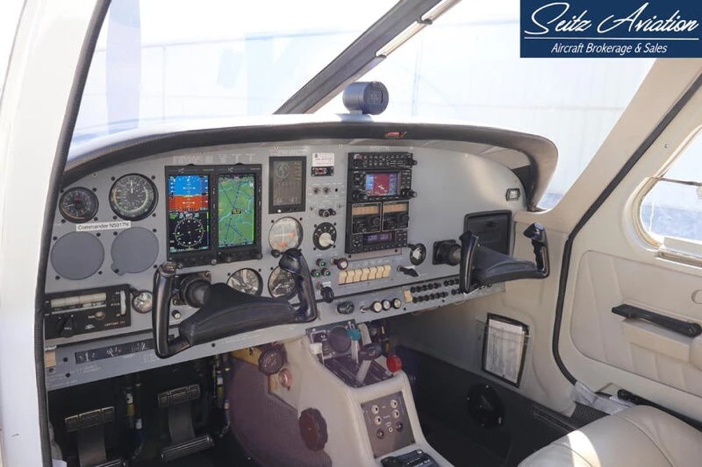
Taking command from the left seat is a pleasure thanks to a beautifully modernized, laser-cut instrument panel outfitted with a Nulite lighting system. The primary flight instruments have been upgraded to dual Aspen EFD1000 Pro Max PFDs, complementing a Garmin GNS 430 WAAS navigator, Garmin GTX 345 ADS-B In/Out transponder, Garmin GMA 340 audio panel, Collins nav/comm, and JPI EDM 830 engine monitor. There are also convenient USB power plugs, 406 MHz ELT, and Century III autopilot with functional heading mode.
Listed at $154,500, this well-documented Rockwell Commander 114A features an excellent maintenance history. Benefiting from a recent annual inspection completed in March 2026, it is primed and ready to hit the skies with its next owner.
If you’re exploring ownership options, FLYING Finance can help get you airborne. Use our airplane loan calculator to estimate your monthly payments, or connect with an aviation finance expert at flyingfinance.com.
The JMB VL3 has a bubble-
style canopy and a swept-back tail. [Credit: JMB Aircraft]
“Explore the world at over 200 knots.”
When those words appear in an aircraft advertisement, you know you’re looking at something designed to make flying fun. In this case, it’s JMB Aircraft’s VL3 Evolution. Certified as an ultralight in Europe, the sleek, high-performance aircraft has been steadily gaining attention—and popularity—among U.S. pilots.
The JMB VL3 is imported as an experimental aircraft according to Nick Weber, operations manager at Elite Pilot Services in Bend, Oregon. The company sells the low-wing design that is gaining a foothold in America as more pilots and flight schools are expanding their fleets to take advantage of MOSAIC, which makes it possible for certificated sport pilots to fly a wider range of aircraft.
If you're not already a subscriber, what are you waiting for? Subscribe today to get the issue as soon as it is released in either Print or Digital formats.
On a slightly windy day earlier this year, I first set eyes on this striking machine on the ramp at Tacoma Narrows Airport (KTIW) in Gig Harbor, Washington. Weber and demo pilot Jacob Meinig were traveling to local airports providing demo flights in the JMB VL3. I was immediately excited at the opportunity to fly it.
Some of the folks they met during their tour are looking for their next airplane—perhaps to fly cross-country to see the grandchildren. But I approached it wearing my flight instructor cap, asking questions like, “Is the aircraft appropriate to the mission of a busy flight school?”
For flight schools that exist on tight budgets, it’s important to find an airplane that can take a learner from student to private pilot, instrument pilot, commercial pilot, and flight instructor while simultaneously being student friendly and cost-effective to operate.
Ramp Appeal
The VL3 has a bubble-style canopy and a swept-back tail. The aircraft I flew was equipped with a turbocharged, fuel-injected Rotax 915 iS engine, paired with a composite four-bladed Duc Tiger propeller. The aircraft is also offered with a Rotax 912.
The VL3 is built from carbon fiber and composite materials. That enabled the designers to create complex curves that improve aerodynamic performance. Looking at this airplane, you get the impression it wasn’t built, it was carved. Part of that may be due to the fact the airplane is painted, not wrapped.
“It gets a lot of attention at the fuel pump,” said Weber. “We get people coming up to us asking us what it is, and saying it looks fast. It really turns heads. The paint is not masked off like most American planes receive. Because it is a European ultralight and every ounce matters, it is a single layer of paint.”
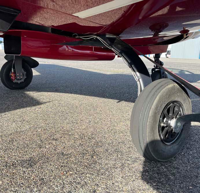
The finish is surprisingly smooth. You don’t feel a seam or a bump where the colors transition. The angle of incidence on the wings optimized cruise performance—there’s that “looks fast sitting still” thing—and a glance under the aircraft reveals landing gear that easily and aerodynamically tucks into the belly during flight. The pilot can check the position of the landing gear in flight (and especially before landing) on the Garmin G3x display by means of an optional camera mounted on the belly.
Look Inside
The cockpit features carbon-fiber and Kevlar construction. Entry into the cockpit doesn’t require a large step up or an advanced yoga pose to enter. The seating is side by side, and you have plenty of room at both the seat and shoulder level. There’s plenty of headroom, and I found myself wondering if even my client who is north of 6-foot-7 would fit in it.
The aircraft is controlled by a stick, so pilots who have most of their time behind a yoke need to prepare for a learning curve. I recommend holding the stick lightly in your palm with a two-finger grip to avoid wrist fatigue.
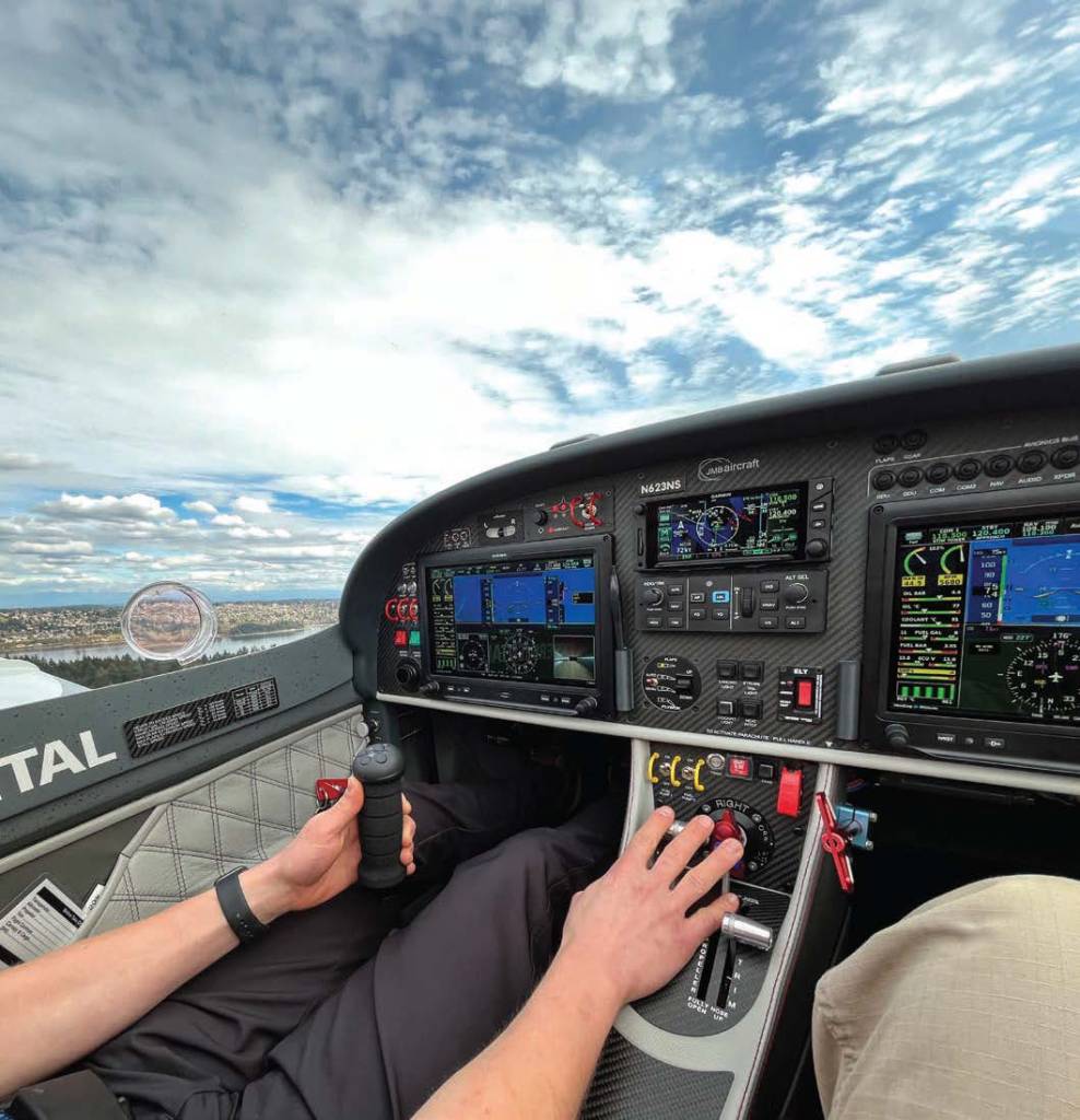
The JMB VL3 cockpit provides a modern, efficient training platform, with a Garmin G3X touchscreen display on both sides. [Credit: Meg Godlewski]
Once seated with my feet on the rudders, I leaned to the left to see if I was able to easily reach the important switches on the left side of the panel without getting jammed by the seat belt harness—a CFI thing—because you have to be able to easily reach across the cockpit.
The panel is a single piece of acrylic. Garmin G3X electronic flight touchscreen displays are on both sides of the panel. There’s a lot of information, so I recommend that in the flight school environment candidates take a few ground lessons to learn what data is most pertinent and how to cycle through pages expediently to avoid the “guess, press, hope for the best” scenario. You can configure the displays to your preferences.
I particularly liked the use of color on the panel. Not for aesthetics, but for safety. Red in an airplane when used for a lever or switch means emergency or mission critical. Yellow is one step below that. Red and yellow safety cages protect switches that activate vital systems. The fuel pumps are framed in a yellow cage. There’s a red cage on either side of the switch for the landing gear.
There are also cages over Lane A and Lane B, the dual channel redundancy of the digital engine control unit (ECU). The redundancy is part of the safety features. Both control the ECU, which is for proper engine fuel-to-air-mixture and engine ignition timing. They operate in parallel, so if Lane A fails, Lane B takes over and the engine doesn’t quit.
The bright red fuel selector lever is on the center console and easily accessible from either seat. The emergency locator transmitter (ELT) switch is just to the left of it, and on the right you’ll find the activate handle for the ballistic parachute.
Safety is key with JMB aircraft, as evidenced by Garmin Smart Glide (GSG). When paired with the autopilot and activated, it automatically engages pitch for best glide, a direct heading toward the nearest suitable airport, and sets the radio to airport communication frequency and the transponder to 7700 (emergency).
Meinig suggests GSG is a good safety feature in the event the pilot runs into trouble beyond their capability or they become task saturated.
“Obviously, as an instructor, you want to teach them to be able to handle things,” Meinig said. “But just in case you have the level button on the autopilot, so when you are sending a student out on a solo cross-country for their first time, it’s a little bit [of] extra insurance for an instructor. The pilot has an extra layer of safety. If they do end up panicking, they have Smart Glide. Take me to an airport. Calm down. All right, now I can fly the airplane.”
This airplane is equipped with a ballistic parachute. In the event of an in-flight emergency, the pilot can deploy the parachute, which is a rocket fired aft of the airplane. Embedded airplane harness straps release from the fuselage, and the aircraft and the occupants are safe in the Kevlar-reinforced cabin and float to the ground.
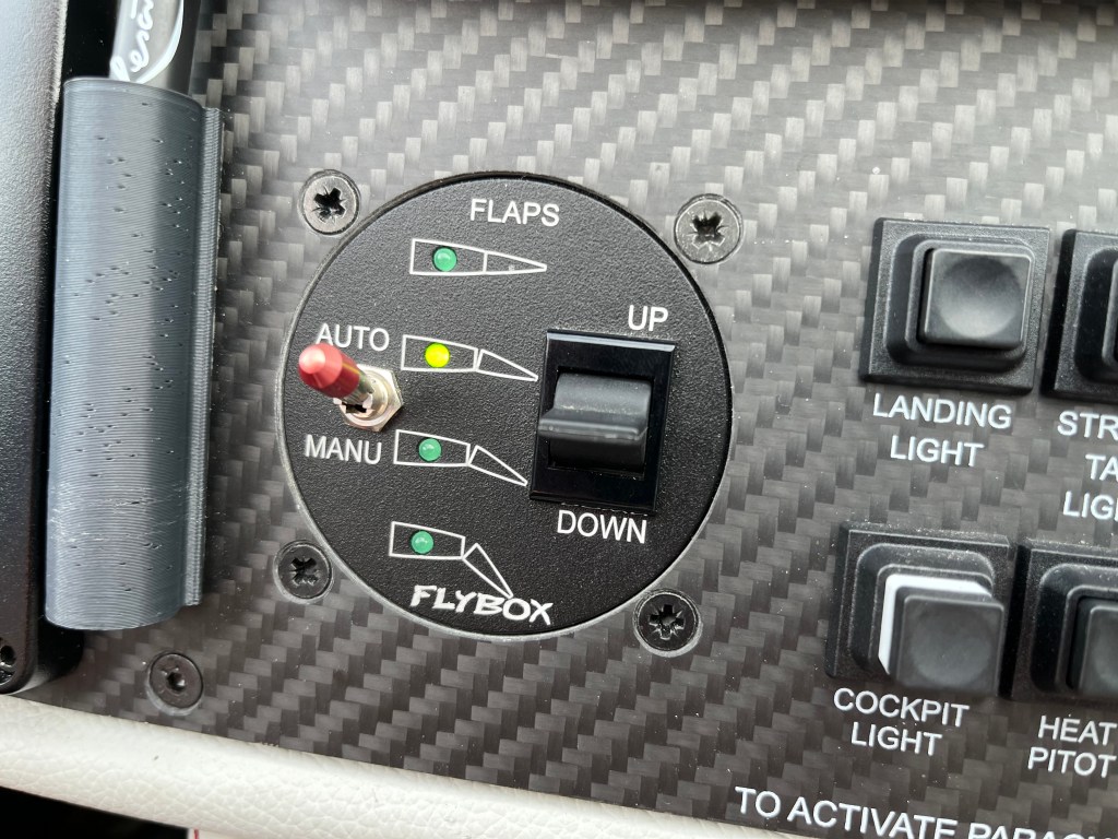
The flap indicator also received my nod of approval as it is on the center of the panel and uses pictograms to indicate how much flap you are using.
From Takeoff to Landing
The pretakeoff checklist is run directly off the primary flight display in front of the pilot. After a few minutes of checking systems, performing the takeoff briefing, and making radio calls, the power lever was brought forward, taking us down Runway 17 for a departure to the west.
The takeoff roll was quick and smooth and the liftoff and climb predictable. Meinig said the aircraft was likely more sensitive than the Cessna 172s and 182s I’m used to, but if you expect that and know how to trim, the platform is very stable. The airframe is lighter with an MTOW of 1,650 pounds as opposed to 2,300 on the Cessna 172s I usually fly.
“Once it is trimmed out on a nice day, it is a completely hands-off airplane,” said Meinig, who demonstrated this once we found some smooth air at altitude.
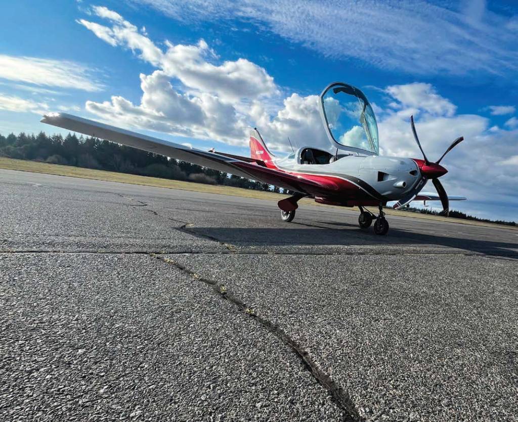
JMB VL3 on the ramp [Credit: Meg Godlewski]
The forward visibility from the cockpit is excellent, as is the side visibility for those all-important clearing turns. On the subject of turns, this aircraft is quite responsive—like a flying sports car. I like to test this at standard rate, 20 degrees, 30 degrees, and then a VFR steep turn just to see how the aircraft handles with the progression of the degree of bank. The bubble canopy offers a great view as you are rolling left or right.
The aircraft is equipped with an angle-of-attack indicator, so you know when stalls are approaching. They are predictable, and the recovery gentle. The straight-ahead descent (the old “engine is on fire, blow it out” scenario from your private pilot check ride) was downright fun.
As we buzzed around the sky the airplane felt nimble, and I found myself wondering why anyone would want to use an autopilot in this machine because it’s such a joy to hand fly.
The approach to landing was textbook with the checklist run and verifying the landing gear position via the image on the pilot’s display. This aircraft exhibited positive handling all the way to the ground. Landing took some finesse as the winds had definitely kicked up.
Do-Everything Airplane
Allow me to put on my chief CFI hat.
The VL3 may be the perfect aircraft to take a client from student all the way up through commercial pilot. By definition, the aircraft qualifies as complex and a technically advanced aircraft (TAA) as it has retractable landing gear, flaps, and a constant-speed propeller.
“The JMB is MOSAIC ready,” said Weber, listing some of the latest options available for the aircraft such as 52-gallon fuel tanks, adjustable seats, and electric trim. “Safety is something JMB really focuses on. It is built into the design of the VL3—from the parachute and angle-of-attack awareness to the thorough training they provide. Safety is their top priority.”
If you ordered a VL3 now, you might have the only one at the airport—but likely not for long.
The centrally located flap indicator (right) uses simple pictograms to clearly display flap position at a glance. [Credit Meg Godlewski]
“There are over 80 VL3 aircraft already flying in the U.S. and more arriving each month,” said Weber.
The JMB factory-approved VL3 training center is located at the Modern Pilot Flight School at Houston Southwest Airport (KAXH).
“They are also a Cirrus Platinum Training Center, so they already have a strong background in technically advanced aircraft and structured transition training,” he said. “Factory-approved training will be available for VL3 pilots, and JMB has also been working on continuing to expand the existing support network for maintenance. Our understanding is that new U.S. orders will be imported as MOSAIC aircraft once MOSAIC is fully implemented and the final consensus standards are in place. JMB has stated that it fully intends to comply with the final consensus standard to ensure the VL3 is MOSAIC ready. They started the process over a year ago.” JMB has also indicated that it still intends to offer the VL3 as experimental for buyers who prefer that route. Weber noted that I’m not the only person who saw the VL3 as a good choice for flight schools..
“There is strong interest, but many are understandably waiting for the MOSAIC pathway to be fully defined before making a commitment,” he said. “Once that is in place, we believe the VL3 could be a very compelling option for flight schools that want a modern, efficient, high-performance training platform.”
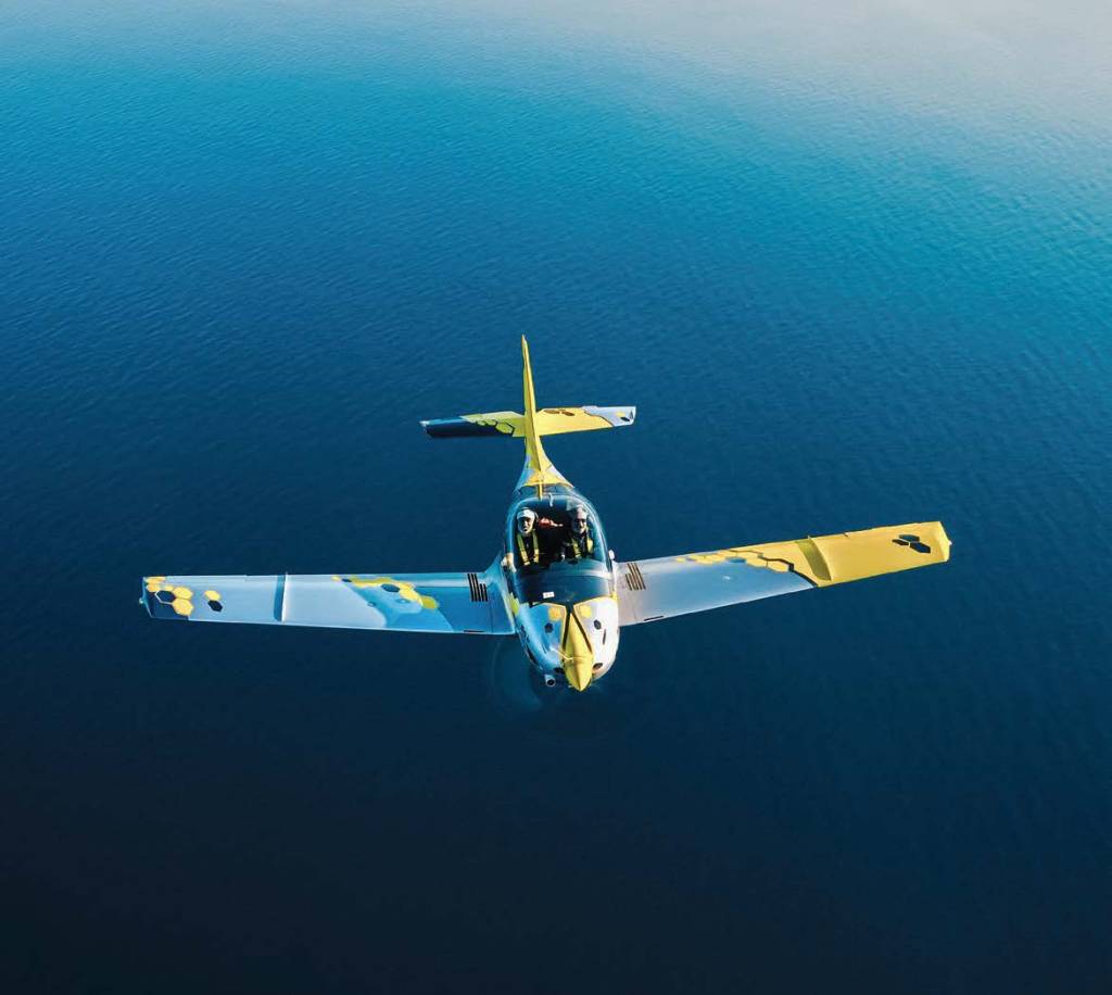
The sleek, carbon-fiber JMB VL3 offers impressive high-performance capabilities for pilots of all experience types to enjoy. [Credit: JMB Aircraft]
MOSAIC and Flight Schools
The JMB Aircraft VL3 is often described as “MOSAIC ready,” and that designation is a major reason flight schools are watching it closely. The FAA’s Modernization of Special Airworthiness Certification rule could expand training opportunities for sport pilots and increase demand for advanced aircraft such as the VL3.
So will MOSAIC really result in an economic boost to the flight school and training community? In theory, it’s possible.
Unlike the weight restrictive 2004 light sport/sport pilot rule, MOSAIC allows sport pilots to obtain training to legally fly traditional training aircraft such as Cessnas, Pipers, and Diamonds that have a gross weight higher than the 2004 LSA rule of 1,320 pounds. The details can be found in Advisory Circular (AC) 61-65K released in November 2025. The AC notes that the FAA “determined that performance-based standards are more appropriate based on the safety continuum concept, and the other existing performance and design characteristics provide appropriate limitations for sport pilot operations.”
Under MOSAIC, a sport pilot may operate an aircraft that has a “maximum stalling speed or minimum steady flight speed without the use of lift-enhancing devices (VS1) of not more than 45 [kcas], except for airplanes, which must have a VS1 speed of not more than 59 [kcas] at the aircraft’s maximum certificated takeoff weight and most critical center of gravity (CG) (14 CFR § 61.316(a)(1)).”
With additional training and an endorsement, a sport pilot can operate an aircraft with a controllable pitch prop and retractable landing gear. For the flight schools that have an RG that hasn’t seen much use since the commercial pilot certificate experience requirements changed to allow the pilot to acquire experience in a technically advanced aircraft instead of a complex aircraft, this could mean more revenue. Potentially, a large portion of the fleet is now available to sport pilot training.
JMB VL3 on the ramp [Credit: Meg Godlewski]
Spec Sheet: JMB Aircraft VL3 (916 iS)
Wingspan: 27.7 ft.
Length: 20.5 ft.
Height: 6.7 ft.
Cabin Width: 3.8 ft.
Fuel Tanks: 37 gal. with option for 52
Basic Empty Weight: 804 lbs.
MTOW: 1,653 lbs.
Useful Load: 750 lbs.
Takeoff: 320 ft.
Landing: 656 ft.
Best Rate of Climb: 2,700 fpm
Max Cruise Speed: 204 kts TAS
Stall Speed: 44 kias
VNE: 183 kias
Engine: Rotax 916iS (160 hp)
Power Fuel Burn (80%): 7.9 gph
This column first appeared in the August Issue 973 of the FLYING print edition.
Meg Godlewski has been an aviation journalist for more than 24 years and a CFI for more than 20 years. If she is not flying or teaching aviation, she is writing about it. Meg is a founding member of the Pilot Proficiency Center at EAA AirVenture and excels at the application of simulation technology to flatten the learning curve. Follow Meg on Twitter @2Lewski.
Overwhelmed by the constant stream of aviation weather data? By adopting a funnel-shaped briefing approach, pilots can filter out the noise, starting with broad patterns before drilling down into critical, flight-specific details. [Credit: Adobe Stock]
Ask 10 pilots how they get a weather briefing and you’ll likely get 10 different answers—and all of them can vary quite a bit.
Between aviation and weather apps, government websites, radar feeds, forecast model outputs, satellite loops, webcams, and social media, general aviation pilots have access to more weather information than airline dispatchers had a generation ago. The problem isn’t lack of data. It’s too much of it.
The result is a familiar trap: Pilots bounce from product to product, zooming into details before they understand the overall weather story. This can lead to confusion, wasted time, and—worse—poor aeronautical decision making.
If you're not already a subscriber, what are you waiting for? Subscribe today to get the issue as soon as it is released in either Print or Digital formats.
When I speak to a group of GA pilots at an airshow or other aviation event, I often get this question: How does a CFI, commercial pilot, and meteorologist do a weather briefing? Although I have all these qualifications, I don’t have a step-by-step method I can quickly scratch down on the back of an envelope. Even if I did, I wouldn’t be giving it away for free—it would be worth millions.
Nevertheless, as I ease into retirement, I’ll share with you a method I have used for nearly three decades. It’s a funnel approach to weather briefings. Start with the big picture at the top of the funnel, then progressively narrow your focus toward the details that matter most for your specific flight. It’s the latter part of that statement that’s key.
Information Overload
If you’ve ever opened your favorite heavyweight aviation app to “just do a quick briefing” and looked up 30 minutes later wondering how you got there, you’re not alone.
To that extent, GA aviation pilots have access to an almost absurd amount of weather information. We don’t have a weather shortage problem. We have a weather firehose problem. And the danger isn’t that pilots don’t look at enough weather. It’s that we often look at it in the wrong order—depth perception matters. When it’s not a severe clear day, GA pilots are often overwhelmed before they ever leave the ground.
Consider a typical preflight: national radar mosaics, regional radar, hourly forecasts from model output statistics (MOS), TAFs, surface observations, prog charts, PIREPs, G-AIRMETs, SIGMETs, surface observations, satellite imagery, Skew-T forecasts, forecast model guidance, and turbulence and icing forecasts—oh my. Each product answers a specific question, but none of them individually answers all of them, and looking at them out of sequence can distort your understanding and lead to bad assumptions.
The key is not to look at everything. The key is to look at the right things in the right order.
Funnel Concept
As mentioned, one way to tame the chaos is to think of your weather briefing as a funnel. At the top of it is the big picture—the overall weather pattern. As you move downward, the focus narrows until you’re looking at the fine details that matter for your flight on that day at that time.
Many meteorologists use this same funnel approach when they forecast the weather. The top of the funnel helps understand the big picture or what is referred to as the synoptic-scale weather overview. The middle is the regional view and route-specific impacts. The bottom describes the airport-level details and timing. Each step informs the next. If you skip the top, the bottom often makes no sense or may create confusion.
Most importantly, it may not spell out the intensity—are we dealing with jumping in front of a moving school bus or a Little Tikes Cozy Coupe?
The funnel approach doesn’t require more tools or better apps. It just needs discipline. By starting big and working smaller, you spend less time chasing conflicting forecasts. You avoid fixating on a single product. You will begin to build confidence in your decisions. And you will begin to think more like a meteorologist—and, yes, fewer surprises sneak up on you.
Ironically, most pilots who adopt this approach find they actually look at fewer weather products, not more. Even though I love to analyze weather, less is often more.
Top of the Funnel: Big Picture
Before worrying about ceilings at your destination, zoom out. Really zoom out.
At the top of the funnel, you’re asking a simple question: What’s the overall weather pattern doing? Essentially, at the widest part of the funnel, you’re not asking, “Can I fly at 10 a.m.?” You’re asking, “What kind of day is this?” You’re not hunting for specifics or details. You’re looking for structure.
Start with weather guidance that shows overall patterns, not details. This is where surface analysis charts, prog charts, upper-level winds, and broad satellite imagery shine. You’re looking for the book jacket cover story to understand what the book is about. These are structural things: Is high pressure in control, or is the atmosphere unsettled? Are fronts nearby—and moving? Is the jet stream overhead or well displaced? Is convection likely or suppressed?
This includes the most recent surface analysis charts and their forecast counterpart, the prog charts. Upper-air constant pressure charts play a huge role in the overall patterns (500 mb, jet stream). Even if you’re not planning to fly at those higher altitudes, knowing how the atmosphere is poised will give you both quantitative (wind speed and direction, for example) and qualitative guidance (sharp V-shaped meridional flow pattern). You might also want to examine the broad satellite imagery, learning where clouds are located and evolving over time. Are they deep, convective clouds or perhaps dense fog? And how broad is the cloud coverage? Is it mostly overcast or more scattered?
This step doesn’t need to take long, maybe five to 10 minutes. But it frames everything else, so you need to be complete. A marginal forecast under a stable ridge behaves very differently than the same numbers ahead of a fast-moving cold front. A scattered cumulus day under an upper-level ridge (high) behaves quite differently than a pre-frontal, warm-air-advection day—even if both show VFR at your departure airport.
Middle of the Funnel: Flight Context
Once you understand the big picture, narrow your focus and move to your region and route. Now you can ask different questions: How does this weather system affect my flight path? What hazards are realistic, and which are not?
Here’s a familiar scenario. You start with surface observations (METARs) and see VFR flight conditions at both ends of the trip. Encouraging. Then you glance at radar and notice a smear of yellow and green along your route. You open the hourly forecast and see ceilings flirting with your personal minimums around arrival time. A model-based product suggests it clears out earlier than expected. Another shows lingering moisture. Now you’re toggling between screens, zooming in and out, trying to reconcile conflicting information. At the end of it all, you’re not sure whether conditions are improving or deteriorating—or whether you should even go.
What’s missing isn’t another weather product. What’s missing is context.
Useful tools here include regional radar, convective outlooks, airframe icing and turbulence guidance, and winds and temperature aloft forecasts, including the height of the lowest freezing level. Because you already understand the larger weather pattern, these products now have significant context.
A turbulence forecast makes sense when you know you’re flying beneath a strong upper-level jet streak. A radar return means something different when you know the air mass is stable versus unstable. That widespread area of low stratus is there because of a radiation fog event that occurred overnight under high pressure. This is where many pilots start their briefing—and where confusion often begins.
Bottom of the Funnel: Details That Matter
Only after the first two steps should you zoom all the way in. This is where airport-specific products belong that include surface observations (METARs), terminal aerodrome forecasts (TAFs), MOS forecasts, pilot weather reports, timing of ceilings, visibility and surface winds.
Instead of drowning in a firehose of meteorological information, skilled pilots can use a structured funnel method. This technique prioritizes the big-picture weather patterns, ensuring essential flight details are prioritized for safer decision making. [Credit: Adobe Stock]
At this point, you’re refining decisions such as the exact time of departure, cruise altitude, fuel and alternate considerations, IFR vs. VFR, and risk tolerance adjustments (personal minimums). Because you already understand the weather story, these details confirm—or challenge—your plan instead of dictating it blindly.
When you reach this point with a solid mental model of the atmosphere, the details feel less overwhelming—and far more useful.
Why the Funnel Works
The funnel approach reduces information overload. Too much information all at once can overwhelm most seasoned pilots.
You can’t eat the entire elephant all in one bite, but some pilots try.
It also prevents fixation on single products. You begin to integrate the weather guidance in a way that works to your advantage, not against you. It improves weather interpretation. The more you step through the process, the better interpretation you will have to utilize all of those fine details. Lastly, it supports better aeronautical decision making (ADM) because it is generally repeatable and easy to catch omissions.
Most importantly, it actually mirrors how most skilled meteorologists think—pattern first, details second. Pilots who adopt this method often find their briefings are faster, clearer, and more confidence building, even though they’re using fewer tools to reach the end result.
Learning the Tools
I’ve always had a love of carpentry. No, I am not a master carpenter by any stretch of the imagination and will never be. But what I learned over the last 50 years is that you need to know how the tools of the trade work to build a cabinet, bunk beds, shed, or outdoor deck, especially if you want to do it safely and be proud of what you produce.
Learning the tools of weather are very similar. To build a firm weather briefing requires that you learn how to use the tools of the trade. No, you don’t need to have the skills of a highly trained meteorologist, but you do need to be able to utilize those tools safely so that the end product is useful and accurate.
As a flight instructor, I spend an enormous amount of time teaching pilots how to use these tools and, most importantly, learn their limitations. Too many pilots often try to use the wrong tool for the job, like using a screwdriver when a hammer works the best.
This means learning simple but critical aspects of the tool, such as knowing when the guidance used is valid.
For example, graphical AIRMET (G-AIRMET) snapshots for the conterminous U.S. are valid at a single time whereas the retired legacy AIRMETs were time-smeared over a six-hour period—a subtle but important distinction in how to interpret those advisories. Even knowing how often a product is issued or the details behind how it is issued helps you understand the freshness of the guidance. Most SIGMETs for severe or extreme turbulence and severe icing live and die by pilot weather reports.
Just like power tools, weather products all have designed limitations.
For example, TAFs are forecasts at an airport which is the area within 5 sm from the center of the airport’s runway complex. That’s a very tiny area. Many pilots use a TAF as a zone or area forecast. When the weather is homogeneous, that might work fine. However, when the weather is changing or developing rapidly or the confidence of an event is low, using a TAF as an area forecast will eventually bite you. It’s designed to be used as a point forecast, and the local forecasters are betting that this tiny region will not be impacted by those isolated or scattered thunderstorms, although you may encounter them while en route to your destination.
Final Thought
More weather data does not automatically equate to better decisions. The safest pilots aren’t those who check the most boxes but those who understand the atmosphere as a system. Next time you brief the weather, resist the urge to dive straight into the METARs or radar.
Step back. Take a deep breath. Open the funnel wide. Let the big picture guide you, and the details will fall into place. That’s a win before you ever turn the key.
This column first appeared in the August Issue 973 of the FLYING print edition.
Scott resides in Charlotte, North Carolina, and flies regularly throughout the Mid-Atlantic and Southeast U.S. He is a CFI and former NWS meteorologist. Scott is the author of "The Skew-T log (p) and Me: A Primer for Pilots" and the founder of EZWxBrief.
Sign-up for newsletters & special offers!
Get the latest stories & special offers delivered directly to your inbox.