fbpx

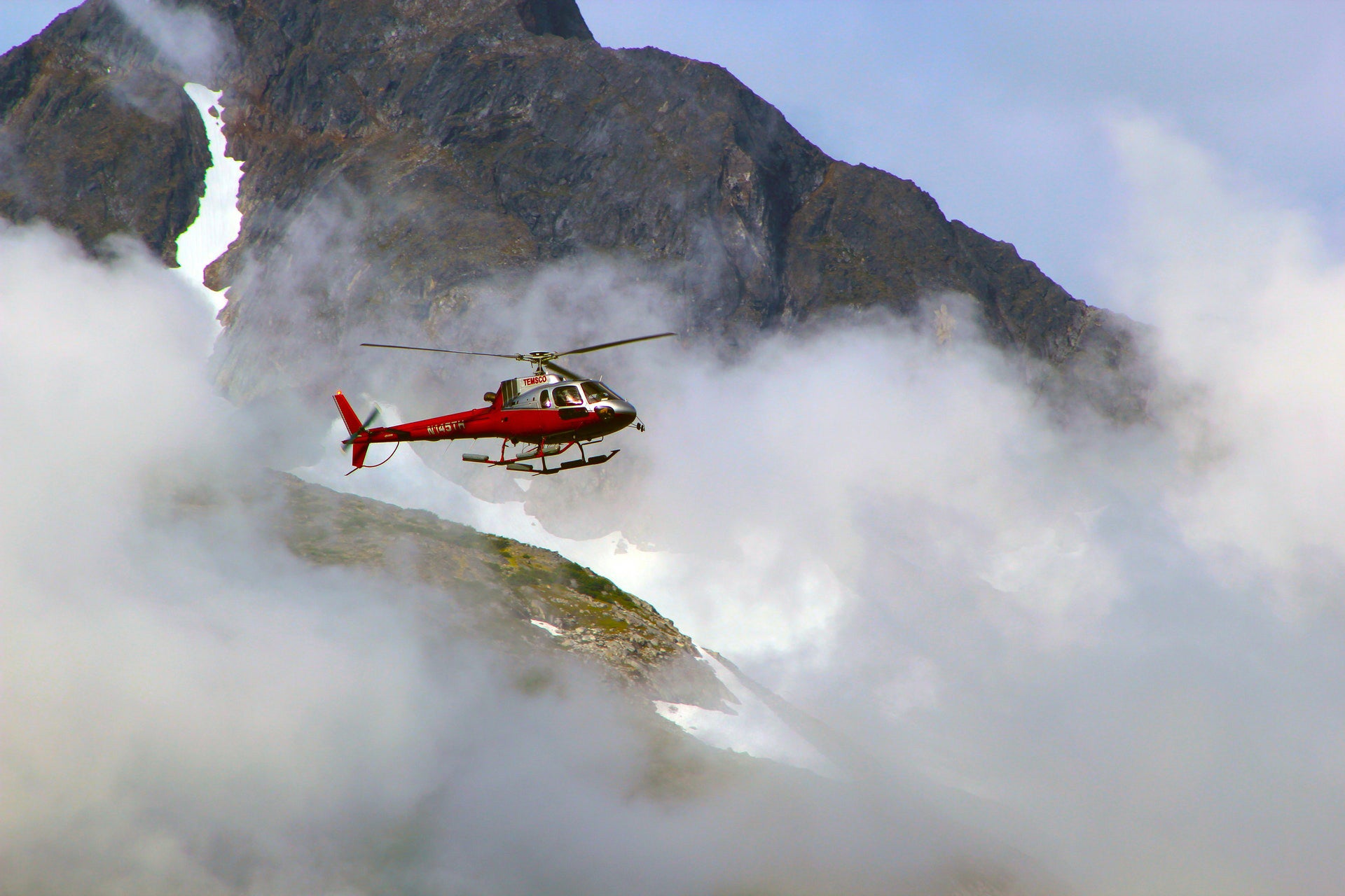
Aftermath: Mountain, Cloud, Highway

There are so many ways for this recipe to go wrong.

Twenty-five years ago, a Seattle-area pilot tried to do his mother a favor. He would take her to visit a friend on the other side of the Cascades. Their route would go through the Snoqualmie Pass, which, on the day of the trip, was unfortunately beset by fog and low-lying clouds. The pilot was instrument-rated, but the rented Cessna 152 he was flying was not instrument-equipped. He followed Interstate 90. At a certain point, fog blocked the way, and the pilot decided to turn back. In the turn, he inadvertently flew into cloud, clipped a tree and crashed. Mother and son died together.

While sifting through the National Transportation Safety Board’s reports for this column, I happened upon that obscure accident, and it jumped out at me because of its superficial resemblances to the extremely well-publicized one that recently took the life of Kobe Bryant, his daughter and seven others. I live in Los Angeles, so I observed firsthand, and shared, the general consternation and grief caused by the Bryant crash. I also observed the weather on the day of the accident. A mild, dry cold front was passing through, bringing sub-VFR visibilities and a solid, but not deep, overcast. I did not know exactly how it was at the place and time of the accident, but I heard reports—from both the media and friends of friends—of fog sufficiently dense to make driving difficult along eight-lane US Route 101, which the helicopter was following through hilly terrain.

The Bryant accident was the talk of the town for days. Friends assumed I must have special insight into it, but I didn’t. There is usually a tree of contingencies, each accompanied by its shimmeringly indefinite coefficient of likelihood or plausibility and branching into an equation that defies any available calculus. It is the work of the sleuths of the NTSB to pare away those branches until a single, clear, demonstrable trunk of explanation remains.

It was too early to analyze the Bryant accident. But, in their broad outlines, it and the Washington crash had elements in common.

The 34-year-old pilot of the 152 in Washington had a commercial license and almost 1,800 hours, of which nearly 150 had been logged on instruments. On the morning of the accident, he told a friend he was flying 46 miles from Gig Harbor (KTIW) to Monroe (W16) to pick up his mother, and from there about 130 miles to a private grass strip near Tonasket. He would be returning in the afternoon. A dispatcher at the FBO from which he rented the 152 played the automated weather report over a speakerphone, but the pilot, he said, “was not real interested in getting the details.”

To cross the Cascades, they would first have to fly south from Monroe to pick up Interstate 90 and then follow it through the mountains. Emerging on the east side of the range, they would turn northeastward; Tonasket is in central Washington, near the Canadian border.

The highest point on the highway is 3,000 feet above sea level; nearby mountains rise almost to 6,000. The pilot’s lack of interest in the details of the weather sounds cavalier, but it may have been logical. Under some circumstances, the only way to know the weather is to go have a look. Besides, he was flying toward improving weather—beyond the mountains, it was clear.

The trouble with taking a look is that it is a slippery slope. The destination beckons, and you have made it this far. It looks only a little worse ahead; the hard part will soon be behind you. Downward visibility and forward visibility are easily confused with one another.

Numerous travelers on the interstate, some of them pilots, saw the Cessna “skimming below the clouds” between 100 and 300 feet above the roadway. Reports were inconsistent. A private pilot saw the airplane 5 or 10 miles west of the summit of the pass; it entered clouds, turned and then continued westbound. Another witness reported seeing the airplane enter a cloud while eastbound, 2 miles west of the summit. The location of the wreckage, however, made it plain that at the highest point in the pass, where the highway makes a turn to the right, the pilot decided to give it up. He turned to the left, where the terrain was relatively flat.

One of the traps in this kind of scud-running is the lack of a visual horizon. The pilot judges the horizontal not by a line between the Earth and sky but by the surface of the ground below. When he begins to turn, the geometric precision of the highway is replaced by uneven ground, hills and forest, partly obscured by ragged clouds and mist. The visual cues by which he would normally regulate his bank disappear or become ambiguous. In this situation, anything can happen: unintended gain or loss of altitude, entry into cloud, or collision with terrain. Turning back is difficult—not just emotionally but also practically.

Read More from Peter Garrison: Aftermath

The Bryant crash, at first, seemed similar. Within minutes of learning about it, I and everyone else who knew about online flight-tracking services had downloaded from the internet the ADS-B track of the helicopter. It appeared that the pilot had—almost identically to the Snoqualmie accident—attempted a left turn over an area of relatively flat terrain surrounded by hills. Somehow the climb had turned into a steep descent. What happened?

Spurred by the conspicuousness of the crash, the NTSB quickly issued an “investigative update.” At John Wayne Airport, where the flight originated, the weather was overcast but VFR. Farther north, visibility dropped, and the pilot had to request a Special VFR clearance to pass by the Hollywood Burbank and Van Nuys airports. At the time of the accident, the cloud base at Van Nuys, a few miles to the northeast, was 1,900; the tops were at 2,400, and visibility was 2.5 miles. At Camarillo Airport, the flight’s destination on the other side of the hills, visibility was unlimited, and the ceiling was 1,800 broken.

After passing west of Van Nuys, the Sikorsky S-76 joined up with US Route 101 as it approached the foothills of the Santa Monica Mountains. The pilot had reported to SoCal Approach that he was at 1,500 feet and requested flight following, which was denied because he was too low for radar. (ADS-B data for that segment of the flight shows the Sikorsky at 1,200 feet, doing around 130 knots; the highway gets as high as 1,100.) A little later, the pilot reported to SoCal that he was climbing (VFR) to 4,000. Witnesses near the accident site described the hills as entirely shrouded in fog and mist.

Whereas the 152 pilot was clearly trying to reverse direction in a left turn, the S-76 pilot’s left turn was more puzzling. For a helicopter to reverse course, it does not have to make a procedurelike turn; it can stop in place and rotate 180 degrees. Why would the pilot have turned toward rising terrain? Furthermore, if he had decided to pop up through the cloud deck, why would he turn at all?

It will be a while before the NTSB determines, or hypothesizes, the cause of the Bryant crash. It has already reported a preliminary finding that the helicopter climbed westbound to within 100 feet of the cloud tops, then banked left and began to descend. The helicopter was under power at impact, traveling at 180 knots with a 4,000-feet-per-minute rate of descent. In other words, it was not turning back at all; the left turn, and the failure to climb the last 100 feet, were unintended.

I know—it sounds an awful lot like spatial disorientation or vertigo. But let’s wait and see. Maybe the NTSB can find some other way to explain how an 8,000-hour instrument-rated pilot could fail to climb straight ahead through 1,000 feet of cloud. Or, perhaps, the finding of probable cause will be no more enlightening than that of the Washington accident, faulting “the pilot’s attempt to continue VFR flight into instrument meteorological conditions, and his failure to maintain clearance with the terrain.”

This story appeared in the May 2020 issue of Flying Magazine

Login

New to Flying?

Register

Already have an account?