fbpx

Forecasts: The Biggest Weather Traps

We all rely on the weatherman's educated guesses; sometimes we rely too much on them.

To begin, pilots are almost never “trapped” by weather. Some will come up with a tale they think proves that they were “trapped,” but you simply have to fly by too many clues to wind up in weather trouble without some sense of trespass.

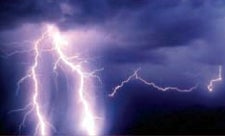
So what is the biggest trap? Simple. The forecasts, or, the way that we use the forecasts.

Many of us look at long-range forecasts to get a sense of the weather for an upcoming trip. That is fine so long as we don’t put much stock in those long-range forecasts. Any time you want to see how much uncertainty there is, just go to the forecast discussion on the NWS site for your area. (Go to noaa.gov and type in the name of your town.) Some of the forecasters go into greater detail than others but from reading the discussion for periods out more than about 24 hours, you can see that they deal mainly with generalities and have a lot of variables to deal with.

That basically tells us what we need to know about forecasts. They are guesses, based on history. Educated guesses to be sure, but they don’t deal with realities. As pilots we do have to deal with the reality of conditions as they develop.

How does this transfer to flying?

To begin, it’s not a good idea to use forecasts in isolation. The terminal forecasts (TAFs) attempt to predict the weather for only a little bit of the air, that within five statute miles of the airport, and they look ahead for only 24 hours. They are issued every six hours, starting at 0000Z.

The bigger picture can be found by considering other forecasts offered to pilots.

A bigger look at the weather comes from the six area forecasts (FAs) that cover the 48 contiguous United States. These include a synopsis of weather features such as fronts and lows, and forecast general weather conditions over an area. Be careful about what you are looking at when it comes to cloud heights as the FA gives them both in height above the ground and height above mean sea level, and specify which is used. There is also word on flight precautions that are addressed in airmets (WA) and sigmets (WS).

The airmets forecast various weather phenomenon of concern to pilots and come in Sierra for IFR conditions or mountain obscuration, Tango for moderate turbulence or surface winds of 30 knots or greater and/or non-convective low-level wind shear, and Zulu to cover moderate icing and predict freezing level heights.

Sigmets are issued as forecasts of severe icing not associated with thunderstorms, severe or extreme turbulence or clear air turbulence not associated with thunderstorms, for dust or sandstorms lowering visibility to below three miles, or volcanic ash. Convective sigmets (WST) are not forecasts but instead report thunderstorms that exist.

Using these forecasts works a lot better if you know the synoptic situation. That is given in the area forecast but reading it is no substitute for looking at a weather map. The ones on TV shows are not too good because they are trying to cover the whole day. The Weather Channel keeps its big picture maps more current but these are not aviation charts. The best charts for us are on the ADDS site (adds.aviationweather.noaa.gov), where they have a current surface map plus prog charts out to 48 hours. Private weather services such as WSI and Jeppesen also have excellent prog charts.

A lot of pilots want to dumb down weather and have it fed to them through a pacifier, but that doesn’t work. A pilot who wants to avoid weather surprises has to put effort into understanding weather. Fronts and lows and highs are important. They affect the air in which we fly. The conditions that we encounter, and how we deal with them, not the forecasts, are what determine success.

Having stood on that soapbox, the next logical step is to look at how we use forecast products to make the best possible deal with flying weather.

For most pilots, the most used forecast product is the terminal forecast (TAF). We look at that and form a visual picture of the weather that it describes. That is a basic mistake because the accuracy of a terminal forecast is subject to a lot of variables. The person who makes the forecast is a qualified meteorologist but it is more of an art than a science, though it is taught as a science. A meteorologist does his work with numbers and history. As pilots, we deal with clouds and stability or instability.

Still, the terminal forecast is the best basic tool to use because it covers expected weather at airports and, especially when IFR, it defines whether or not the forecaster thinks you will have landing minimums when you get there.

Terminal forecasts used to contain word on frontal passages (FROPA) but that seems to be gone now. To tell when they expect a front to pass, you have to look at the expected surface wind. They also deal with variables by defining temporary (TEMPO) conditions.

Anybody who has flown much has experienced a “blown” forecast, or, one that is terribly wrong. This shouldn’t affect the safety of a flight because there is plenty of information, in the form of actual weather observations including radar, to tell us that a forecast is incorrect and that we had best get on with a new plan.

Regarding the possible inaccuracy of forecasts, read this quote from an old edition of the government publication Aviation Weather. “The forecaster understands certain principles of atmospheric behavior and has watched this behavior long enough to know how incomplete our knowledge really is.” That’s from an old book, granted, but I don’t think much has changed.

This book went on to address the accuracy of forecasts, and as pilots we can use this information to better understand forecast products.

For example, it says that “forecasts of single reportable values of ceiling and visibility instead of ranges of values imply an accuracy that the present forecasting system does not possess beyond the first two or three hours of the forecast period.” That statement is especially pertinent because it tells us that the forecast we get at home before departure might not be worth very much when we reach a destination.

The publication also says that they can’t accurately forecast ceilings of 100 feet or zero before they exist. It goes on to say that forecasts of poor flying conditions are most reliable when there is a distinct weather system, such as a front, a trough, or precipitation, which can be tracked.

Looking out 12 hours, a forecast of good weather was said to be more likely correct than a forecast of a ceiling below 1,000 feet or visibility a mile or less.

And, this quote is great: “Surface visibility is more difficult to forecast than ceiling height, and snow reduces the visibility forecasting problem to one of rather wild guesswork.” That was in reference to the difficulty of predicting surface visibility when snow is falling, and snow does even worse things to flight visibility than it does to that at the surface so that is something to remember.

The stronger a front, the better the forecast on a time of passage. The old FAA manual referenced a lot of other items but those are the most important. I am sure many forecasters will say they have better tools now and can do a better job. And they may be right. However, from personal experience, the accuracy of forecasts does not seem to have changed all that much with time.

We have to consider, too, what an incredible thing we are asking meteorologists to do in a forecast that, in a TAF, goes out 24 hours into the future. Predicting the exact visibility, ceiling, weather and wind that will occur in a given location is a daunting task, a long way from doing partly cloudy to cloudy with a chance of rain for the general public.

All of those computer models forecasters use and talk about deal with generalities. They look at the current situation, go back and look at similar situations in the past, and at what happened during the time after the condition was observed. Then they project the current situation forward. That often works well, as with snowstorm forecasts for the public. But it doesn’t do much for the pilot who wants to know what the surface weather is going to be in Morgantown in 10 hours.

The age of a forecast is important because, as was noted in that book, specifics beyond the first two or three hours of a forecast period are suspect. One place where we have seen great help with this is in the up/downlink of weather. If we leave home early, before 1200Z, the forecast from the home briefing is old. The new forecast might be available at the FBO or, on the instrument panel. Failing that, you can get it from an FSS.

Now, let’s go flying and look at the conditions that I have found to generate worse than forecast weather.

When flying we are nowcasting, not forecasting, and have to use all available information. One word about nowcasting. In VFR, what you see is what you get all the time. On IFR approaches, what you see at the moment you reach the decision or minimum descent altitude is what you get, regardless of what is reported. All that counts is what happens right now.

To me, the most suspect forecast of all is the one of improvement when there is fog. Simply put, there is no way to know when fog is going to lift. Heading toward an airport that is zero-zero now but that is forecast to be up to landing minimums at the projected time of arrival had best be done with a lot of extra fuel. It is not uncommon for fog that was forecast to lift by 1400Z to still be there four hours later. This is especially true if there is a higher overcast or if there is snow on the ground.

Another condition where a forecast might not be reliable is where the surface flow is bringing low-level moisture in underneath warmer air aloft. That temperature inversion will tend to cause a concentration of the moisture at low levels, making for low ceilings and visibilities. In such a condition, often found within a few hundred miles of a coast, improvement is often forecast as the day goes on, but it doesn’t always happen that way. A few moments looking at the surface temperature and at the temperature aloft will pay dividends when dealing with such a condition.

The forecast of visibility in any precipitation, and especially in snow, does not always translate into visibility ahead, out the windshield. Often, when rain starts to fall some low scud will begin to form and where the forecast and reported visibility might be a couple of miles, the slant range visibility might be poor as you look for the runway.

The only cloud top forecasts are in the area forecasts and these are really generalized. If staying on top of the clouds is in the game plan, the synopsis is important. If you are flying toward a front or a low pressure area, the cloud tops will likely become ever higher as you fly closer to the front or low.

Icing forecasts are quite broad. The possibility of ice is forecast all winter and it’s up to the pilot to determine whether or not the forecast might come true. That is best done with a gold-plated alternate plan if ice starts to accumulate on the airplane. Changing altitudes might help but, again, if you are flying toward a front or a low pressure area, the ice will get worse before it gets better.

Thunderstorms are forecast whenever they think the atmosphere will support their development. This is pretty easy to forecast ahead of a cold front, where a squall line might form, or in a warm frontal zone with all the right properties. Air mass thunderstorms that can exist in lines or clusters, might be forecast with some accuracy that they will form, but with little accuracy on location. That is what Nexrad is for.

The forecasts of turbulence cover the obvious. If there is a strong wind flowing over rough terrain, yes, there will be turbulence. Same goes for strong wind shear close to the ground or aloft. Forecasting the level of turbulence is another matter because so many things affect that. For example, downwind of a mountain range you might find much worse turbulence than would be found upwind of the range. This is an obvious thing and the nowcast has to come from the pilot’s brain, not from the forecast. I recall a day when a pilot downwind of Mount Mitchell reported severe turbulence at an altitude where I was getting an acceptable ride upwind of the big mountain. One condition that used to be in turbulence forecasts but that seems to be gone are up and down drafts (UDDFs). I guess they decided that pilots could put wind and mountains together and come up with their own conclusions.

Also on turbulence forecasts, one thing that is not covered are building cumulus clouds. Long before a cumulus becomes a thunderstorm and/or something that will show on Nexrad, radar or a lightning detector, it is generating an incredible level of turbulence. What you see is the best information available here. If a cumulus looks bumpy, even if it tops out at only 10,000 feet, it will be.

Turbulence forecasts also often do not address wet and bumpy clouds. These are more common in and near frontal zones and close to low pressure areas and while the level of turbulence might not meet the “moderate turbulence” parameters required for a forecast, flying in those clouds is hard work and a significant weather factor for a flight. Any turbulence found in clouds seems to be at least one level worse than the same turbulence in clear air.

For VFR flying, the big picture is also in the windshield. If you can’t see clearly where you are going then it is time to do something else regardless of the forecast. The VFR pilot has to be especially wary of precipitation because it affects both flight visibility and promotes the formation of lower clouds.

Using all the information, the pilot who works hard at understanding weather will fly with less surprises and won’t have to work as hard while flying. Anyone who thinks that someone else will spoon feed an accurate weather picture before a flight is making a serious mistake because while the information might be accurate at the time, nobody but the pilot, at the end of the flight, knows what was really there all along the way.

Login

New to Flying?

Register

Already have an account?