Question: I am a relatively new pilot. I recently read about something called a forecast discussion that could be useful for preflight planning. Can you tell me more about this and how I can access it online?
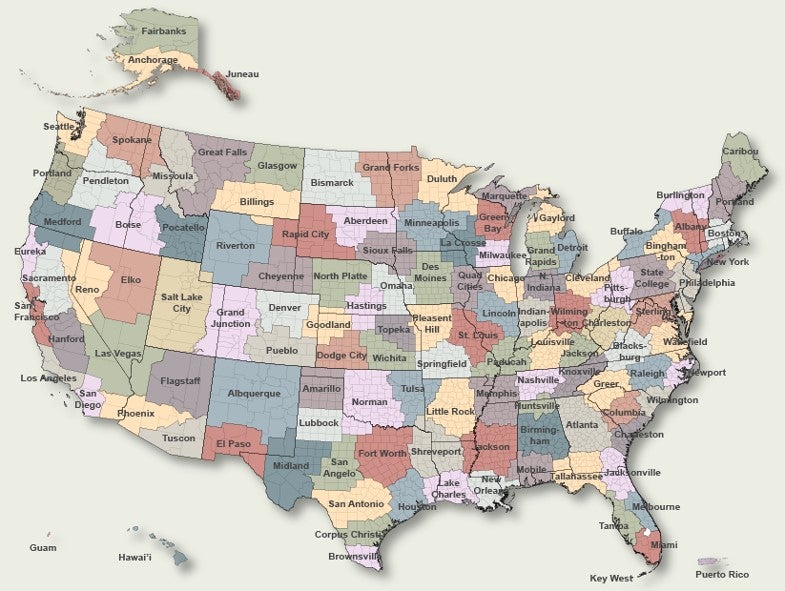
Answer: Since I introduced the area forecast discussions (AFDs) to the general aviation community a couple of decades ago, this has become a common resource for pilots to review before making operational decisions as it relates to weather. Just to clear up any initial confusion, the area forecast discussion is not a discussion describing the legacy aviation area forecast (FA) that was retired back in October 2017. The AFD is written by forecasters located at each of the local weather forecast offices (WFOs) scattered throughout the U.S. The same forecaster at the WFO that issues the terminal aerodrome forecast (TAFs) for their county warning area (CWA) is also responsible, in part, for issuing the corresponding AFD. The CWA defines the geographic “area” they are discussing. Shown below are the boundaries of the CWAs for the U.S. and its territories.

The AFD is not a two-way conversation. However, it is a vehicle that the forecaster can use to document the technical reasoning behind the forecast they just issued. In other words, it’s a way for a pilot to know what the forecaster is thinking about the current trends in the forecast. Most important, this is the method the forecaster can use to quantify their uncertainty. It allows them to let the reader know what could go wrong or describe alternate scenarios. I’ve read dozens of errant terminal forecasts over the years; however, there have been very few forecast discussions that didn’t somehow confront the potential of a busted forecast before it happened. I tell all of my one-on-one online students that if you are not reading the AFDs and only looking at the TAFs, you are potentially missing out on half the forecast guidance.
Each AFD has two primary parts of interest to pilots. The first consists of a synoptic overview and a review of the forecast weather over the next few days for the CWA. The good news is AFDs are written in plain English. The bad news is a lot of jargon is used in this part of the discussion. This is because the AFD is designed as a forecaster-to-forecaster memorandum, so it might be quite technical at times. Be prepared for dozens of terms that may be unfamiliar. For example, here’s a small excerpt from a past discussion outlining the long-term forecast.
.LONG TERM /MONDAY THROUGH THURSDAY/…
Mid-level ridging will take place across the local area Monday into Monday evening. Mid-level transitions to a zonal pattern thereafter through Tuesday and then more SW Tuesday night through midweek with shortwave approaching. Mid-level ridging shown in forecast models thereafter through Thursday.
If you are a bit perplexed after reading an AFD, the National Weather Service glossary may help unravel some of the mystery.
The second part is the aviation section, where the forecaster will discuss pertinent information about the TAFs they issue for their CWA. This section is generally written so that it is easily understood by any certificated pilot or other stakeholder in aviation (e.g., air traffic controller). How much information they put into this section often depends on the specific WFO, the current weather, and the individual meteorologist writing the discussion. In some cases, a forecaster can pack a lot of information into that aviation section, and some will offer few details.
For example, in the aviation section below issued by the Greenville-Spartanburg WFO in Greer, South Carolina, it’s clear that thunderstorms are expected across the area, but it’s not certain if they will impact the Charlotte Douglas International Airport (KCLT) terminal area. So, the forecaster is adding a placeholder for showers in the vicinity (VCSH) in the KCLT TAF to cover the convective threat. In most cases, the AFD may also provide an aviation outlook beyond the typical 24- or 30-hour forecast period.
.AVIATION /16Z TUESDAY THROUGH SATURDAY/…
At KCLT…Little change from 06 UTC package as a west wind less than 8 kts under mostly clear skies will continue thru mid-morning. Expect increasing WSW winds with low amplitude gust potential by midday and perhaps periods of VFR ceilings thru the afternoon. Scattered showers and perhaps at tstm…are expected across the NC Piedmont from the afternoon until early evening and will carry VCSH for now to cover that threat. Deep convective activity will diminish by mid-evening when a wind shift to NW is expected.
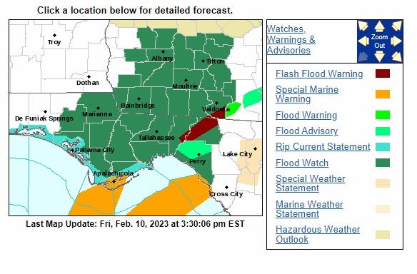
There are several ways to view the latest AFDs. A few heavyweight apps provide access to the full AFD, including my progressive web app, EZWxBrief. By the way, you may see the AFD referred to as the “TAF Discussion,” or more simply, “Forecast Discussion,” leaving out the word “area.” You can also visit the National Weather Service and enter the city and state or airport identifier of interest in the location field at the top-left of the main webpage and click Go. This will send you to the local WFO’s page, where you will look for a map that says, “Click a location below for detailed forecast,” similar to the one below.

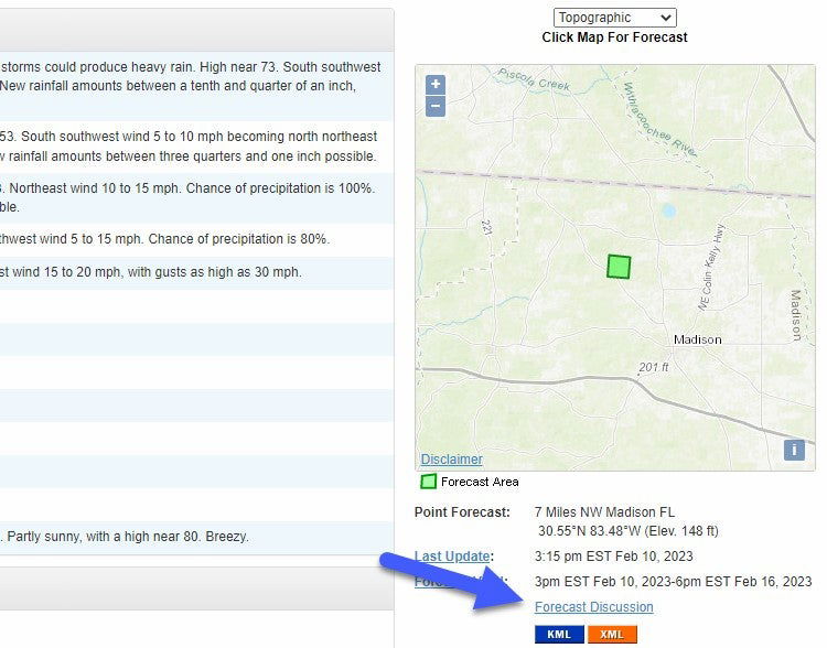
That will take you to the correct page where you’ll find a link to the forecast discussion below the map, located further down the page on the right side. By visiting this forecast discussion link you’ll also be able to view previous versions of the AFD issued by this WFO.

However, don’t just skip to the Aviation section. Read the synopsis and then focus on the part of the discussion that is pertinent to your proposed departure time. The Aviation section only may be viewed at the Aviation Weather Center (AWC). Selecting the CWA here on the map searches the latest AFD and pulls out only the text associated with the aviation section (if any).
Here’s my suggestion: Before you spend any time sifting through the TAFs along your route or at your departure and destination airports, take a few minutes to peruse the AFDs to get a good overview of the weather before examining the “fine print” that represents the TAFs. In some instances, your final decision might actually hinge on the forecaster’s comments in the AFD.


