fbpx

Deadly Downdrafts: Understanding the Risks

In mountainous terrain, beware of deadly winds.

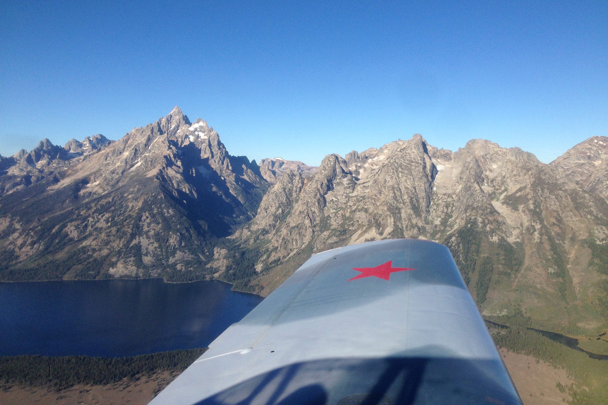
December is the cruelest month in the Culebra Range of southern Colorado. This chain of lofty mountains is rugged terrain, where the raging winds of winter have caught several airplanes in downdrafts. in my Navion, I have sniffed out the range’s updrafts and downflows, trying to identify weather conditions leading to airplane disasters and to relate winds to mountain contours. On foot, I have spent many days climbing Culebra Range peaks. These mountains are my backyard.

The Culebra Range is a segment of the magnificent Sangre de Cristo Mountains, which extend from Salida, Colorado, all the way south to Santa Fe, New Mexico. The Culebra section runs from the infamous La Veta Pass east of Alamosa, Colorado, to the New Mexico state line. Prevailing southwest winds to the west of the Sangre de Cristos scour the floor of Colorado’s San Luis Valley, a huge intermountain plain at 7,500 feet. These winds rise up more than 6,500 feet to the 14,000-foot crest of the mountains and then tumble down more than 8,000 feet to the Great Plains of eastern Colorado.

One December airplane crash a couple of miles north of Culebra Peak had a happy ending. A pilot from Amarillo, Texas, had always wanted to fly into Leadville, Colorado, which at 9,927 feet msl has the highest public airport in North America. On Christmas Eve a few years ago, he set out in his 85 hp Luscombe and made it into Leadville. On Christmas Day, he started home, winging south along the San Luis Valley and then southeast into the rugged Culebra Range. Cold, ropey, gray stratus clouds brooded over the valley and 30-knot surface winds siphoned across it from east to west, an atypical pattern. At about 11:30 a.m., flying upwind toward the east, the pilot approached the 12,560-foot Whiskey Pass.

In a later newspaper interview he said, “I was riding along just as pretty as could be. It was a little bumpy but not too bad. I was flying about 500 or 600 feet above the ridge, just about to clear it, when I got hit by a downdraft. It just pointed the nose straight down, and within two seconds, I was on the ground. It was like somebody took a fly swatter and hit a fly. It was just whack! And I was on the ground.”

Imagine crawling out into the snow at 12,000 feet with a broken back, discovering that walking out to safety is impossible and trying to stay warm in the ruptured cockpit by stuffing crumpled charts, papers and clothes into the fractured windows. The pilot ate two hamburgers that were “frozen like a brick.” He drank all the water he could before the bottle froze. Forty- to 60 mph winds carved the snow, driving ice crystals into the cracks in the fuselage. Daylight passed and deepened into dusk. No one knew where he was. He didn’t file a flight plan. But the emergency locator beacon worked, sending its little howls out into the sky, and by nightfall, a search had commenced. Somehow, he survived the night and was rescued about 25 hours after the crash.

The Luscombe crash is typical of dozens of similar Colorado aircraft accidents in which underpowered aircraft swim upward into lee-side downdrafts and are flung to Earth. In most of these crashes, someone is killed. Colorado mountain passes that collect lee-side airplane wrecks are La Veta Pass, Monarch Pass and Rollins Pass, to name a few.

Winter is the time of high winds in the mountains, of downdrafts in my backyard. Now that pilots utilize GPS constantly, they sometimes don’t flight plan for terrain or use the ancient skills of pilotage. Especially when IFR, aviators may expect a straight-line direct flight and may be only slightly aware of the mountain contours they will cross. Moreover, pilots often appear to be ignorant of the lethal influences of mountain airflow. Some often have the mindset that a few thousand feet will give them an impenetrable cushion against downdrafts — if they consider downdrafts at all.

On December 20, 2008, a pressurized Beech Baron crashed on the lee side of the Culebra Range in mountain-wave conditions. The aircraft was flying on an IFR flight plan from Pueblo, Colorado, direct to Santa Fe at night in visual conditions. The intended direct route crossed the Sangre de Cristo mountains a few miles south of Culebra Peak.

On that dark winter night the pilot took off from Pueblo at 7:15 p.m. and 16 minutes later reported level at 18,000 feet, east of the mountains. At 7:47 p.m., when the flight was just east of the Culebra Range, in the lee of the highest peaks, air traffic control, apparently noting an altitude deviation, radioed, “say altitude.” The pilot replied: “uh … we’re having some problems here, sir. We’re just trying to rectify it; we’re going back up from 17 to 18.” Twenty-eight seconds later, the pilot requested 16,000 feet and said he didn’t know what the problem was. He asked center for a groundspeed readout. ATC replied 135 knots. (Cruise groundspeed in calm air for that sort of aircraft should be around 190 knots.) Within a minute the pilot said, “We’re having some serious difficulties here.” ATC offered him a vector away from terrain but said it would be into the wind. Eleven seconds later the pilot’s last word was “uh.”

The radar track at that time shows the airplane was descending through 14,000 feet. The Baron made several heading changes, including one to the right toward the mountains, climbed 500 feet in nine seconds, descended 500 feet in the next 10 seconds, heading left to the south, and half a minute later, dropped 1,000 feet. Within seconds, the Baron flew directly into the snowy northeast slope ­— the lee side — of the 13,723-foot Vermejo Peak, crashing at the 12,077-foot level. Only four minutes had elapsed from “say altitude” to impact.

A Cessna P210 equipped with a turboprop 450 hp Allison engine happened to be flying at 19,000 feet a few miles to the south of the Baron crash site. ATC asked the Cessna pilot if he would take a look. Flying in the darkness toward the last radar position, the Cessna pilot spotted a ground fire that he thought was the wreckage. While circling the fire, the Cessna descended 500 feet. The Cessna pilot thought he was using poor flying technique and added full power. To his surprise, the airplane continued to descend at 500 fpm, when the pilot knew at full power it should have been climbing at 1,000 fpm. The Cessna pilot reported to ATC that he was in a downdraft and then escaped to the south, where the rate of descent slowed and the Cessna was finally able to maintain altitude.

The National Transportation Safety Board meteorologist investigating the weather at the time of the Baron accident focused on a mountain wave and found that radar measurements issued from Albuquerque, New Mexico, for the airmass at 5:00 p.m. that day portrayed severe mountain-wave activity at 16,200 feet (the center of the wave), with theoretical downdrafts greater than 4,500 fpm. In addition, numerous pireps all over the Colorado mountains had been transmitted concerning moderate to severe to extreme turbulence. A pirep from an Airbus near Gunnison, Colorado, reported “mountain wave.” Sigmets and airmets were issued for moderate and severe turbulence in the Central Rockies. An internal meteorological impact statement issued for ATC planning purposes that day warned of strong west winds and a mountain wave.

The NTSB probable cause for the crash was “inadvertent flight into mountain-wave activity resulting in a loss of control.” The board found nothing wrong with the aircraft or instruments and could not determine the attitude in which the aircraft hit the mountain.

The NTSB factual report does not include anything about the pilot’s weather briefings and offers little about his experience. The airman, age 67, held a Canadian private pilot multi-engine license and was instrument-rated. Ten months earlier on an insurance application, the pilot claimed 1,634 hours total flight time with 84 hours in the last 12 months (21 in the last 90 days). He also listed recent flight training at SimCom (apparently an IFR renewal), a taildragger checkout and about 400 hours in a Beech A55 Baron. No current logbooks were available.

According to newspaper accounts, the pilot was an internationally recognized oil exploration geologist. His wife, who also perished in the flight, was a prominent local physician who was learning to fly. The couple left their home base in Calgary the morning of the accident and flew to Great Falls, Montana, refueled in Pueblo and were on the last leg of their trip to Santa Fe.

Inferring from the pilot’s comment to ATC that he didn’t know what the problem was, the Baron pilot apparently did not realize from his greatly reduced groundspeed and rate of descent that he was in a downdraft. He may not have believed his instruments. Considering his route of flight from Great Falls, he must have known about the airmets and sigmets and probably experienced turbulence in his flight across the Rocky Mountains into Pueblo. What happened here? Was this aviator unaware that he was flying into a mountain wave in the lee of a major mountain range? Did fatigue play a role in this accident?

On Jan. 9, 2011, a Piper Malibu crashed on the lee side of the Sangre de Cristo Range in mountain-wave conditions. This accident occurred in daylight a few miles north of La Veta Pass, about 49 miles north of the Baron crash site. The Malibu had departed daytime IFR from the Phoenix area, bound for Waterloo, Iowa, with a refueling stop in Pueblo. The airplane flew eastbound direct in visual conditions at 25,000 feet until cleared at 1:27 p.m. to descend at the pilot’s discretion to 17,000 feet on approach into Pueblo. There were no further communications from the pilot after he said he would start his descent in about two minutes over the Sangre de Cristo Range.

The radar track shows a steady descent of about 1,400 fpm, until at 1:33 local time, the flight was at 19,500 feet just to the lee side ­— the downwind side — of the crest of the Sangre de Cristo mountains. Radar plots portray a vivid picture of distress. In

19 seconds, the airplane dropped 1,400 feet, then changed heading to the right and in the next nine seconds, lost 500 feet. Continuing the right turn, the aircraft shot up 1,600 feet in 20 seconds. From that point the Malibu plummeted 9,500 feet in slightly more than a minute to the crash site in timber at 9,733 feet. The NTSB summarized radar as depicting “the aircraft entering a right turn, climbing rapidly and then descending rapidly in a spiral-like pattern.”

The NTSB noted that “the radar information along with the wreckage at the accident site was consistent with the pilot losing control while trying to maneuver the airplane in an area of turbulent weather.” The aircraft may have entered an edge of cloud shortly before the loss of control. The NTSB found nothing wrong with the aircraft and, judging from signatures on the trees at the crash site, concluded that the aircraft flew nearly vertically into the ground.

The pilot was an Iowa physician, age 66. He had logged more than 3,030 hours and had about 467 hours in make and model. His biennial flight review was not current. He had a checkout in a similar Malibu 18 months earlier and an IFR proficiency check in a Mooney in June 2010. He had logged 37 instrument approaches in the past year, 29 of them in a Mooney. Also losing her life in the accident was the doctor’s partner, a Waterloo businesswoman.

The NTSB report does not disclose what sort of weather information the pilot had obtained before he called FSS in Arizona the morning of the flight. The FSS briefing was termed an “abbreviated briefing” and pertained to possible IFR conditions at Pueblo, Amarillo and Goodland, Kansas. The pilot received advisories for relevant turbulence and icing east of the Colorado mountains. The conversation with the briefer was casual. The briefer prompted the pilot for the information needed to file IFR.

That day there were numerous pireps concerning mountain wave and moderate to severe turbulence in Colorado. Shortly after crash time, a Citation pilot climbing out through 14,000 feet 30 miles south of Alamosa, Colorado, reported moderate to occasional severe turbulence.

Topography in the area of the Malibu crash site is a major locus for hazardous mountain-wave formation. Within 30 miles north of La Veta Pass, the main ridge of the Sangre de Cristo mountains crests in eight 14,000-foot peaks. To the east, terrain drops 6,000 feet within a few miles to the Wet Mountain Valley floor at about 8,300 feet, quickly rises more than 5,000 feet to the summits of the Wet Mountains then falls again to the Great Plains 7,000 feet below. This double ridge creates accelerations of the mountain wave. Under mountain-wave conditions, lethal turbulence swirls over the peaks and valleys.

How do you recognize a downdraft? If your flying occurs primarily in the more level parts of the country, you may experience downdrafts as rough air with a few hundred feet of up-and-down. But when flying upwind in the mountains into a nice smooth wave, the first sign of the wave may be a slowdown of groundspeed. You find yourself holding the nose up to maintain altitude. Your airspeed bleeds off fast. Then you begin to sink in the downdraft while trying to maintain altitude with additional power. The ridges, snowfields and rocks are getting closer. You see best rate-of-climb go by. You firewall the prop and throttle. Nonetheless, the indicated airspeed needle is working its way backward toward best angle-of-climb airspeed. The altimeter unwinds rapidly. In no uncertain terms, flight conditions are saying: Turn away; push that nose down; flee down your escape route!

If you are flying downwind into a mountain wave, your first indication as you approach the mountain range may be an increase in groundspeed. There may be little warning at all before you hit the rotor or another form of turbulence.

When planning your flight across the Sangre de Cristo Mountains, obtain a standard briefing from FSS. This will include sigmets, airmets, pireps and any mountain-wave forecasts. Always get the winds/temps aloft forecast. If the wind is blowing against the mountains at more than 20 knots, there will be a mountain wave. Evaluate the topography under your route. Various flight programs include terrain profiles under a route line and most avionics now show areas of sectional charts. However, the best flight-planning tool is a paper sectional chart. Before flight, you can spread it out and thoroughly examine the mountains and valleys under your route. Consider winds aloft relative to the valleys and ridges beneath your path. Envision the flows. Assuming you have current information in your electronic flight-planning devices, your sectional chart doesn’t have to be up-to-date.

If the weather is relatively calm you may venture into the mountains. But on a windy day, what are your alternatives? Unless you have received specific instruction in recognizing a mountain wave, understanding the implications of lenticular and rotor clouds and flying in turbulence, you should avoid the mountains entirely.

Many pilots think that heading from Denver directly west or west-northwest is a little too risky, so they try to find a nearby southern route via the town of Salida. Avoid the 11,312-foot Monarch Pass, which is extremely deceptive: On the east side of the pass, there’s a terrain crook south that focuses downdrafts. The next option is the 10,845-foot Marshall Pass over to Gunnison or the 10,149-foot North Pass, south of Marshall. But Marshall and North involve first traversing Poncha Pass, which happens to be where I have taken many of my inflight photos of rotor clouds. These are not routes for a neophyte.

Then pilots may think La Veta Pass looks like a really good option, being unaware that La Veta has some of the strongest mountain-wave conditions in the country. The bottom line for our general aviation aircraft is when a mountain wave and turbulence are forecast, don’t fly across the central Rockies. The best way to go around the Sangre de Cristo range is to circumvent it to the south, around by Las Vegas, New Mexico, and north of Albuquerque.

Reconsidering the Baron and Malibu misfortunes, we see that they bring to the forefront a previously unpublicized type of accident: that of a sophisticated GA airplane flying a direct route over mountains bristling with turbulence. Look at the factors common to these two crashes: mountain-wave conditions, same general range of mountains, severe downdrafts or rotors just a short distance in the lee of the range crests, flight altitudes of 4,000 to 5,000 feet above the peaks when difficulties started, instrument-rated pilots flying direct on an IFR flight plan and total loss of control of the airplanes. Each pilot seems to have been oblivious to the warnings of pireps and mountain-wave/turbulence forecasts.

Were autopilots in use, and if so, how did that affect these two flights? Would upset recovery training have assisted the Malibu pilot? Would specific teaching in mountain-wave recognition have prevented the Baron accident? Had these two aviators been navigating via victor airways, they would not have been snared over such treacherous high terrain. Flying GPS direct, off airway, over mountains may not be such a good idea.

And so, intrepid aviators, I have learned that we are puny compared to mountain weather. Pay attention to mountain-wave forecasts and pireps. Before any mountain flight, analyze the underlying terrain. Assume nothing about your own skills or airplane. On the way, read the clouds. Always have an escape route. And beware of downdrafts in my backyard.

Login

New to Flying?

Register

Already have an account?