
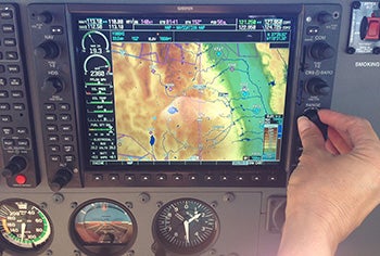


On a recent flight over the Sierra Nevada Mountain Range I spotted a prominent landmark — Half Dome — a massive rock formation at the end of the valley at Yosemite National Park. While I had an idea of where it may be located from looking at the Sectional Chart, I didn’t know exactly where it was since it was not marked on the Garmin G1000 system I was using to navigate.
Flying over these national treasures is an immense pleasure, but it is important to do so responsibly. When flying over national parks and wilderness areas, the FAA requests that pilots fly at least 2,000 feet above the highest point in the area to minimize the disturbance to visitors and wildlife. It is therefore worth marking these locations on the moving map display to help you fly responsibly and minimize the chances of further regulation, as have been adopted over some tourist destinations such as the Grand Canyon.