
There’s no substitute for competence in reading a weather map. Alamy
In spite of our best efforts, the weather is still a problem.
Though we have better access to weather-focused graphics, both through aviation sources as well as those for the general public, confusion reigns when it comes to interpreting that data and displaying that knowledge on a check ride. In other words, everyone knows about the weather, but few seem to know quite what to do with that information.
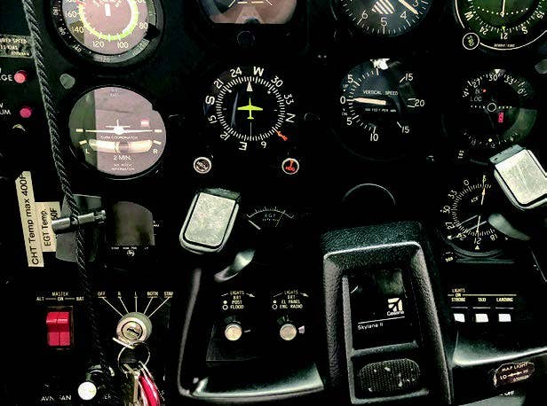
Instructors bemoan the lack of ability among students to read a raw weather report — a skill that ebbs with the launch of decoded data and cartoon-colored weather segments on the news. Examiners lament that those coming to them for flight tests are now hamstrung by their reliance on technology. “How to find weather information outside of ForeFlight is beginning to be a problem,” says one examiner. With all due respect to ForeFlight and the host of weather apps available, what happens when your iPad runs out of juice, there’s no Wi-Fi signal, and you have nothing but your cellphone with which to call Flight Service? (For those who learned to fly back in the 20th century, cue the violins. We know; it’s an embarrassment of riches.)
The bottom line? You still need to learn how to read a weather map and decode a metar (aka routine aviation weather report) to pass both the knowledge exam and your check ride. Moreover, your ability to find the latest, most accurate weather information — and interpret it the right way — is one of the most critical skills you obtain as a pilot.
So what is the critical weather task your examiner needs to see you perform (and one you must do well to fly safely)? You must be able to make a competent go/no-go decision and determine when deteriorating weather conditions mean you need to divert.
In order to complete this task proficiently, focus on the following risk elements:
There are many factors involved in making the go/no-go decision. Take a look at all the data you have available and analyze the weather conditions you see, not the ones you hope to have. What are the ceiling, visibility, and wind direction and strength? Have you flown in these conditions before? What was the result? Look at the forecasts, specifically for clues as to the rate of change you might expect, particularly if a frontal system approaches. Perhaps adverse weather factors in your area grow and dissipate with the time of day (such as morning fog or afternoon thunderstorms). Will your flight take place during these hours?
It’s important to acknowledge the limitations of weather equipment, forecasts and the resources you have on board. The bold colors splashed on television or in online weather reports make you think radar can display raindrops down to the tiniest pixel. But these displays are misleading — they only show you what is and can still only predict what might be, so take them with a grain of salt. Same too with the Nexrad products now beamed into the cockpit. Are they amazing tools to assist you with en route weather assessment? You bet. Do they make you Superman with X-ray vision? Nope.
Always establish personal minimums and know how to use them. What’s good for your instructor or your airline pilot friend may not be the right weather conditions for you. It’s nothing against your skills as a pilot. Beat this concept into your head now, and you’ll fly safely throughout your career. Set your personal minimums conservatively when you first start out, and if you wish to lower them, do so by honing your skills and obtaining more training, possibly in more capable aircraft. But know that there are certain weather conditions you will never feel at ease in, and it’s just fine to avoid those altogether.

To ensure you have your bases covered, collect weather data that covers each area, as outlined in these knowledge task elements in the new Airman Certification Standards adopted in June:
Acceptable sources of weather information appropriate for flight planning:
Weather products for preflight planning and en-route operations, such as area and winds-aloft forecasts and graphical weather data.
Current and forecast weather for your departure and destination airports, travel en route and any alternate airports you may wish to consider.
The meteorological theory behind the host of weather phenomena that may affect your flight, including weather systems, clouds, precipitation, thunderstorms, turbulence, wind shear, icing and fog.
Cockpit displays of weather information, including those delivered to installed avionics, such as the Garmin G1000 avionics system, and portable devices.
Seasonal weather phenomena specific to the region where you fly or plan to fly.
KNOW THE LINGO
English remains the international language of aviation. But if you’re traveling internationally, know that many countries have their own national weather services with online tools that range from robust to rarely functional. Though you may not speak the language, with Google Translate you can navigate these sites pretty well.
KNOW THE CODE
PA.I.C.S3: Weather information and go/no-go decisions
PA: Reference to the ACS for Private Pilot Airplane
I: Area of operation, "I" for Preflight Information
C: Task, "C" for Weather Information
S3: Defines the specific task element, in this case to "correlate available weather information to make a competent go/no-go or diversion decision."
These codes will help you and your instructor track any areas you missed on the knowledge exam and ensure you’re prepared for them on the check ride; they will be the same for both. The ACS can be found on the FAA’s website.


Subscribe to Our Newsletter
Get the latest FLYING stories delivered directly to your inbox