An iPad can be a pilot’s best friend during one of the most confusing parts of any flight: after landing at a busy, unfamiliar airport. Jerry Pomales
Over the course of your flying career you’ll likely experience several technological advances that will change the way you fly. In the early years of aviation, these came in the form of new airframe design and propulsion innovations, such as the transition from tailwheel to tricycle landing gear and turbojet engines. Next came the development of sophisticated avionics, providing pilots with the HSI, loran and RNAV direct-to navigation. The biggest leap in this category took place in the mid-1990s, when GPS was opened up for civilian use, unlocking the modern form of navigation that we all depend on today.
With each of these breakthroughs in aviation, pilots were sure to look back and wonder, how did we ever get by without this? That question runs through my mind on just about every flight when I think about all the developments that have taken place during my short flying career of 17 years. At the top of my list is the iPad and the ecosystem of aviation apps and accessories that it helped to spawn, which collectively have done more for safety and situational awareness than anything else over the past two decades.
Ask a group of experienced pilots their opinion of how the iPad has changed the way they operate in the cockpit and you’re likely to get a variety of answers depending on what and where they fly. Some marvel at the simple fact that there are no longer paper charts to manage. Others love the display of radar imagery on a moving map during summertime flying. Those flying in the high country benefit from the terrain and synthetic-vision displays.
But there is a less glamorous phase of flight that the iPad has significantly improved, which many may not consider: taxiing around the airport. During my private pilot training, the most stressful and task-saturated event was right after touchdown at tower-controlled airports, when I had to determine my location and call ground control for a taxi clearance, all while completing the after-landing checklist. Inevitably, the ground controller would read back a clearance with five or six taxiways and a few locations to hold short to make sure I was on my toes.
On a good day, I planned ahead and printed out a large taxiway diagram and highlighted the FBO or parking area on the chart. There were equally as many days when I found myself fumbling through the Airport/Facility Directory while taxiing clear of the runway, scrambling to find the airport diagram and some semblance of a parking area or FBO noted on the chart.
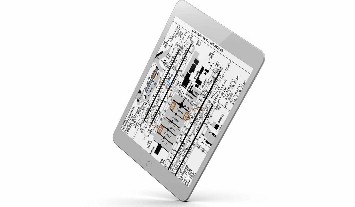
Fast-forward to the age of the iPad, with aviation apps that show your location right on the airport diagram as you move about the airport using GPS positioning. This basic feature alone is worth the price of admission for those who regularly operate in and out of large airports, but there’s so much more they can offer to improve your surface situational awareness. The trick is knowing where to look and taking the time to tweak a few settings. Here are six ways you can use your iPad to improve your situational awareness before takeoff and after landing on your next flight:
Geo-referenced airport diagrams for all airports — We're all familiar with the standard FAA airport diagrams published for tower-controlled airports, but many apps, such as ForeFlight, Garmin Pilot and FlyQ, also include custom airport diagrams for thousands of smaller airports across the United States. These are drawn to scale and will display your position on the taxiways and ramp areas surrounding the hangars, just like you'd see on the FAA diagram. In addition to studying these diagrams during preflight, you'll really appreciate the detail after landing at an unfamiliar airport at night to help locate the parking area and while taxiing along unlit taxiways.
Notams on airport diagrams — There are two things that will change on just about every flight: weather and notams. While the weather reports, forecasts and briefing tools are front and center on most flight-planning websites and apps, notams seem to be tucked away and easily overlooked. To help increase the chances that you'll actually examine these important notices before a flight, apps such as ForeFlight put the airport notams on the airport diagram with a conspicuous red button that says "Tap to view notams." This displays the pertinent taxiway and runway closures in a location that would be tough to miss: on the chart! With this enhancement, there are no excuses for not knowing about a closed runway, say, or when the runway lights are inoperative.
Airport diagram overlays — Back in the paper-chart era, most pilots got in the habit of marking up their sectionals and airport diagrams with highlighters and notes to call out important features for easy reference in the airplane. Now, most apps offer this same capability, with digital annotation tools that allow you to highlight and write notes on the screen with your finger. For example, after reviewing the notams, you can use the red-pen tool to note any closed taxiways or runways and circle the FBO location. Most of the apps provide identification labels on the diagram, eliminating any confusion about where you need to go after landing.
Runway verification — There have been many cases over the years of pilots landing on the incorrect runway, and sometimes even at the wrong airport. To increase your situational awareness during the approach and landing, enable the extended centerline overlay (ForeFlight users can find this in the Map settings menu), which will draw a 5-mile extended centerline labeled with the runway number. In addition to helping you plan your traffic pattern and final approach, it will allow you to verify with a quick glance that you're indeed lined up with the assigned runway — and not the parallel runway next to it. You can take this a step further, if your app has synthetic vision, by seeing the runway layout ahead in the 3D view. This can be a big help in reduced visibility.
Auto-show taxi diagram — Most apps include a feature that will automatically display the airport diagram on your iPad as you decelerate after landing. This is a tremendous help as it minimizes the head-down time required to find the chart in the critical moments after landing. It'll just take a quick glance down at your iPad after landing to see your location, making it much easier to follow the taxi instructions from the ground controller. Check the main settings section of your app to verify the feature is enabled.
Runway alerts — This safety tool is unique to ForeFlight, and displays a visual pop-up alert and audio warning to get your attention as you taxi near a runway. As you taxi across the hold-short line and enter the runway, you'll get another visual and aural alert stating the runway number and how many feet of runway remain from your current position. In addition to confirming the runway number, it's reassuring to hear the runway distance remaining from your present position, especially when ATC clears you for an intersection departure. If your headset supports Bluetooth audio, pair your headset to your iPad to better hear these alerts — it's like having a digital copilot.
Using the iPad for help on the ground isn’t as flashy as some other technologies, but collectively, these tools can make you more aware of your surroundings at large airports, minimizing the amount of head-down time while taxiing and reducing your risk of a runway incursion or ATC-clearance violation.

Subscribe to Our Newsletter
Get the latest FLYING stories delivered directly to your inbox


