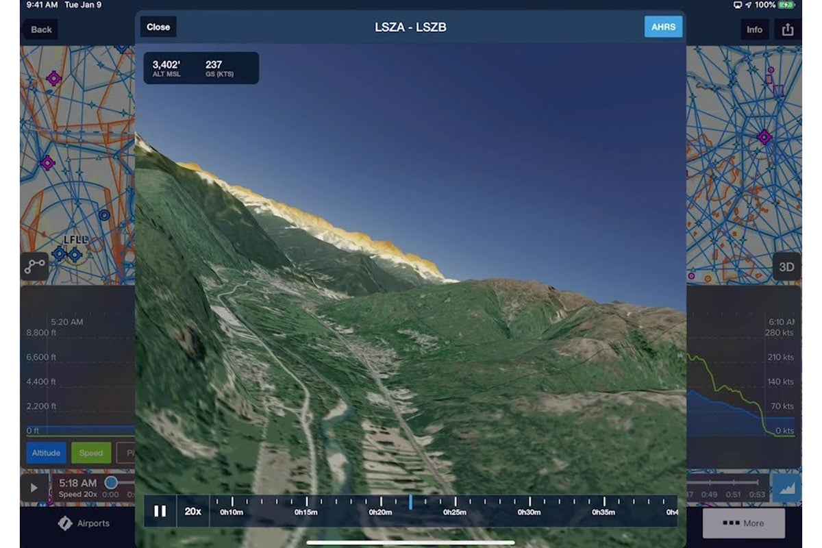
ForeFlight has added 3D flight planning tools for top-tier subscribers to its mobile flight-planning app that allow a pilot to see a digitized map of any airport and virtually fly any route before a flight or afterward as a debrief tool.
ForeFlight Adds New 3D Flight-Planning Tools
Key Takeaways:
- ForeFlight has introduced new 3D flight planning tools for its mobile app, allowing top-tier subscribers to virtually plan or review flights and explore airports using integrated aerial imagery and high-resolution terrain data.
- These 3D capabilities are available to ForeFlight Mobile app's Performance Plus subscribers, which costs $299 per year and includes other features like predeparture clearances and detailed aircraft performance profiles.
- The release reflects an accelerated pace of innovation at ForeFlight following its acquisition by Boeing and subsequent closer collaboration with sister company Jeppesen.
- ForeFlight also recently updated its takeoff and landing performance tools to conform to new FAA guidance, which recommends longer runway lengths for aging piston aircraft.
Key takeaways sponsored by Aviator Pro | Start Your Training ->
See a mistake? Contact us.