fbpx

Aviation Weather Center Website Upgrade—the Good, Bad, and Ugly

While the site was due for an update, some of the changes haven’t necessarily been a step forward.

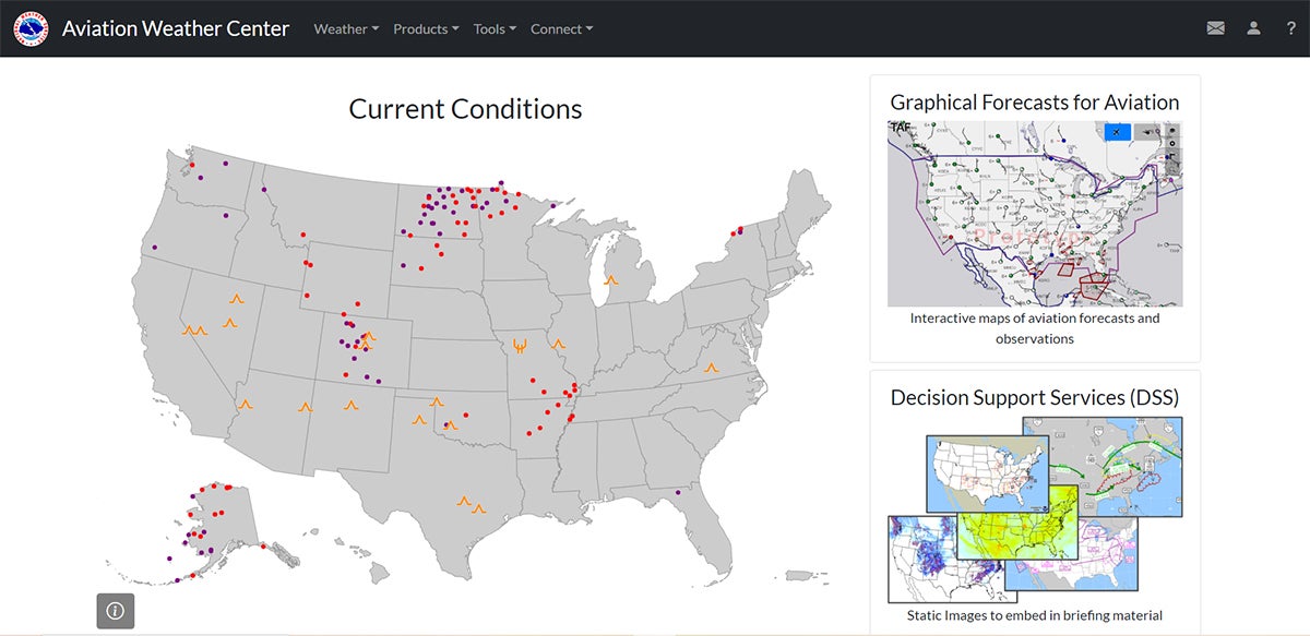
If you frequently use aviationweather.gov for your preflight planning, by now you’ve noticed a new look and feel to the Aviation Weather Center website. That’s because on October 16, the website received a long overdue facelift. There were a lot of changes—some of them for the better, but also some for the worse. Here’s a brief summary of a few of the more significant alterations.

Overview

A majority of the weather data will appear on the graphical forecasts for aviation (GFA) webpage. This is the heart and soul of the new site. Here’s a brief description of the purpose of this page as posted in the GFA help on aviationweather.gov.  

“The GFA webpage is intended to provide the necessary aviation weather information to give users a complete picture of the weather that may impact flight in the United States (including Alaska & Hawaii), Gulf of Mexico, the Caribbean, and portions of the Atlantic and Pacific Oceans. The webpage includes observational data, forecasts, and warnings that can be viewed from 18 hours in the past to 18 hours in the future. Hourly model data and forecasts, including information on clouds, flight category, precipitation, icing, turbulence, wind, and graphical output from the National Weather Service’s National Digital Forecast Data (NDFD), are available.”

What’s a Progressive Web App?

Let’s begin with the good news. Like my website, EZWxBrief, the Aviation Weather Center (AWC) decided to build its website  as a progressive web app (PWA). The aviationweather.gov legacy site was very clumsy and nearly impossible to use on a mobile device such as an iPhone. Developing this as a PWA offers a very responsive design, and that means it works reasonably well on those smaller hand-held devices in both portrait and landscape orientations. 

No, you won’t find this “app” in the App Store or Google Play Store. Instead, you should install the PWA on your device to have the best user experience. Not to worry, it literally takes just a few seconds and applies to any device, not just handhelds. 

Here’s the installation process. Simply open a browser that supports a PWA such as Chrome, Safari, or Brave and enter “https://aviationweather.gov” into the browser’s address bar. On your hand-held device, locate the “Share” icon (sometimes called a “Bookmark” or “Send to” icon). This is an icon that’s shaped like a square with an upward pointing arrow in the center. Please note that not all browsers support progressive web apps. A tap on that icon and you have finished step one of three to install the app. 

To install aviationweather.gov as a progressive web app, tap on the ‘Share’ icon. For Chrome, it’s at the end of the address bar as shown here. For Safari, you’ll find the Share icon at the bottom of the browser window for most installations. [Courtesy: Scott Dennstaedt]

Next, you’ll be shown the “Share” menu. Scan down that menu using Chrome or Safari and tap on the “Add to Home Screen” selection.

The next step is to tap on the ‘Add to Home Screen’ selection in the ‘Share’ menu. [Courtesy: Scott Dennstaedt]

During the third and final step, you’ll be able to name your PWA icon. You are free to change the long default name from “AviationWeather.gov” to AWC or whatever you like. When you’ve chosen the name, tap on the “Add” button in the upper-right corner. This will add an Aviation Weather Center icon to your home screen with the name you chose. Even better, when the Aviation Weather Center makes future updates, they will be available the next time you restart the app. It’s actually easier than installing and updating native apps.

The third and final step is to tap on the ‘Add’ button in the upper-right of the screen. You can accept the default name or change the name of the home screen icon. [Courtesy: Scott Dennstaedt]

Just like any native app, tap on that home screen icon and the aviationweather.gov site will open up. You’ll notice that it doesn’t have any browser bar or other browser controls, which frees up valuable screen real estate on smaller devices. Essentially, it will have the same look and feel as a native app without the overhead of Apple or Google. 

You can do the same installation on your desktop or laptop computer, but the process is a bit different. Once again, open up your browser and type “https://aviationweather.gov” into the address bar, and you will see an Install button appear at the end of the address bar for any website (and browser) that supports a PWA.

On a desktop or laptop computer, you’ll also be able to install aviationweather.gov as a progressive web app. After visiting aviationweather.gov using Chrome or Brave, click on the ‘Install’ button. [Courtesy: Scott Dennstaedt]

Clicking on the “Install” button will provide the prompt below to install the app.  Once done, you’ll see an Aviation Weather Center icon on your desktop. By the way, you can also always uninstall the app at any time for any of your devices.

The last step is to acknowledge the install, and you’ll see an icon added to your desktop. [Courtesy: Scott Dennstaedt]

One of the issues that is apparent with the site on some hand-held devices is that the app will crash or reset when using a rapid, pinch-and-zoom gesture on the interactive GFA map. This is evidently an issue with Leaflet (the software it uses to render the maps), and the workaround is to avoid any rapid, pinch-and-zoom gestures. Just slow your roll and you’ll be fine.  

Cross Section Tool

To replace the Java Flight Path Tool that required you to download Java onto your computer (Java isn’t permitted on iOS devices), the AWC added a cross-section tool that now runs on any platform. You will see an icon on the right to start this tool. It’s the icon just under the settings icon (cog wheel).

Look for the icon with the curved arrow and two dots to start the cross-section tool. [Courtesy: Scott Dennstaedt]

You simply define a route, such as KMCI.KMEM.KAVL (note the periods in between the identifiers), and you can plot this path on the GFA map as a great circle route or view it as a cross section. Currently, the only variables you can plot on the vertical cross section are temperature, wind speed, turbulence, and icing.

The new cross-section tool allows you to plot four different variables (temperature, wind speed, turbulence and icing) along a proposed route of flight. [Courtesy: Scott Dennstaedt]

Reduction in Static Imagery

The overall new design of the website is radically different from its legacy counterpart. Perhaps the most significant long-term effect is that the AWC decided to terminate the generation of dozens of static images that were available on the legacy site. Many flight planning websites, and even some of the heavyweight EFB apps referenced, scraped many of these images off of the AWC site. Consequently, you may have noticed back in the middle of October that these apps had to scramble to delete those from their own static imagery collections. The imagery collections that were depreciated included: 

  • Lowest freezing level forecast from the Rapid Refresh (RAP) model
  • TCF, eTCF, ECFP convective forecasts
  • RAP/NAM Wind/Temperature graphics
  • PIREP plots
  • Satellite regional plots

Although you can still find access to prog charts, G-AIRMETs, as well as icing and turbulence static imagery within the decision support imagery page (https://aviationweather.gov/graphics), the AWC has a goal to eventually eliminate all static imagery.

Missed Opportunities

Your opinion  may differ, but I find the user interface for the decision support imagery to be very antiquated and clumsy. Even on large screens, you have to constantly scroll up and down, and it requires an immense amount of button clicks or taps to get what you want. It’s very exhausting and tedious to use. In fairness, that page suggests it was “designed for Center Weather Service Unit meteorologists who build information packages on desktop computers.” Instead, AWC suggests that pilots utilize the interactive map page (https://aviationweather.gov/gfa).

The issue here is that the DSS page gives you a vertical resolution of 2,000 feet for icing and turbulence forecasts. If you use its interactive map, you only get a 3,000-foot or even 6,000-foot vertical resolution despite the fact that the native vertical resolution of the icing and turbulence products is 1,000 feet. It is understandable that browsers have hard limitations, and this was likely a tradeoff to providing something that has a reasonable performance. 

While the Aviation Weather Center removed the regional satellite imagery from the site, it has been incorporated as a separate layer into the graphical forecasts for aviation (GFA) tool. Currently there isn’t a replacement for the color infrared satellite imagery. That is something it will be adding in the future.

Another deficiency is that the site doesn’t acknowledge when the layer you are viewing is void of data. For example, if you pull up the center weather advisories (CWAs) on the GFA tool, you may get a blank map. Is the map blank because there are no CWAs active, which happens more often than not? Or perhaps it’s because your browser or internet connection is being finicky? The lack of any data or advisories is just as critical as the presence of them. AWC doesn’t provide any acknowledgement or banner to alert you when this occurs.  

If you are looking to travel outside of the U.S., some of the weather guidance on the GFA tool, such as icing and turbulence, stops at the border. While this was also true with the legacy GFA tool, it still represents a shortcoming given that much of this guidance is available over a good portion of Canada and northern Mexico. The National Weather Service (NWS) has a directive that it can’t show forecasts outside of the U.S., especially over Canada and Mexico. Pilots are supposed to go to the respective website/services for those countries to receive that forecast information.

When using the GFA tool, you will notice that forecasts for icing ends at the U.S. border. [Courtesy: NOAA]

This is inconsistent since some decision support graphics (i.e., static imagery) clearly show forecasts for icing and turbulence in Canada and Mexico. Moreover, if you plot a route from International Falls, Minnesota, to Caribou, Maine (through southern Ontario and Quebec, Canada), the cross-section view shows this guidance.

The vertical cross section provides guidance for routes that include points outside of the U.S. [Courtesy: NOAA]

Finding HEMS

If you are looking for the helicopter emergency medical services (HEMS) tool, it has been integrated into the interactive GFA and rebranded as the GFA-LA tool (with “LA” for “low altitude”). When viewing the GFA, click on the helicopter button in the upper-right part of the map to switch the GFA from general aviation mode into low-altitude mode, which offers expanded capability from the HEMS tool.

The Helicopter Emergency Medical Services (HEMS) tool has been rebranded as the Graphical Forecast for Aviation – Low Altitude (GFA-LA) and can be found by clicking on the helicopter icon in the upper right from within the GFA tool. [Courtesy: Scott Dennstaedt]

Final Thoughts

There’s no doubt that there are winners and losers with this update. I’ve read hundreds of comments on social media posts and other aviation forums that despise the new site and those that simply love it. The biggest advantage is that the site is very responsive on hand-held devices with the occasional glitch that I’m sure will be resolved in time. The dismantling of nearly half of the static imagery is truly a loss and will likely be felt for months, if not years, to come. As a matter of fact, I am in the process of finding replacements of these image collections for my own website, EZWxBrief. 

Lastly, if you are still hanging onto a glimmer of hope that AWC will bring back the legacy site, don’t hold your breath. While there are still some growing pains with this new version, the Aviation Weather Center is fully committed to this new release—so just get used to it. 

Login

New to Flying?

Register

Already have an account?