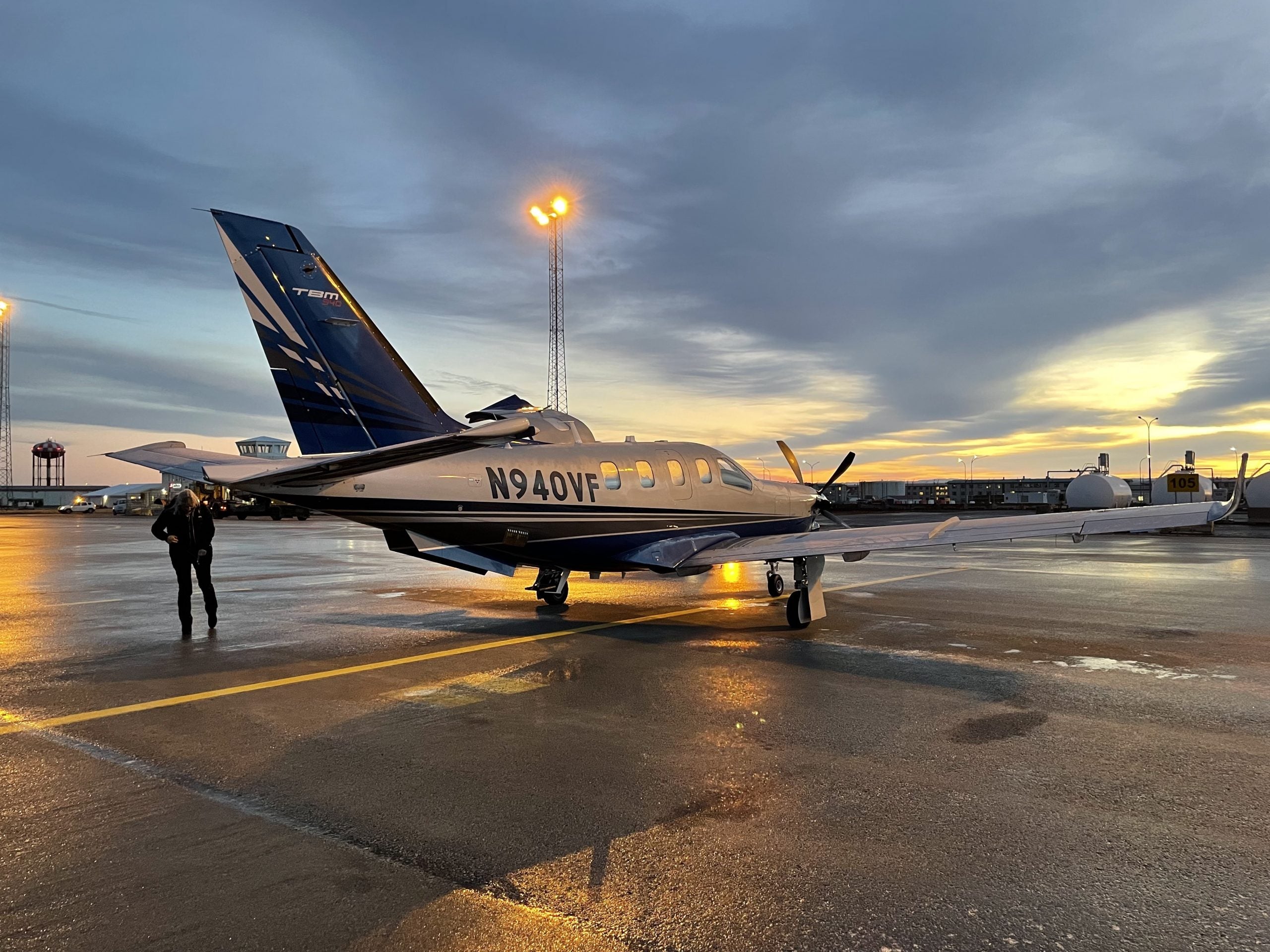
fbpx

A Flight by the Numbers

Performance to optimize the speed and range envelope makes for an efficient ferry flight.

We talked a bit about the longest leg of the trip during our first call.

It was important, because in order to optimize the efficiency of a ferry flight, a professional pilot must take a number of things into consideration, including the stamina of those on board.

The TBM 940, by the book, can make route segments from Iceland to Labrador in a single hop—if the winds don’t conspire against you. But it means a leg length of roughly 1,320 nm, and a flight time at an extended range power setting that lasts nearly six hours.

I know a lot of pilots who can’t make it that long without attending to nature’s call—and this particular 940 wouldn’t have the optional potty installed—so I took Margrit’s advice and packed a selection of Depends. Just in case. 

Our flight track from Tarbes (LFBT) to Wick’s John O’Groats airport in Scotland (EGPC).

Tarbes to Wick

Every leg would see us climb as promptly as possible to the TBM’s sweet spot (westbound) of Flight Level 280. While the airplane has a service ceiling of 31,000 msl—and might see its top speed at that height—Waltz has found almost no altitude works better. And as our discussions would reflect, regardless of the winds aloft in between. “I’ve almost never gained by stopping at a lower altitude,” she said, because the advantage in winds rarely makes up for the loss in true airspeed at lower altitudes.

I’ve spent a little bit of time flying in long cross-country races, and it also holds true that if you decide to climb for advantageous winds or true airspeeds, you want to get there as quickly as possible. Cruise climbs don’t help with overall speed.

So I wasn’t surprised when Waltz opted for a climb at 124 knots indicated upon our departure from Tarbes. We had to stop a couple of intermediate altitudes for French ATC, but otherwise she programmed autopilot and auto throttle to command the airplane straight to 28,000 feet, maintaining between 1,300 and 1,700 fpm into the mid-20s.

We shuffled past a stack of waypoints on our way to Wick to take us through U.K. airspace. Fortunately, controllers knocked off quite a few of them along the way into a more direct path. That put our time from LFBT to EGPC at 3.3 hours, seeing speeds between 315 and 322 ktas (at outside air temps of -30C to -40C) over a distance of 972 nm.

Our first long overwater leg takes us from Wick to Keflavik, Iceland (BIKF).

Wick to Keflavik

The next leg—from EGPC to BIKF (Keflavik, Iceland)—would be shorter, but we added two new elements to the mix: over water and approaching nightfall.

Those two items didn’t alter our plan, really, since we were already running at max cruise and at a nice, high elevation over the waves. But with 652 nm to cover against a stronger headwind (up to 50 knots on the nose), I was happy we kept the speed up.

The display on the right-hand MFD showed the sunrise and sunset times at our destination: 10:00 and 16:29 UTC—and local time, this time of year. Our ETA into Keflavik crept up to 18:54, but we had the southeastern coast of Iceland in sight as the last light of the sun went below the far horizon.

Waltz chose to fly the next segment to Iqaluit (CYFB) rather than Goose Bay—though the change would add a couple hundred nm to our overall flight plan, it took us away from the strongest headwinds.

Keflavik to Iqaluit

It’s Waltz’s routine in Keflavik to determine the next day’s flight plan the night before—and fuel up—so that she can simply make an update to that the next morning. A long day lays ahead on day two for many of her crossings, if the weather otherwise cooperates. And having the overnight to think through the projected winds, ceilings, and precip helps too.

She decides that evening that we likely wouldn’t make her preferred stop of Goose Bay based on nearly 100-knot headwinds along a significant portion of the route. So we plan for Iqaluit, Nunavut (CYFB), as our landing spot in Canada, a distance of 1,193 nm. The alternate of Sondrestrom air base near the west coast of Greenland would make for an expensive stop (in terms of jet-A) but a welcome one if the winds don’t go according to plan.

Fortunately, the winds continue to perform as predicted, and slack off as we reach our decision point, abeam Sondrestrom. We need to have enough fuel on board to land with nearly an hour’s reserve, according to policy, and that’s what we have as we cross Greenland’s rugged, fjord-laden coast: 46 gallons on board predicted upon landing. We end up beating this by about 10 more gallons that we gain with slacking winds and an easy approach.

Our leg into the U.S. landed at Bangor, Maine (KBGR) in order to clear customs and refuel ourselves.

Iqaluit to Bangor

With a bit of relief, our turn at Iqaluit is quick—albeit cold—and we’re off to enter the U.S. with a stop in Bangor, Maine. The 940 could have made the leg all the way to Groton, Connecticut, our final destination, but U.S. Customs and Border Patrol kindly asks that everyone stop at the nearest point of entry (with a customs facility) upon crossing the border.

We’re still sliding along at a torque setting of 95 percent at 280 and 200 kias, for a true airspeed between 309 and 312 on the segment. It’s getting warmer, and I can feel it through the window as we track nearly south (a 200 heading after we cross the south end of the Hudson Strait).

After a friendly VFR traffic pattern at KBGR, we land and taxi straight to the customs holding area near the FBO, and wait for the also friendly officer to indicate we can open the door and show off our passports and airplane for inspection. Waltz calls for fuel and we walk over to the FBO, where we feed ourselves from the vending machines in the pilot lounge—and talk with another ferry pilot taking a Cessna 414 eastbound.

The final segment is the shortest, at about 250 nm, but offers an opportunity to test the 940 once more.

Bangor to Groton

We had one last performance metric to tick off the list, as it turned out—a maximum performance descent. While getting down quickly is important in any aircraft that trips the high-altitude flight levels, it’s an extra-special event in the 940.

Waltz gave the controller a heads-up that we might trigger an alarm at Boston Center with our upcoming descent rate. Then she said something like Watch this… and pushed the nose over to 230 knots indicated. The PFD on the Garmin G3000 showed us averaging about 3,500 fpm—and sometimes pegged at 4,000 fpm down—as ATC complied by clearing us first to FL160, then 11,000 feet, then 8,000 feet, then 6,000 feet. Yee haw! It felt like we rode down on a rail.

The strong-arm of Cape Cod came into view over the nose with the 940 pitched down 10 degrees below the horizon. St. Francis looked casual in his prime spot on the glare shield. Boston turned us toward the west for the last leg into Groton (KGON). Waltz loaded the RNAV (GPS) 23 into the Groton-New London Airport into the flight plan and soon we were direct JOGIL, then onto the initial approach segment. 

The five legs went as smoothly as one could possibly expect—with nary a hiccup from the Pratt & Whitney PT6A-64 up front. Believe me, I would have known. Pretty much everything worked, with only a couple of minor squawks to share with the folks at Columbia Air Services, the TBM dealer in Groton who would take possession of N940VF until it went on to its lucky owner.

A fortunate one, indeed.

Our last leg took us into the sunset over Massachusetts—a real treat to top off 15.4 hours of flight time.

Login

New to Flying?

Register

Already have an account?