How Do You Check NOTAMs?
Here’s how to build in the habit of getting a thorough weather briefing before every flight.

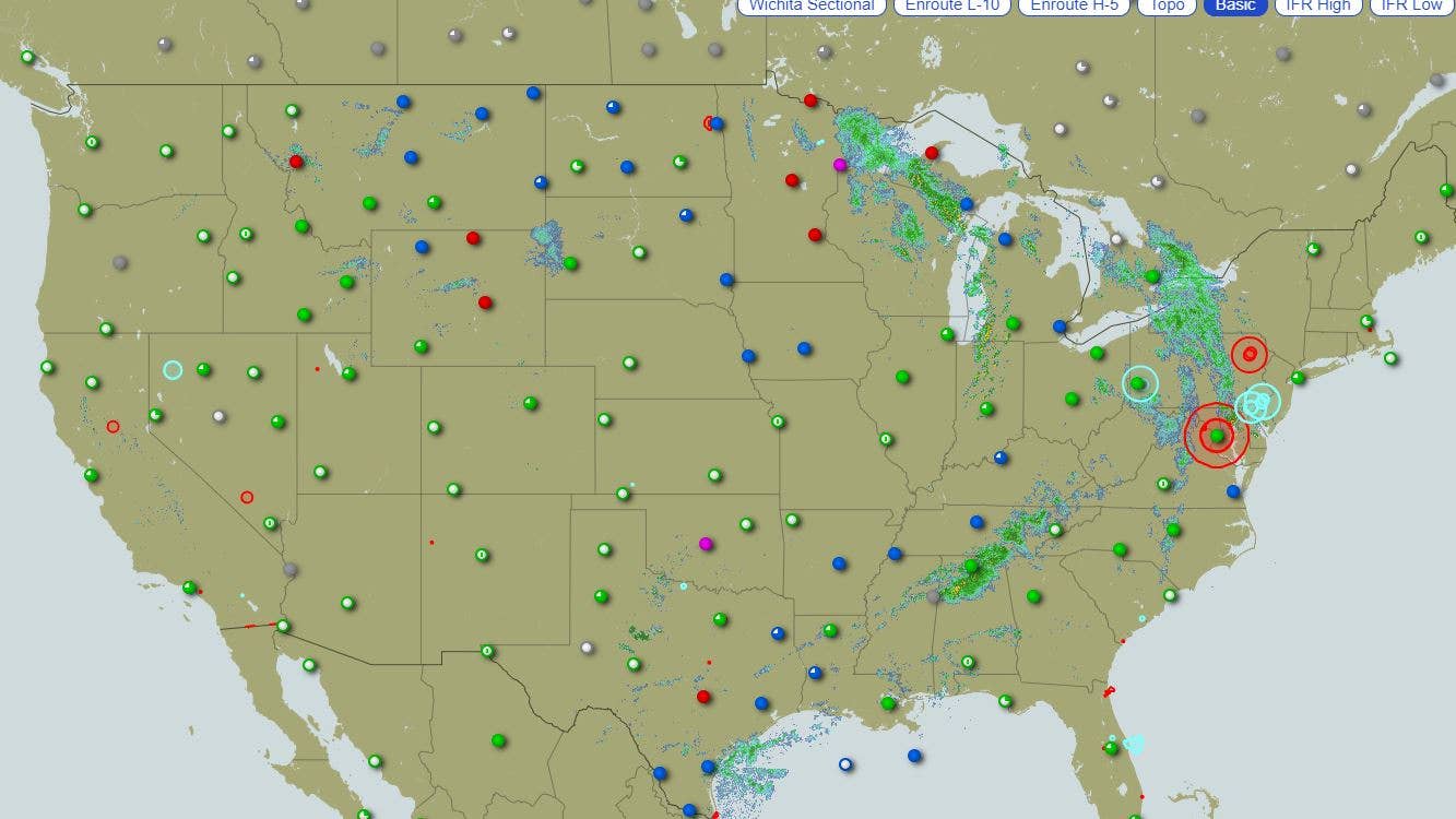
A screenshot of Leidos Flight Service interactive map [Credit: Leidos Flight Service/ screenshot]
Question: I am a private student learning about airspace, and I am about to start solo flights to other airports. There is so much information a pilot has to know, particularly about airspace and ramp closures and TFRs. Is there a best practice for checking them before a flight? What happens if I forget to do this?
Answer: There are several ways to check Notices to Air Missions (NOTAMs) as required by CFR 91.103.
The first one is when you get a weather briefing from Leidos Flight Service system. To use this service you will need to create a free account , click on "Plan & Brief," and fill out the required information. This generates your weather briefing, at the end of which you will find a list of the NOTAMs. Be sure to check for the TFRs along the planned route of flight.
The Leidos Flight Service interactive map may be found here.
You can also go directly to the FAA page for NOTAMs, which allows you to check by location, flight path, around the vicinity, geography, and by latitude and longitude. You will find information about runway and taxiway closures, changes in instrument approaches, navigational aids out of service, etc.
ForeFlight makes finding NOTAMs—especially TFRs—ridiculously easy. ForeFlight allows the pilot to overlay TFR information on the mobile app by selecting TFRs as one of the layers in the digital briefing.
In regard to the question about forgetting to do this, that could be construed as a violation of FAR 91.103, which states that, "Each pilot in command shall before beginning a flight, become familiar with all available information concerning that flight. This information must include—
(a) For a flight under IFR or a flight not in the vicinity of an airport, weather reports and forecasts, fuel requirements, alternatives available if the planned flight cannot be completed, and any known traffic delays of which the pilot in command has been advised by ATC;
(b) For any flight, runway lengths at airport of intended use, and the following takeoff and landing distance information:
(1) For civil aircraft for which an approved airplane or rotorcraft flight manual containing takeoff and landing distance data is required, the takeoff and landing distance data contained therein; and
(2) For civil aircraft other than those specified in paragraph (b)(1) of this section, other reliable information appropriate to the aircraft relating to aircraft performance under expected values of airport elevation and runway slope,aircraft gross weight, and wind and temperature."
Get in the habit of getting a thorough weather briefing before every flight, even if it is just a lap in the pattern.

Subscribe to Our Newsletter
Get the latest FLYING stories delivered directly to your inbox


