











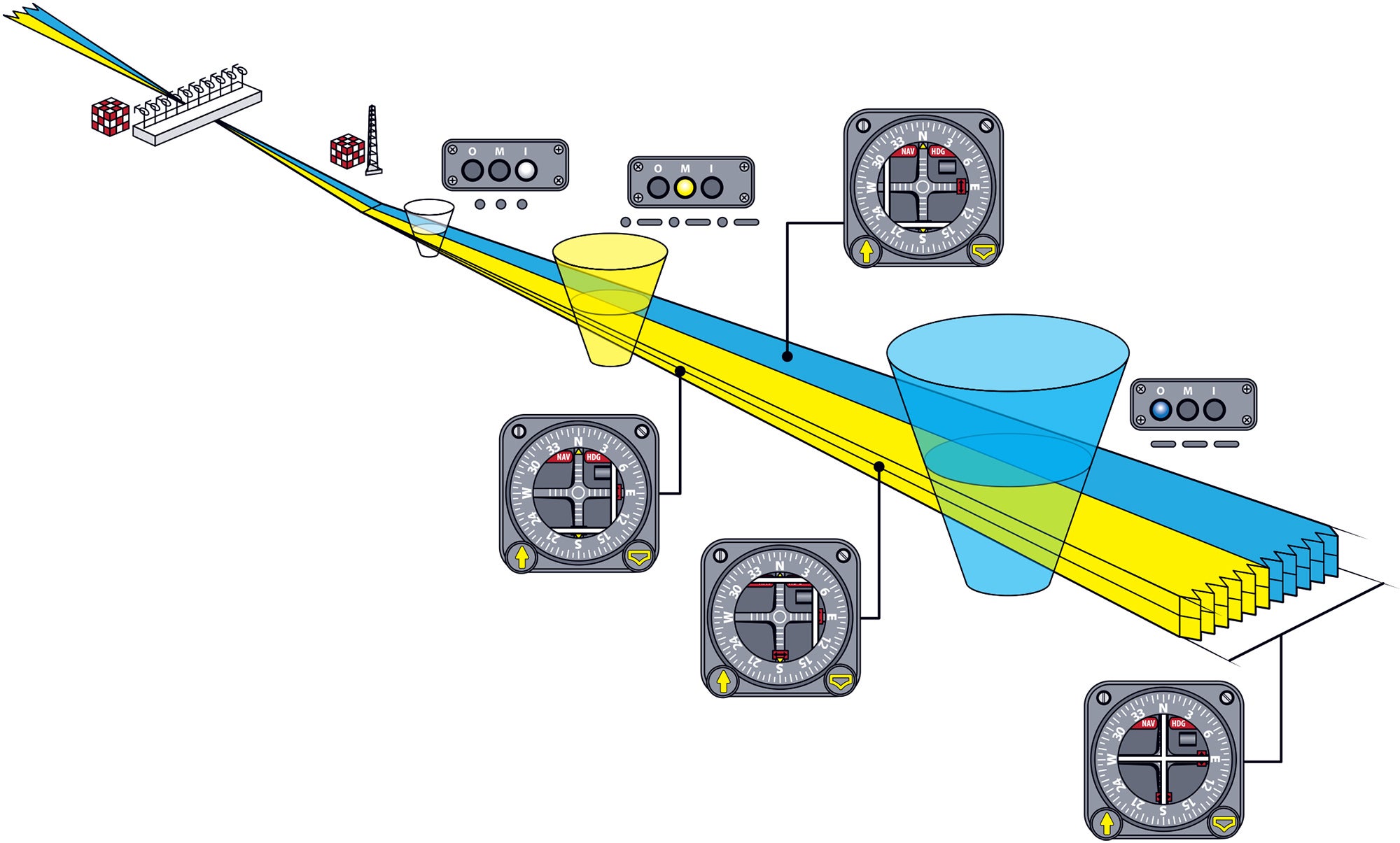
An instrument landing system (ILS) uses two separate ground-based radio transmitters to provide both lateral and vertical guidance to pilots during an instrument approach procedure that normally includes the lowest landing minimums. A Category I ILS approach, for example, typically offers a 200-foot decision height above the ground. ILS approach visibility minimums are measured either in statute miles or by using runway visual ranges down to zero-zero for a Category IIIc ILS approach. (Approaches of Cat 2 and greater require special flight crew certification.)
How an Instrument Landing System Works

Key Takeaways:
- An Instrument Landing System (ILS) utilizes ground-based localizer and glideslope transmitters to provide precise lateral and vertical guidance, enabling instrument approaches with the lowest landing minimums.
- The ILS system becomes significantly more sensitive as an aircraft approaches the runway, requiring pilots to make precise and progressively smaller corrections to maintain course and glideslope.
- While a failed glideslope allows for a localizer-only approach to higher minimums, the localizer signal can also be used for back-course approaches from the opposite direction.
Key takeaways sponsored by Aviator Pro | Start Your Training ->
See a mistake? Contact us.

