Getting a Dose of Flying with NyQuil in the System
You may feel better on the medication, but you’ll fly worse.
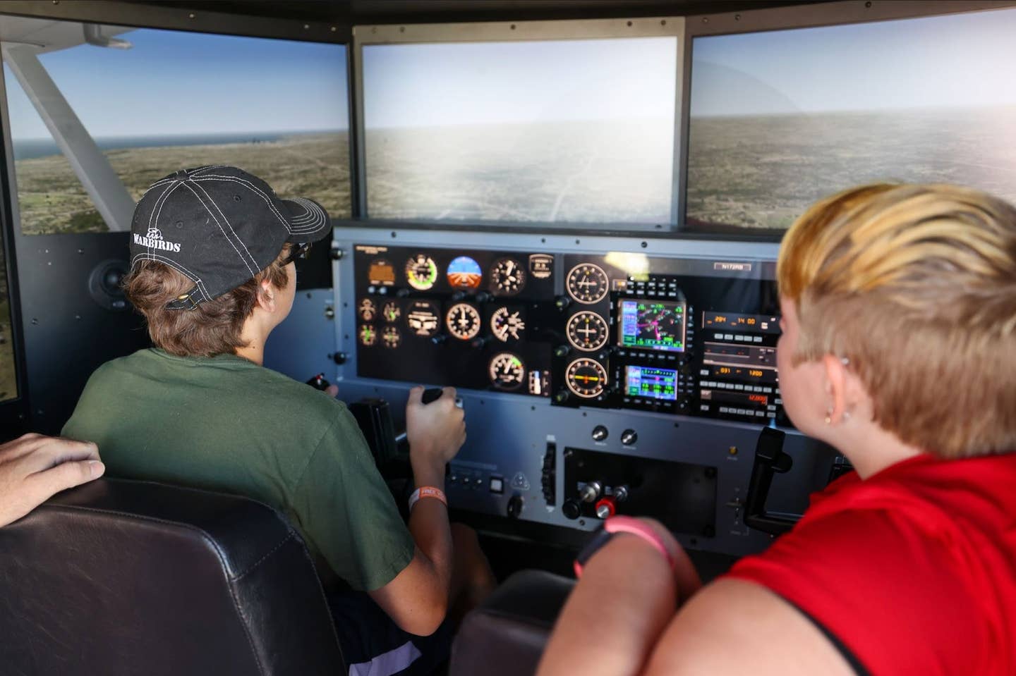
For those who have never used an AATD, it can be more difficult to “fly” than an actual airplane. [Redbird]
The only thing I despise more than getting sick is taking medication that keeps me out of the airplane. I came home from EAA AirVenture with the flu, and for the better part of two weeks I was the poster girl for NyQuil, the popular over-the-counter (OTC) nighttime cold and flu medication.
Although NyQuil is approved per the Aircraft Owners and Pilots Association database of FAA approved/disallowed medications, I've learned to give myself at least a week of nondosing before going back into the cockpit. I made this a rule after reading an aeromedical report that claimed pilots who ingest this kind medication within 72 hours of a flight are three times as likely to develop spatial disorientation than those who did not. Apparently the combination of acetaminophen (aspirin), dextromethorphan (cough suppressant), and doxylamine (sedating antihistamine) stays in your system a lot longer than the typical eight hours allotted for “bottle to throttle.”
Since FAR 91.17 prohibits the use of "any drug that affects the person's faculties in any way contrary to safety," there was no way I'd get into an airplane. But I wanted to see what effect, if any, the medication would have on me as I worked on instrument proficiency on a Redbird AATD.
Instrument proficiency is big with me. I fly practice approaches sometimes several times a month, a combination of real world and in the AATD. I wondered if this experience would lessen the impact of the OTC drugs.
The Plan
Justin Boyd, a CFII whom I helped train, agreed to be my observer. We have been flying together for the better part of a decade. If I did something out of character, he would know it.
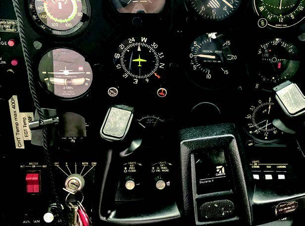
The Redbird AATD FMX was set up as a Cessna 172 with round dials. I wanted motion, IFR, and turbulence, and left the metrics to Boyd to determine. Surprise me, I said, as I arranged my kneeboard, approach plates, flashlight, checklists, etc. in the cockpit.
For those who have never used an AATD, it can be more difficult to “fly” than an actual airplane, as you lose some of the situational awareness because of the lack of vertical movement. It takes more focus to fly the AATD.
I planned to try the VOR-A at Ogden-Hinckley Airport (KOGD) in Utah. FLYING Magazine contributor Jason Blair submitted the approach as part of his column, “Chart Wise.” I fly all the approaches he sends our way in an AATD as part of my proficiency plan and to look for any gotchas that might snare a reader.
As we began the experiment, I started the timer in the cockpit—part of this exercise was to determine when saturation occurred in addition to noting what discrepancies manifested. Boyd was armed with a notebook and pen to document his observations. His job was to note how long it took me to notice them and if I took prompt and corrective action.
Although the AATD is not approved for circle-to-land approaches, the focus of the exercise was staying ahead of the aircraft and maintaining situational awareness. The airport has two runways, 3/21 measuring 8,107 by 150 feet and 17/35 measuring 5,195 by 100 feet. The approach consists of two 10 nm DME arcs— one approach begins from the north, the other from the south. The inbound heading for both is 101 degrees, and you have 10 nm to make the descent. Because it is a VOR-A, it is not directly lined up with a runway—you need to pay attention and read the fine print in the notes.
Through the magic of computers, we placed ourselves 10 miles south of JEMKU, the initial approach fix for the arc that takes us north. We started at an altitude of 7,500 feet with the understanding I could go no lower than 7,200 on the arc. With a ground speed of approximately 100 knots, I had approximately six minutes to brief the approach using the acronym MARTHA (missed approach approach weather and type, radios/radials, time, heading on final and attitude) before we reached JEMKU and made the 90-degree turn to the west to get on the arc.
The 10 DME arc required an altitude of at least 7,200 feet. That is a long arc to the north, 10 degrees at a time until you roll out on the final heading. When established inbound, you begin your descent and plan to cross the VOR at 5,200 feet. There is no glide slope, so you need to know where you are both laterally and vertically. Airport elevation is 4,473 feet.
The approach is challenging on the best of days since it is sandwiched between two sets of hills. The descent profile measures a short distance from the final approach fix (FAF) to the missed approach point (MAP). The missed approach involves a climbing left turn, and you better keep climbing in the hold until you reach 13,000. That’s 8,000 feet to travel or else you risk flying into a hillside. To legally land after this approach, you need at least 1 mile of visibility, and if I maintained a ground speed of 90 knots, I could not go any lower than 4,980 feet.
It was imperative that the pause button was never pressed during the mission, so we bounced along in moderate chop while I diverted my attention between pitch/power/performance, instrument check, cross-check, interpretation, aircraft navigation and control, and communications.
I identified the VOR, set up receiver No. 1 to track the arc, set up No. 2 two for the inbound course, copied the ATIS, then called approach to ask for the DME arc commencing at JEMKU.
The Redbird is equipped with a Garmin GNS 430, but I want to fly this old school—the GPS was for reference only.
I know from experience that if I verbalize procedures, I perform better. I MARTHA'd, double-checked the heading indicator, and set the heading bug for the tune-10, turn-10 procedure. But approximately 18 minutes into the process just after turning into the arc, I realized my scan had broken down. My altitude was 200 feet off, and I was outside the arc. I was at 11.2 DME and had overshot the turn.
I used the No. 2 VOR to determine which radial I was on and struggled to get back on the arc. I admit that I meandered—too much correction and not enough patience with it. It was a challenge.
Boyd noted this "lost situational awareness at 35 minutes in" as I went below minimums by 100 feet and—gasp— did not run the preapproach checklist. There was no GUMPS check, no T-party (timer, tune, twist the throttle, the flaps, the tires and talk) at appropriate moments. Boyd was surprised, and there was a reference to checking the hangar for my seed pod.
I redeemed myself on the missed approach procedure, calling out the UPs: pitch up, power up, climb up, heat up, and fess up, which included adjusting for the mixture for best performance as we climbed to 13,000 feet.
There were a few turns in the hold, followed by the approach from the north, with RACGO as the IAF. The north arc is considerably shorter than the south arc, so you have to get the nav/coms and GPS ready before you are even close to turning onto the arc. I am happy to report that I did better on the second arc because I knew what bit me on the first one.
KTIW for Fun
After sight reading the VOR-A, I wanted to try an approach I am very familiar with—the ILS 17 into Tacoma Narrows Airport (KTIW) in Gig Harbor, Washington.
For fun, Boyd cranked up the winds, giving me a 90-degree crosswind from the west at 30 knots, and he dropped the weather to minimums—the ceiling was 495 feet, and the minimums are 494 feet.
Again I had to verbalize to stay on task, especially when it came to ground speed. There was a gust factor playing havoc. I worked that pitch and throttle, trying to maintain 90 knots over the ground just in case the glide slope failed and it became a localizer approach.
"I'm not using flaps," I said, crabbing to compensate for the crosswind. I was on those rudders like Fred Astaire.
"I wouldn't," Boyd agreed as I applied a crab-and-slip technique, landing the upwind wheel first.
The exercise took a little more than two hours. Not much time in the grand scheme of things, but it felt much longer. I may have not demonstrated that I had eaten the whole bowl of stupid during the exercise, but I was darn sure I had nibbled from it.

Subscribe to Our Newsletter
Get the latest FLYING stories delivered directly to your inbox

