fbpx

Flying the Truckee-Lake Tahoe Region

The year-round vacation hub in offers food, outdoor pursuits, and Olympic history.

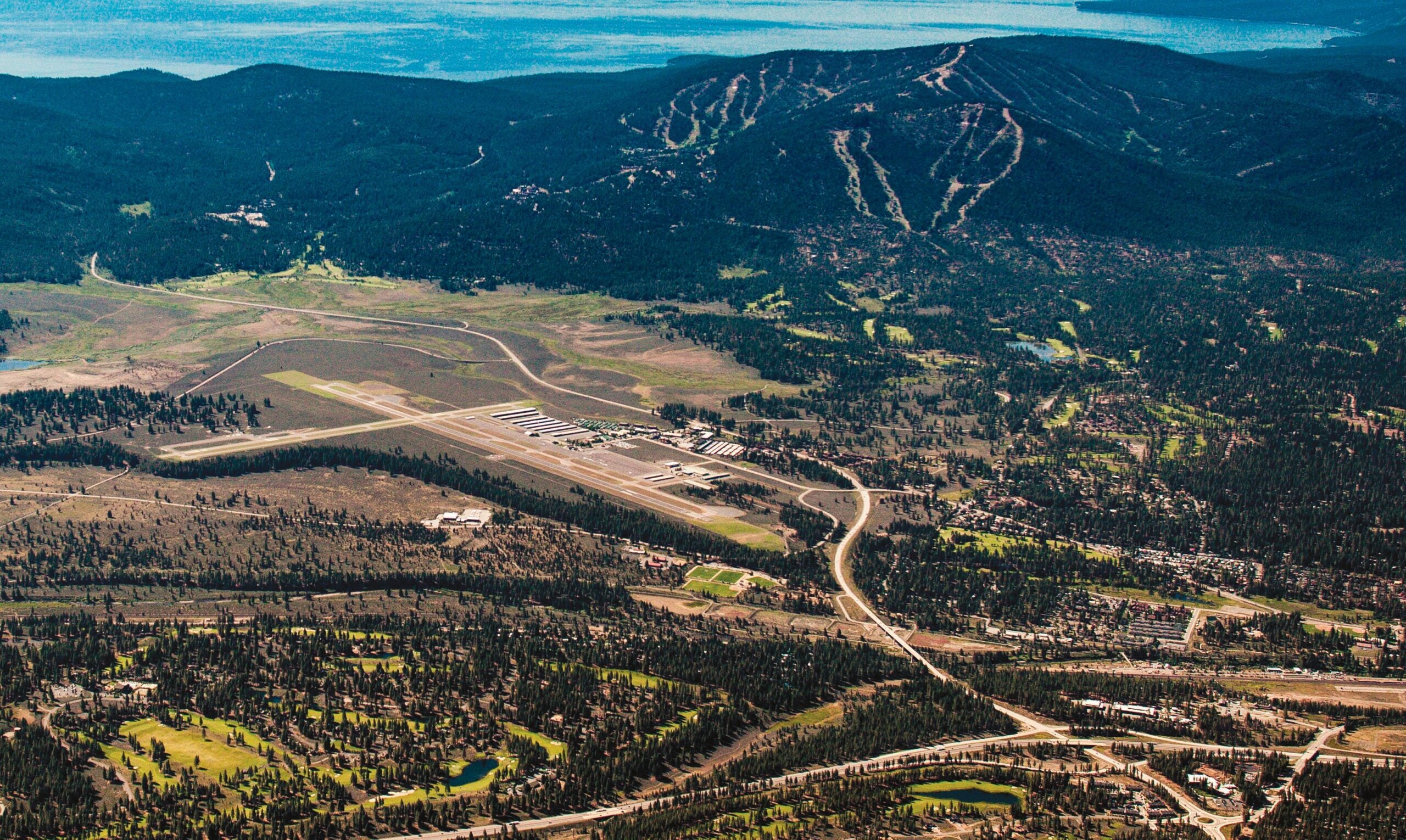
Lake Tahoe is one of those destinations I have heard about for much of my life, mostly from people who told me it was the greatest place they had ever visited. I suspected they were exaggerating or simply had not visited enough places to make the judgment.

Now I think those folks might have been correct. A recent visit to the Greater Tahoe area confirmed that it held more appeal than I had imagined, beginning with some of the most striking natural views I have experienced.

Featured

From the air or ground, the natural splendor of the lake is breathtaking, from its clear, greenish-blue water that changes color with the seasons and more than 70 miles of jagged shoreline to its mountainous surroundings.

My first surprise was how large Lake Tahoe is. One can read about how it straddles a large stretch of the California-Nevada border, spanning roughly 22 miles long and 12 miles wide with a surface area covering 191 square miles, but it appears much larger in person than on paper.

Part of the impressive visual effect is because of the lake’s location high in the Sierra Nevada. Its surface is 6,225 feet msl, and the terrain around it rises thousands of feet above.

The waters of Lake Tahoe entice throughout the seasons but take on a teal blue in the warmer months. [iStock]

Getting There

That terrain is among several factors pilots have to consider when flying into the area, which is dotted with airports whose field elevations fall between 4,400 feet and 6,300 feet. Many piston pilots have a good idea of how operating from such high airports would affect their airplane’s performance. Others might be surprised by the reduced power they are likely to experience, especially when flying normally aspirated aircraft. Density altitude, gusting winds, and weather that often changes quickly can add to the challenge.

Operating at high-elevation fields for the first time warrants additional research and preparation, especially for “flatlanders” not accustomed to mountain flying. High ground around Lake Tahoe and beyond can complicate approaches to certain airports. Well-known peaks in the  area—including Mount Donner at just over 8,000 feet, Mount Pluto at 8,610 feet, and Mount Rose at 10,785 feet—severely restrict maneuvering space and make accurate navigation and situational awareness critical.

The Airport

We visited Truckee-Tahoe Airport (KTRK), which for decades has served as a hub for vacationers and part-time area residents who shuttle between first and second homes. The area is considered a year-round destination for hiking, biking, horseback riding, boating, and watersports during summer, and skiing and other snow sports in the winter. The area is famous for its ski slopes, including Palisades Tahoe, site of the 1960 Winter Olympics.

The airport is challenging because of its elevation of 5,904 feet and surrounding higher terrain. Pilots must follow prescribed approach and departure paths not only to remain clear of terrain but also to avoid flying over noise-sensitive residential areas. Winds can also be challenging at Truckee-Tahoe.

Jeff Menasco, a former Air Force pilot who is the airport’s director of aviation, said the multiple windsocks positioned around the field often point in different directions at once.

A fatal accident involving a Bombardier Challenger jet in 2021 reinforces the notion that Truckee-Tahoe can be unforgiving.

Demanding and Appealing

Truckee-Tahoe is an inviting airport with a generous parking lot and a bright, airy terminal with lots of space to relax, flight plan, and conduct meetings. The second floor has a balcony overlooking the ramp and runway that is a great place for aircraft watching. There is an adjacent park and playground for families with children—and you might meet several staff members’ dogs during a visit.

The airport makes an effort to help pilots with advisories and tips, including a series of approach and departure videos on its website that demonstrate proper flight paths and point out landmarks, such as the truck weigh station on nearby Interstate 80, Kings Beach at the northern end of the lake, and Brockway Summit, which you have to clear on certain approaches.

On the ramp, turbine pilots will notice that only blended sustainable aviation fuel (SAF) is available. Menasco said the airport wants to take a leadership role in promoting sustainability. As a result, he said, some customers embrace the plan despite SAF’s higher cost. Others decline fuel, preferring to fill up with less-expensive standard jet-A at other airports.

Red Truck, the airport restaurant, draws a substantial nonpilot crowd to supplement fly-in customers. The menu features a range of breakfast and lunch treats that blend Mexican and South Asian influences. We arrived in time for lunch, which included a naan-dog consisting of a quarter-pound brisket frankfurter on a “bun” of naan with house-made mustard, relish, hilbeh, cabbage, and caramelized curried onions. Delicious.

We also ordered the lunch bowl, which combines dal, quinoa, fresh cabbage, fattoush, and a choice of meat or seasonal vegetables. The shaded outdoor dining area was ideal for planespotting and people-watching.

History

While the Truckee-Tahoe Airport got its start in the late 1950s, aviation had been part of the local culture for much longer. During the 1920s the federal airmail service established an intermediate landing field near the current airport. The field, which was 2,000 feet long and 600 feet wide, was part of the service’s airway between Salt Lake City and San Francisco. Instructions to pilots included directions that followed railroads and warnings about tall obstacles.

“On the direct course 10,000 feet will clear the highest peak, but an altitude of 15,000 feet should be maintained,” the instructions read, in part.

By the 1950s, business owners in Truckee were eager to build a new, larger, modern airport to attract more tourists. By 1958 they formed the Truckee Tahoe Airport District (TTAD), elected a board, and sought state and federal funding to build a runway and terminal and buy additional property around the airport. Today, the airport is funded by a number of sources, including aviation fuel sales, aircraft services, hangar leases, and local property taxes.

In 2017, when the control tower opened, the airport boasted 33,580 aircraft operations, made up of 14,978 piston single, 1,145 piston twin, 6,942 turboprop, 4,140 jet, 1,229 helicopter and 5,146 glider. The daily average was 92, though the figure grows significantly during holiday weekends and peak tourist periods in summer and winter. The record stands at 532 ops in one day.

Alternates

Other airports, all nontowered, that serve the Lake Tahoe area include Lake Tahoe Airport (KTVL), Minden-Tahoe (KMEV), Carson City (KCXP), Dayton Valley (A34), and Blue Canyon-Nyack (KBLU).

We arrived at Reno-Tahoe International (KRNO), the area’s Class C commercial hub, on our way to the annual weeklong National Championship Air Races at Reno-Stead Airport (KRTS). With an event as big as the races going on all day and local casinos and restaurants buzzing at night, it is easy for visitors to forget about the region’s other attractions, but there are many. Tahoe is close, well known, and clear in its appeal. But there is more to see in the Reno-Tahoe area. Hotel rooms are hard to find during race week, so we stayed 40 minutes away in Carson City, Nevada’s capital.

The town has developed a young, artistic vibe that we found welcoming. There is plenty of creative food, good coffee, and shopping to keep visitors busy. Carson City is also close to Tahoe and Virginia City, the preserved-in-time Old West town that feels like a scene from 3:10 to Yuma or perhaps High Plains Drifter.

Downtown Reno, where the Truckee River runs through, features shops, restaurants, bars, and large-scale outdoor art. If Las Vegas does not quite work for you, Reno might be your place.

For pilots, the network of airports in and around Reno and Lake Tahoe make the area a singular flying destination.


Truckee-Tahoe Airport (KTRK)

Location: Truckee, California

Airport elevation: 5,904 feet msl

Airspace: Nontowered, Class D

Airport hours: Continuous

Runways: 11/29, 02/20

Lighted: Yes, both runways

Pattern altitude: 7,000 feet msl for light piston aircraft, 7,500 feet msl for turboprops and jets


This column first appeared in the December 2023/Issue 944 of FLYING’s print edition.

Login

New to Flying?

Register

Already have an account?