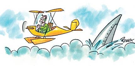
Probably the most feared situation in aviation, besides perhaps an inflight fire, is a midair collision. One moment a pilot is enjoying the flight. He may be checking his chart or tuning a radio. Or maybe he is talking with a passenger or taking a drink of water. Suddenly there is a loud crash. The plane splinters, the wings crumple. The pilot, if he is still alive, has only a few moments to consider what happened as the airplane plummets to the ground.
Most pilots know the standard collision avoidance advice to progressively scan across the windshield. If they are honest, they will tell you that cockpit chores, the labor intensive modern glass cockpits, fatigue and just plain laziness keep them from accomplishing a consistent regular scan. So in reality, to a great extent we are relying on the"big sky theory." When you look at the airspace available both horizontally and vertically, the chance of two aircraft being at exactly the same place at exactly the same time is almost nil.
The big sky theory starts to fall apart in a terminal environment. Suddenly all those airplanes scattered over many miles and tens of thousands of feet of altitude are crammed into a relatively small area at about the same altitude. In a situation like that the odds of having a collision are obviously much higher. There is a new tool available that helps pilots understand the true extent of the threat of a midair collision and provides information that can help to avoid a collision or a near miss.
The goal of See and Avoid (seeandavoid.org) is to"eliminate midair collisions and reduce close calls through continuous flight safety and proper flight planning." Their emphasis is on"promoting infor-mation exchange between civilian pilots and the military flight safety community," and they hope to provide one-stop shopping to help everyone safely share the skies. They state that there has been an average of 30 midair collisions in the United States each year since 1978, resulting in an average of 75 deaths per year. There are more than 450 near midair collisions (NMACs) reported each year, with many more not being reported.
While the emphasis of See and Avoid is reducing the threat of collisions between civilian and military aircraft, the information is useful for analyzing all midair collisions and NMACs. The centerpiece of the website is a Google map of the world with the following information plotted for the continental United States, Alaska, Hawaii, Guam, Puerto Rico and the Virgin Islands-airports, military bases, military operations areas, special use airspace, low-level training routes, and the locations of near midair collisions and midair collisions.
The user can select what information he wants to display. Clicking on the marker for a near midair collision or midair collision displays a box with basic information about that occurrence. A line on that box can be selected to view the abbreviated NTSB report, and some of those allow the user to go to the full narrative report. As with any Google map, the user can zoom in or out and move around the map at will. You can also enter the identifier of any civilian or military airport to go to that location.
Thus there is a wealth of information available. Fortunately there are not enough actual midair collisions to establish much of a trend, but as you zoom in on an area, the clusters of NMACs really stand out. In the Phoenix area, there is one cluster between Mesa's Falcon Field (FFZ), Chandler Airport (CHD) and Williams Gateway Airport (IWA). Besides the traffic for these three airports, anyone flying under the Phoenix Class B airspace to the southeast of Phoenix transits this area, making this a high-risk location.
After I had examined some of the NMAC clusters in the southwestern United States, I started clicking on the actual midair collision markers so I could read about those accidents. What struck me was that very few were just a simple case of the pilots not seeing each other. Almost every time either the aircraft were involved in an operation with a higher risk of a collision, and/or one of the pilots did something that contributed to the near collision or collision.
There were a number of midair collisions and NMACs involving parachute jumping operations. It seems that pilots of parachute jump airplanes are often in a hurry to get back down for their next load and end up cutting corners. In one fatal collision, a pilot returning to the airport reported downwind when he was actually in a descending turn heading generally opposite to the downwind heading on the other side of the runway. Another pilot returning from a drop made a short approach from higher than pattern altitude and cut in front of another airplane on final, nearly causing a collision.
Some other examples:
• Two airplanes that were practicing formation aerobatics collided at the top of a hammerhead stall.
• There were several collisions where one of the pilots either chose not to transmit their location in the pattern or did not have the necessary frequency to do so.
• A pilot was requested by the controller to"report two miles out on the 45" but failed to do so, resulting in a collision in the pattern.
• A pilot lined up on the wrong runway and collided with an airplane on final for that runway.
• A student pilot in an R22 helicopter failed to comply with the controller's clearance and collided with another helicopter in the pattern.
• Several collisions occurred because one of the airplanes was not at the correct pattern altitude.
• At an airport with three parallel runways, a pilot departed from the left runway and either turned or drifted into the path of an airplane departing from the center runway, coming within a few hundred feet of a collision.
In less than an hour on the See and Avoid website, I was able to analyze the high-risk areas for midair collisions in my local Phoenix area. I also found complete descriptions of all current United States military aircraft, from the Air Force X-26A training glider to the new F-22 Raptor. There were links to other websites with information on avoiding midair collisions, and they are encouraging military safety officers to add information about their bases to the website. In addition to showing the Low Level Training Routes, they are working on making it possible for pilots to virtually"fly" any Training Route on a 3-D Flythrough.
I believe every pilot could benefit from spending some time getting familiar with the information on midair and near midair collisions and military operations in their local area. The additional information on specific incidents and accidents makes it clear that no one can afford to get complacent about traffic awareness. Above all, it is critical that everyone flies the proper patterns and altitudes, and makes accurate and timely position calls. As traffic continues to increase, the big sky is rapidly getting smaller, especially around busy airports. No one can afford to let their guard down or cut corners.

Subscribe to Our Newsletter
Get the latest FLYING stories delivered directly to your inbox

