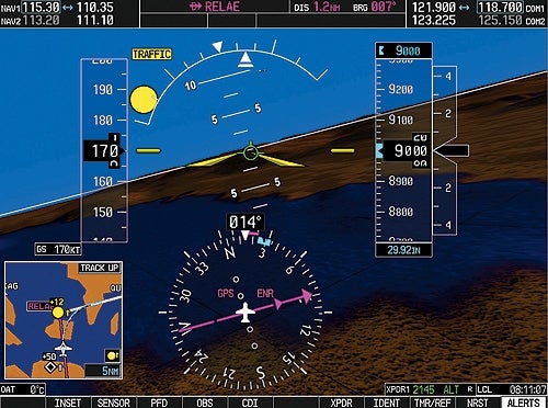
Garmin's Synthetic Vision Technology (SVT) clearly distinguishes water from the sky using different colors and textures on its display.
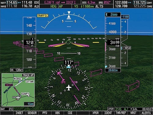
The SVT system provides "pathway" boxes that illustrate the desired lateral and vertical flight path for precise course tracking.
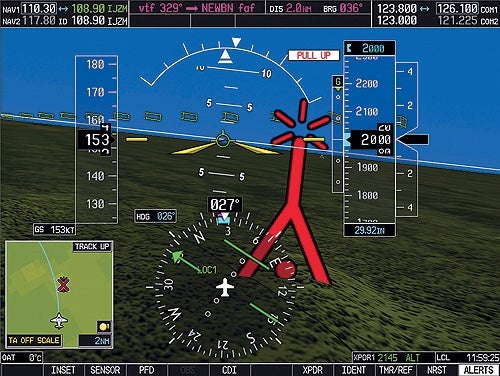
SVT includes obstacle warning features, enlarging symbols and changing their color (yellow at <60s, red at <30s) to alert pilots to impending collisions.
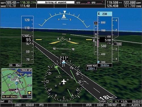
During runway approaches, SVT displays the runway pavement, centerline, and numbers in proper perspective, with an optional inset window for additional information.
This display shows how Garmin created a different color and apparent texture for water so that there is no confusing it with the blue sky presentation.**You can see the Garmin SVT “pathway” boxes stretching out ahead and below the airplane. The boxes represent the desired path in space, both laterally and vertically, so to track the course you need to keep the flight path marker flying th?**As you approach an obstacle the SVT display enlarges the symbol to make it visually jump out. If you continue on a collision course the symbol turns yellow when impact is less than 60 seconds away, and finally red when the threat is 30 se?**When you near the desired runway the SVT shows the pavement in proper perspective along with the centerline and runway numbers. The inset window on the lower left can show a variety of additional information, a wider view of the area arou?
CREATE A FREE ACCOUNT
Sign up to keep reading
Create a free account to continue. Already a member? Sign in below.