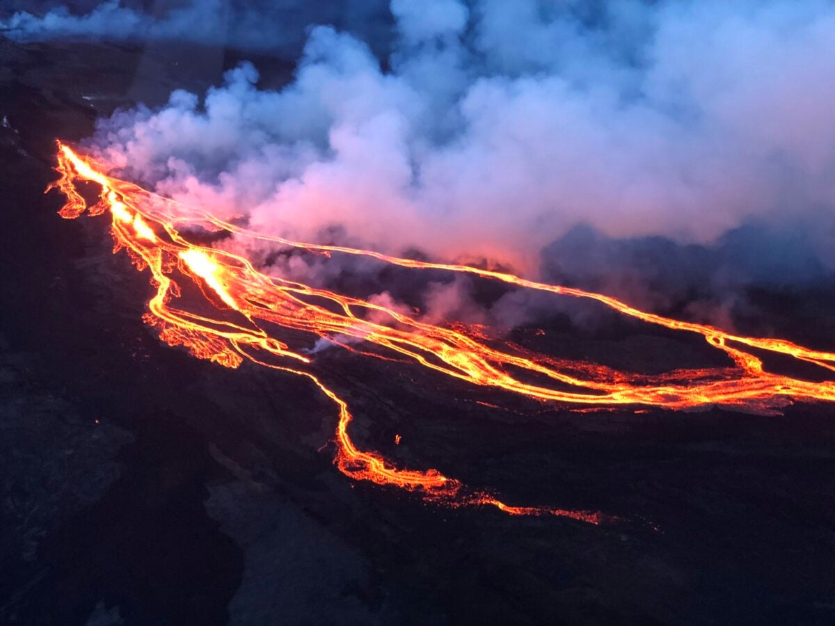
Mauna Loa, which is located on the Big Island of Hawaii, erupted on November 28. [Courtesy: Civil Air Patrol]
Key Takeaways:
The Hawaii Wing of the Civil Air Patrol (CAP) is assisting U.S. Geological Survey (USGS) scientists by conducting aerial missions to monitor lava flows from Mauna Loa.
CAP flew two flights on Monday, collecting photos and videos of the lava to assess potential dangers to downslope communities and the critical Daniel K. Inouye Highway.
Flights were temporarily paused as the lava flow is now close enough to the highway for ground observation, but CAP remains on standby for future tasking.
Flying near the active volcano presents unique hazards, including avoiding ash and smoke plumes, flying lava, and navigating around unauthorized small unmanned aerial systems (sUAS).
The Hawaii Wing of the Civil Air Patrol (CAP) is helping U.S. Geological Survey (USGS) scientists keep track of the lava flows from Mauna Loa. The volcano, located on the Big Island of Hawaii erupted on November 28.
CAP flew two flights Monday—one at daybreak and a second in the late afternoon, according to CAP Hawaii Wing Commander Colonel Stacy Haruguchi.
CREATE A FREE ACCOUNT
Sign up to keep reading
Create a free account to continue. Already a member? Sign in below.
Meg Godlewski has been an aviation journalist for more than 24 years and a CFI for more than 20 years. If she is not flying or teaching aviation, she is writing about it. Meg is a founding member of the Pilot Proficiency Center at EAA AirVenture and excels at the application of simulation technology to flatten the learning curve. Follow Meg on Twitter @2Lewski.