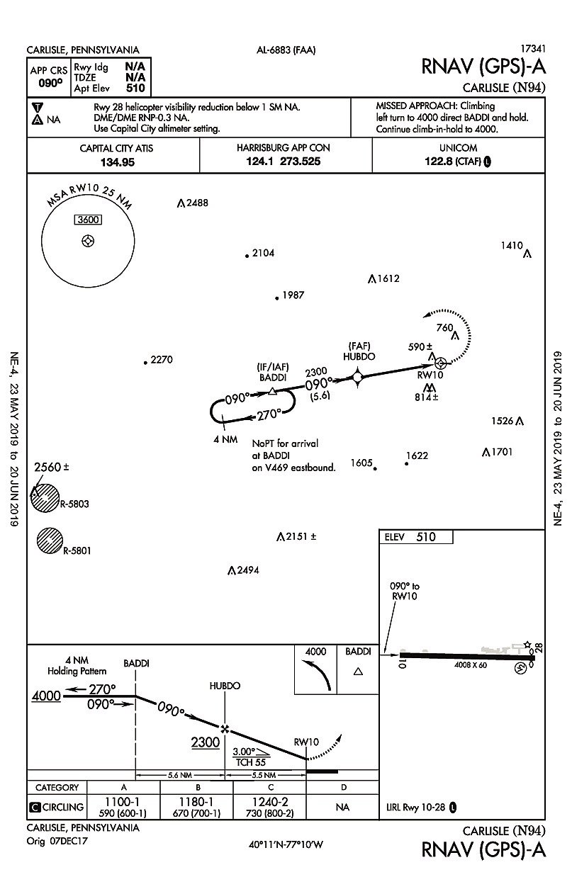

Recently, we heard from a reader with a question about an approach into Carlisle, Pennsylvania (N94). The RNAV (GPS)-A approach has a final approach course that’s offset from the runway by around 12 degrees and a standard three-degree descent angle. Approaches are usually published with only circling minimums when the final approach course alignment relative to the runway exceeds 30 degrees (for most procedure types) or the descent angle is greater than 3.77 degrees (for Category C and below). Since neither of these reasons apply to this approach, why doesn’t it have straight-in minimums?
It turns out that the reason this procedure has only circling minimums has to do with the runway markings, of all things. The runway at Carlisle has basic, visual, runway markings; airport design standards call for at least non-precision instrument markings in order to publish straight-in minimums. This little detail isn’t found on the chart, the Airport/Facility Directory, or most EFBs, but can be found in online sources, such as Airnav.com, which include FAA airport survey data. If not for the visual runway markings, lower minimums might be possible since LP, LNAV/VNAV or LPV lines of minimums could be considered.
