If you’ve been flying for very long, it’s likely there’s a route you frequently use. It could be a quick out-and-back to the nearest $100 hamburger or cheapest avgas, or an hours-long trek to Grandma’s house. It’s something you’ve flown often and know well enough to almost do it without a chart. You understand the topography along the way, where the bolt holes are and how any weather may influence the flight. You may even have a couple of the frequencies memorized, along with expected ATC routings.
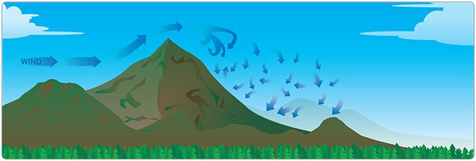
I have a few routes meeting that definition. A couple of them are relatively benign in poor weather. The sketchier routes generally involve unforgiving terrain, the kind that can combine with strong winds and/or convective activity to make flying conditions worse than might be expected over flatter areas. The Appalachian Mountains on the east coast and pretty much anything west of Texas meet this criterion.
