fbpx

Weather Lessons Learned

The third dimension really matters.

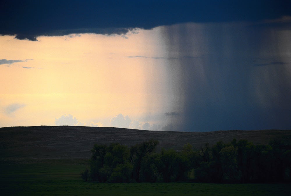
Weather to a ground person and weather to an air person are two completely different things. The ground person feels temperature and wind and precipitation and looks out the window or up at the sky at clouds. The ground person has to wait patiently for the weather in his location to change. Those of us who fly are literally part of it. The fact that we are x-feet high and moving relatively rapidly within a weather system means that we are in effect completely embedded in whatever is going on.

Most of the pilots who get into weather trouble are those who do not go beyond the required knowledge of the subject. A weather-wise pilot is completely curious about what is going on and why it is going on. Every bit of wind and turbulence and cloud begs to be understood.

As I have said many times before, when I got my private certificate the written test was 25 questions, true or false. There was no ground school. There was thus little or no training on weather. Our lessons were learned in flight and we were self-taught. There is no better place to learn about weather than in the cockpit of a light airplane. There you learn a whole lot more than the theory.

The first lesson that I learned was that it is quite important to know where the fronts and low pressure areas are located, the nature of the phenomenon and the flying weather it is creating. Why? Simple. If you are flying toward a front or low, the weather will get worse as you go along. If flying away, it might get better. How much worse or better depends on the strength of the system.

When we didn’t have anything other than the basics we used surface wind to gauge the nature of weather. Strong wind, strong weather. A barometer was also useful to measure the atmospheric pressure and the rate at which it was changing.

We could get terminal forecasts by calling the Weather Bureau, or that day’s equivalent of an FSS, but most weather information was gleaned from listening to scheduled broadcasts of sequence reports at 15 and 45 after the hour. From the reports we could put together an idea of where the weather systems were located and how they were affecting the flying weather. We would usually write down the sequences so we could have an idea of trends.

Before flying away we used a look out the window plus that rudimentary knowledge of the basics to decide whether or not to start out.

The VFR/IFR deal was different in the ’50s, too. It was perfectly legal to cloud fly in uncontrolled airspace. It still is but there was a lot of uncontrolled airspace then and not much now. As is true today, we had a burning desire to get as much utility as possible out of our airplanes. We knew, though, that we were pretty much on our own to figure out the weather and not fly the airplane into something we couldn’t handle, or into the ground. There would never be a way to tell, but I have often wondered if we did any worse on weather-related accidents per 100,000 hours than pilots are doing today.

One thing that took a while to grasp was the slope of fronts. I remember when I first read about frontal slopes. I was amazed that they are so shallow and this explained areas of turbulence behind cold fronts that had come as a surprise. In retrospect, it is pretty simple. There is wind shear along the slope of a front, thus turbulence. I recall one day getting really pounded in my Piper Pacer when flying parallel to the surface position of a front, behind the front, looking for a place to sneak through. At the time, I did not know that I was flying on the slope of the front, and the turbulence was caused by wind shear associated with that slope.

Wind shear was always there but understanding was a long time coming. One airline pilot who spanned the DC-2/747 age said he was glad they didn’t invent wind shear until after he retired.

With an understanding of wind shear comes an ability to anticipate things that will affect the airplane, be it related to turbulence or performance. When flying an approach, if you know the wind at the altitude where the final descent starts and the wind at the surface, you can anticipate how the airplane will be affected as it descends.

It is true that a steady wind does not affect an airplane in flight, and for a long time a lot of pilots held tenaciously to the belief that wind doesn?t affect an airplane in flight, period. But when we learned how changing wind, with height or over distance, affects an airplane in flight we had a lot of answers to a lot of questions.

Pilots were a long time learning about this, and once after I had written about how a decreasing tailwind affects an airplane as it descends on an ILS approach, I had an allegedly experienced aviator say that this was a preposterous thing to say. He apparently flew along without wondering why his airplane was behaving as it was.

Another wind lesson relates to mechanical turbulence. If wind flow over obstacles and rough terrain is visualized, we can do a better job of minimizing the bone-jarring turbulence that is found in those post-cold frontal conditions when the wind roars out of the northwest. The most basic observation is that it is rougher on the lee side of mountains than it is upwind of the mountains.

The period of maximum turbulence behind a cold front in rough terrain can come soon after the front passes. The wind shear in the lower levels is maximized, and if the air behind the front is a lot colder than the air ahead of the front, the turbulence can be especially enthusiastic as the cold air scours the warmer air out of the valleys. I learned the lesson that it might be a good idea to wait awhile before flying after the passage of a strong front. The clouds and weather might be okay but the air might be in a period of maximum disturbance.

When fronts occlude, usually a cold front overtakes a warm front because a low strengthens and starts moving more slowly as the cold front moves more rapidly; surface wind can be the first clue that this is happening. If there?s a strong southeast wind here and a strong southwest wind a bit farther west, that?s a sign of an occlusion between the two points. An occlusion is a big event for pilots, too, because the wind shear turbulence in an occlusion can do a pretty good thunderstorm imitation though it might be without the strong vertical currents.

So, wind has been a big lesson learned and, like all else about weather, I never quit learning and discovering new things.

Clouds and precipitation and ceiling and visibility decide whether or not we can go VFR or successfully complete IFR approaches. The main thing to learn here is that what you see is what you get. Especially with automated weather reporting equipment, the reported condition is a snapshot at the airport. An observer making a report might see a fog bank over the end of the runway, or see scud that the machine doesn?t detect, but you can?t count on that.

Anytime the reported ceiling is 500 feet or less and the visibility two miles or less, and/or the temperature and dew point spread is 2 degrees or less, completing either a precision or a non-precision approach is open to question. The culprit is scud. We are looking at a slant for a view of the runway, and it doesn?t take a lot of scud to obliterate that view. I learned long ago to glance down when passing through 500 feet on an ILS. If the ground is visible and there is scud beneath, best be ready to miss the approach regardless of what the reported weather might be. The base of any scud is likely to be below 200 feet.

And then there is fog, the lowest clouds of all. The fog lessons are pretty simple.

Don?t depend on any forecast of the time for fog to lift. It?s a hard forecast to make. If the level of cooler air that is supporting the formation of fog is more than a few hundred feet thick, and the air above is quite a bit warmer, lifting will be slow. That?s especially true if there is snow on the ground. If there are higher clouds that will prevent the sun from shining on fog, that too makes a difference.

Fog that forms in an upslope condition, where, for example, there is an easterly flow over the ever higher ground of the Midwest, can be thick and widespread and tenacious. That is a time to carefully guard your fuel reserves.

I long ago quit flying approaches when the weather is reported below minimums in fog. I have read too many accident reports involving pilots doing this. It simply does not work, so why take the risk of descending to 200 feet above the surface when nothing but bad can come of it? If the pilot is one of the macho dudes who is going to keep descending until he sees something, that is a question that relates to extremely high-risk behavior.

There is really only one weather-related thing that we can do in Part 91 operations that will likely result in trouble with the government. If we fly into an icing condition that is getting the best of the airplane, the NTSB will scold if we crash and the FAA will prosecute if we cause a stir in the air traffic control system.

I flew my deiced Cessna P210 for 28 icing seasons and seldom used the boots to shed ice. There were a lot of days that I wouldn?t have flown without the boots, and I recall one day when I was satisfied with the conditions for the flight but when I turned the prop deice on, it didn?t work. That called for a landing at the nearest suitable airport, which happened to be home base because I had just taken off.

The lesson is that you can fly a lot in the icing season without getting a lot of ice. The main requirement, deiced or not, is to flee the ice at the first sign of it. Change altitude or turn around and go back to the ice-free air from which you came. Pilots who get into ice trouble are the ones who keep going, hoping that it will get better.

When dealing with conditions that might be conducive to icing, the business about knowing your position on a weather map is important. If you are flying toward a low or a front, the tops will become higher and the ice will get worse the closer you get to the inclemency. I made that mistake a few times, many years ago, and vowed not to repeat it.

If there is something that tells you that any ice is likely to get worse in a hurry, it is turbulence. Turbulence in clouds means cumulus and cumulus means larger supercooled water droplets, more of them, and the likelihood of airframe icing at colder temperatures. I learned that lesson in western Tennessee, flying toward a surface low that was located in northern Louisiana. If I had known then what I know now, I?d have spent that New Year?s Eve in a bar in Nashville.

Thunderstorms have always been a fascinating challenge for me. I flew into one many years ago and it taught several good lessons.

No radar then and I was flying from west to east. I didn?t know the synopsis but it was a warm or stationary front, or an area with the properties of one of those fronts. No thunderstorms were in the terminal forecasts.

The clouds got dark, the rain started, the turbulence was like a roller coaster and there was lightning. The passage didn?t take long but it felt like an eternity.

One lesson was that with some luck you can make it through an embedded warm frontal thunderstorm at low altitude if you pay careful attention to the attitude of the airplane. Another lesson was that I never wanted to do that again. And I didn?t, helped by an ever increasing amount of weather information. Today, a pilot who gets into thunderstorm trouble is simply pushing too hard.

I flew a lot in the south-central and southeastern part of the country, and kept a lot of thunderstorms at arm?s length. There are guidelines about the distance to stay away from storms, but I found several times that the guidelines are not adequate, especially when it comes to severe storms. Also, geography has a lot to do with this. You can comfortably fly a lot closer to a nonfrontal Florida storm than you can fly to one of those deep-breathing green ones in Kansas.

At one point I did a lot of thunderstorm photography. The flying was visual, always. I learned never to get inside a cloud when avoiding big storms. But I did go out looking for storms. They were both easy to find in Arkansas and easy to avoid.

I learned one day about the visual clues a storm will give about turbulence. I was giving a storm a wide berth. I noticed some wispy clouds ahead, well away from the storm. As I approached those clouds, the turbulence went crazy. It actually threw a suitcase from the aft baggage area of my Cherokee Six into the front seat.

I remembered that years later when I was avoiding a tornado-producing storm in the middle-Atlantic area. Using the radar, I probably had a 30-mile separation from the precipitation of the storm. Peering out the windshield, though, I saw some of those wispy clouds ahead and turned so the nose was pointed well to the left of those clouds.

The turbulence around a thunderstorm is caused by wind shear. Air rushes into the storm, turns and heads upward, and then comes back down with the rain. Just like with rough terrain, visualizing wind flows around a storm can help avoid wind shear problems, both while taking off and landing and while maneuvering around the storm.

Moving the wheel, wiggling the pedals and manipulating the power are one thing. Using the autopilot and managing the avionics are another thing. You have to be able to do those things to be checked out in an airplane. But a pilot is not complete until he faces the realization that, when flying, we are part of the weather and the more we understand it, the better we can manage the weather-related risk found in flying. When it comes to flying experience, only the next hour counts. But weather wisdom is cumulative.

Login

New to Flying?

Register

Already have an account?