











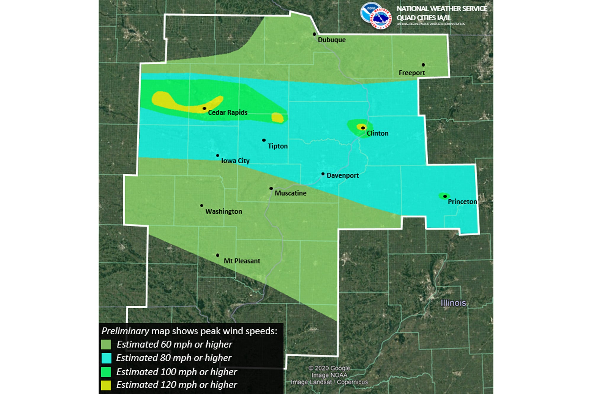
Cedar Rapids, Iowa, stood in the gunsight of an awesome derecho storm that hit the state on Monday, August 10, in the early afternoon hours. A derecho, usually associated with rapidly-moving bow-echo or squall-line thunderstorms, packs immense straight-line winds, often in excess of 100 mph—and it remains far more difficult for meteorologists to predict than garden-variety cells and tornadic rotation.
Iowa Airports Clean Up After Derecho

Key Takeaways:
- A powerful derecho storm with winds exceeding 100 mph struck Cedar Rapids, Iowa, causing widespread devastation to cropland, property, and infrastructure, and resulting in prolonged power and communication outages.
- The Marion Airport (C17) suffered severe damage to hangars and aircraft, with power out for a week, while the nearby Iowa City Municipal Airport (KIOW) was largely spared, experiencing only minor damage and an overnight power outage.
- The storm, characterized by immense straight-line winds and difficult to predict, hit with little warning, as evidenced by airports having minimal time to prepare.
Key takeaways sponsored by Aviator Pro | Start Your Training ->
See a mistake? Contact us.

