Improvisation Is Not a Flight Plan
Habit born from overconfidence plus nonchalance add up to a deadly combination.
[Photo: Adobe Stock]
According to the pilot's own account, he and his lady friend were on a weekend jaunt to Saline Hot Springs, a tiny, rather charming clothing-optional oasis located in the middle of nowhere on the eastern edge of Death Valley in California. He approached the 1,350-foot gravel and rock “Chicken Strip” at 60 knots in his Grumman Yankee, landing uphill, as recommended. Something went wrong, and the Yankee came to rest upside down at the far end of the strip. The pilot broke out what was left of his side of the canopy, and he and his friend crawled out, uninjured. The airplane, however, was a total loss.
That happened in June 2016. Seven months later, the pilot flew his other airplane, a Mooney M20, into a mountainside in southern California.
The pilot, 56, an electronics engineer, commuted three times a week from his home in Tehachapi, California, to the company in Los Angeles where he had worked full time prior to his semi-retirement in 2015. He would land at Torrance (KTOA), a large GA airport 10 miles south of Los Angeles International (KLAX).A colleague would meet him there and they would drive to work together. The straight-line distance from Tehachapi (KTSP) to Torrance is about 95 statute miles.
Tehachapi lies in a valley ringed on three sides by mountains, and overlooks to the east the Mojave Desert, NASA Armstrong Flight Research Center, Edwards Air Force Base, and the Mojave Spaceport of Burt Ru-tan and SpaceShipOne fame. The natural route from Tehachapi to Torrance would be to fly eastward out of the valley, then turn south. You would probably cruise at 5,500 or 6,500 feet, depending on wind conditions, to cross the mountains on the south edge of the desert—home, incidentally, to the portion of the San Andreas Fault which is said to be preparing a cataclysmic temblor for Los Angeles.
You would fly over Van Nuys Airport (KVNY), staying above Burbank’s Class Charlie airspace, drop down to 3,500 feet to thread the VFR corridor through the Los Angeles Class Bravo—don’t forget to change your transponder to 1201, the required squawk code in this corridor—and then call Torrance.
These are the published VFR procedures. And it appeared, from the tracks stored in his Garmin GPS, that the pilot, who had more than 2,500 hours and an instrument rating, usually did make the trip VFR. The Garmin stored records of 35 trips, beginning about a month before the fatal accident. Of these, 17 were be-tween KTOA and KTSP. In a few cases, the pilot had taken off but eventually turned back, presumably be-cause of clouds over the mountains. It was winter, when Los Angeles would be free of the morning coastal stratus of the spring months but prone to frontal passages and lingering clouds over the mountains to the north.
Between the Garmin and ATC radar, the final, fatal flight was precisely documented—and perplexing. After emerging from the Tehachapi basin, the pilot had flown straight toward the Lake Hughes VOR, which is located on a 5,800-foot peak in the mountains that mark the south edge of the desert. The track was west of all the other stored routes, and differed from them in being absolutely straight. The airplane was obviously on autopilot, whereas it had also been obviously hand-flown on all the previous trips.
KTSP is at an elevation of 4,000 feet. The Mooney had initially climbed to 7,500 feet, then turned toward Lake Hughes VORTAC and immediately returned to 6,500. It stayed there for a short time, then descended to 5,750 feet, where it remained until it struck the mountain just 70 feet below the summit and a stone’s throw from theVOR antenna.
National Transportation Safety Board accident investigators could find no explanation for the altitude of 5,750 feet. The hemispheric rule called for 6,500, since the heading was 210. Fox Field (KWJF), 10 miles or so east of the Mooney’s track, was reporting overcast at 2,400 feet, or 4,750 feet msl. It is extremely probable that a similar ceiling prevailed over the mountains and the ridges were obscured. The pilot was not in contact with air traffic control, and the NTSB determined that he must have, at some point, entered IMC.
The reason for the 5,750-foot altitude, which the pilot maintained quite accurately, can probably be inferred from his previous tracks and altitudes. Although he sometimes flew at 6,500 or 7,500 feet, on three occasions he had crossed the mountains at 5,700. Even at that height, he still had 1,000 feet of ground clearance, because the mountains east of Lake Hughes are only3,500 to 4,500 feet high. Only a couple of isolated peaks rise to 5,200 or so. On one occasion he had passed about a mile and a half east of Lake Hughes, but he was thenat 7,000 feet and would not have formed a definite ideaof the height of the VOR.
He knew that he could drop down below the overcast once he had crossed the initial group of ridges. He was low enough to be out of the way of IFR traffic—hence the odd, neither-here-nor-there altitude—but high enough to get safely over the mountains. To ATC radar, he would look like scud-running VFR traffic. The hemispheric rule does not apply to traffic flying less than 3,000 feet above terrain.
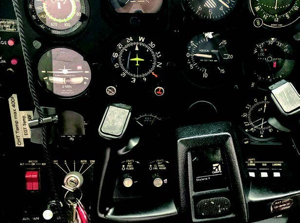
The elevation of the Lake Hughes VOR is indicated in tiny, faint characters on the sectional—much less conspicuously than the heights of charted obstacles. But it is unlikely that the pilot consulted a sectional chart. He was improvising and believed that he was so familiar with the terrain that he had no need of a map.
But there was a critical difference between this flight and the others. This time he was navigating by the VOR, not by pilotage, and the VOR turned out to be a trap. Two aspects of this accident are worth reflecting upon. One is the role of habit and the sense of security that it brings. Familiar tasks frequently repeated dull alertness. The pilot probably felt no threat from these low, forgiving hills.
The other is the pilot’s evident willingness to impro-vise, to take chances, to shrug off norms and regulations. Most pilots would not consider a Yankee, with its high approach speed and small tires, a good candidate for a rugged desert strip a third the length of the typical GA airport. He tried it anyway.
The willingness to take a chance and the optimism about likely outcomes that took him to Saline in the Yankee were also, perhaps, in play when he decided to fly blind across mountains within—he thought—a few hundred feet of them. Perhaps they also made him reluctant to subject himself to the regimentation, scrutiny, and delays of an instrument flight plan.
Adventurousness is not a vice, even in pilots. Which of us has never done an unwise thing, taken a chance, or broken a rule? Proverbially, there are no old, bold pilots, but in fact, there are plenty. The trick is to strike a balance—to know when to be rash and when to draw back.
This accident represents the convergence of a psychological willingness to behave unconventionally and a confident lack of concern born of habit. Unfortunately, it is not always in our power to recognize our mistakes as we are making them. That’s why we fall back on rules and procedures: They insulate us from our own frailties. One may feel a grudging admiration for bold nonchalance—but really, all things considered, he should have filed.
This article appeared in the Q2 2022 issue of FLYING Magazine.

Subscribe to Our Newsletter
Get the latest FLYING stories delivered directly to your inbox

