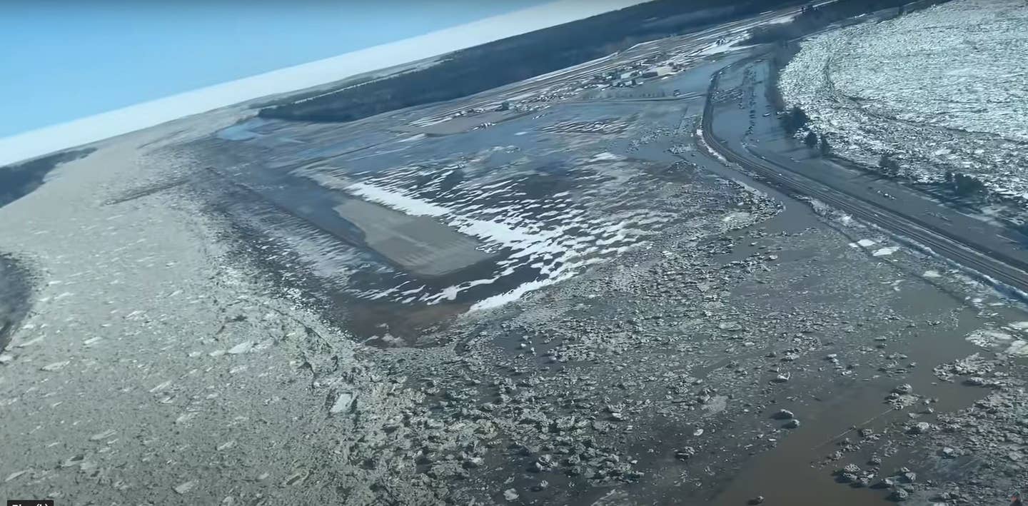
Hay River Airport Flooded
The community of Hay River in Canada’s Northwest territories is under water and ice following the spring break up.

The airport—which lies between two rivers and has a field elevation of 541 feet—was one of the hardest hit areas. [YouTube screenshot]
The entire community of Hay River in the Northwest Territories is underwater due to rain, snow melt and ice flows—and that includes the airport, Hay River/Meryln Carter Airport (CYHY).
Photos published by Canadian media show the airport completely inundated with water and ice. Hay River is located on the south shore of Great Slave Lake just north of the Alberta.
Earlier this week, the 3,500 residents of Hay River were ordered to evacuate. According to community officials, the water rose so quickly that people had to scramble to get to safety. School buses were used to transport the populace to safety.
About the Airport
The airport—which lies between two rivers and has a field elevation of 541 feet—was one of the hardest hit areas. The airport has two runways arranged in a T shape: Runway 14/32 is paved and measures 6,000 feet by 150 feet, and Runway 05/23 measures 4,011 feet by 150 feet, of which 2,950 feet is gravel. The airport is a lifeline for the remote community.
On Thursday, Hay River native and pilot Mikey McBryan and his father, Joe, of Buffalo Airways, one of the air service providers to the community, flew to Hay River and Kátł’odeeche First Nation to survey the flood damage. Mikey published the video to YouTube.
"It's completely underwater," McBryan says as he overflies the airport. A sliver of the gravel runway is visible, but that may have changed as the ice melts.
McBryan went on to describe how his mother had to make a rapid escape from the flash flood, and how his sister's beachfront home had been destroyed.
According to the government webpage, the ice flows shifted overnight creating more issues.
The situation is described as "unprecedented flooding" and residents have been instructed to evacuate, noting that the rising water and ice jams are dynamic, creating rapidly changing conditions.
Like many geographically remote communities, Hay River relies heavily on the airport for entry to and egress from the community and for the delivery of supplies. Telephone calls placed to airport businesses and the airport's automated weather station on Friday morning were met with busy signals.
Community officials are publishing frequent updates on a webpage, reminding the populace to evacuate.
"Water levels are extremely volatile. Rapid changes in water levels remain possible" and "Ice jams remain in the vicinity of the Town of Hay River and Kátł’odeeche First Nation. Water levels are extremely volatile. Rapid changes in water levels remain possible."

Subscribe to Our Newsletter
Get the latest FLYING stories delivered directly to your inbox


