











Fog along the West Coast of the United States has been documented as far back as the arrival of the Spaniards in the 16th century. Ship captains in later years learned to take it seriously; 100 years ago when the Marine Exchange in San Francisco was asked what proportion of coastal shipwrecks were the result of fog, the reply was “All of them.” Even today, aircraft pilots at coastal airports find themselves trying to stay on the right side of a very delicate balance between clear blue skies and zero-visibility IFR.
West Coast Fog Monster

Key Takeaways:
- Coastal fog is a historically prevalent and dangerous weather phenomenon on the US West Coast, particularly from San Francisco to Eureka during summer, significantly impacting both marine and air traffic.
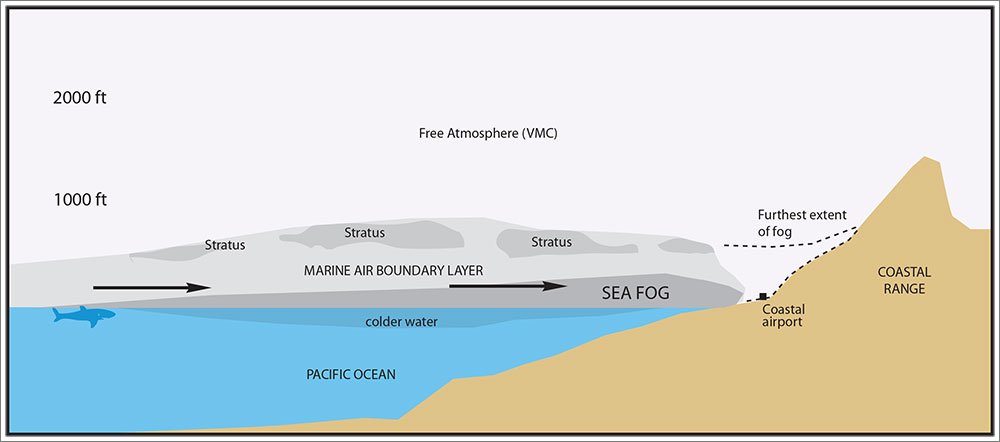
- It forms when moist ocean air cools over cold, upwelled coastal waters, leading to saturation and the creation of a shallow marine atmospheric boundary layer (MABL) capped by an inversion.
- Forecasting coastal fog's onset and intensity is challenging due to its small-scale variations and limitations of observation tools (e.g., not visible on radar, limited satellite resolution), necessitating pilots to use specific indicators like offshore dewpoint and visible satellite imagery, and to plan for potential diversions.
Key takeaways sponsored by Aviator Pro | Start Your Training ->
See a mistake? Contact us.

