













Register

Tornadic Storms

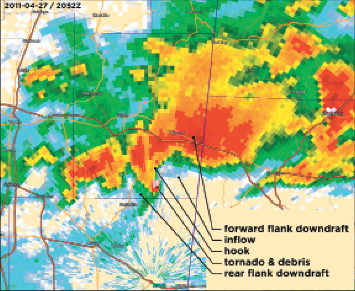
An EF5 tornado was almost a mile wide and was on the ground at the time of this radar image.
Gemini Sparkle

Key Takeaways:

  • Tornado forecasting, spurred by early aviation safety demands, advanced from initial government reluctance to a science focused on "ingredients-based methods" like wind shear and helicity.
  • Key meteorological phenomena for tornadic storms include the mesocyclone (a circulation embedded in the cloud) and powerful updrafts, which are detectable on radar as Weak Echo Regions (WERs) and Bounded Weak Echo Regions (BWERs).
  • While radar helps identify severe storm potential, the precise formation of a tornado from a supercell is complex, requiring real-time nowcasting, visual cues (e.g., rotating wall clouds), and spotter reports due to radar's limitations in showing the most violent parts of an updraft.
See a mistake? Contact us.

Whether you’re in meteorology school or ground school, the tornado undoubtedly captures the attention. I’ve often noticed how a room goes silent when a conversation about this topic begins. Popular weather articles describe the tornado in terms of collisions between the air masses, jet streams, and fronts, and then go on to describe how to take shelter.

However in this article we’ll give you an explanation that’s more grounded in aviation meteorology. In the airplane there’s no place to hide, so you might as well have the best information at hand so you can make sense of these phenomena when they spring up. I would recommend checking back with our March 2022 article on severe storms for some good starter material.


Ready to Sell Your Aircraft?

List your airplane on AircraftForSale.com and reach qualified buyers.

List Your Aircraft
AircraftForSale Logo | FLYING Logo
Pilot in aircraft
Sign-up for newsletters & special offers!

Get the latest stories & special offers delivered directly to your inbox.

SUBSCRIBE