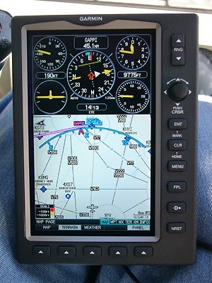
The split screen allows you to customize your display; the IFR map (with airways!) beneath the panel page with GPS-derived data.Photos By Robert Goyer
Key Takeaways:
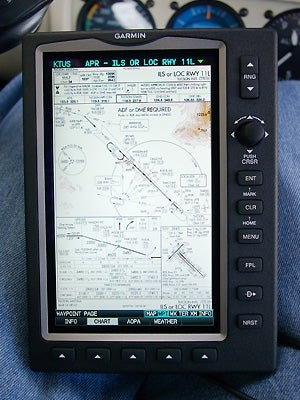
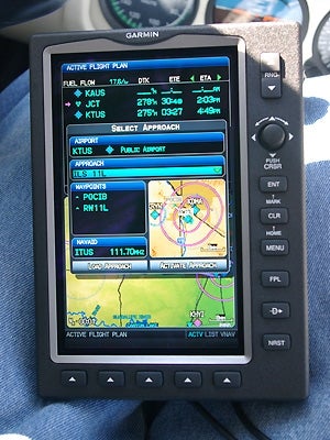
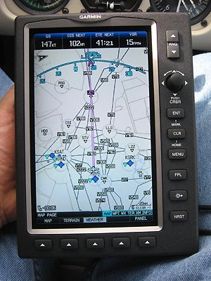
Slightly smaller than the actual paper chart, Garmin’s FliteCharts are still easy to see and work with.Selecting approaches is easy, though you won’t get all the waypoints you’re looking for.Who needs en route charts? The IFR map gives you clearly marked high and low airways, with MEAs, distances between fixes and more.
CREATE A FREE ACCOUNT
Sign up to keep reading
Create a free account to continue. Already a member? Sign in below.