













Register

Online Tools for Icing

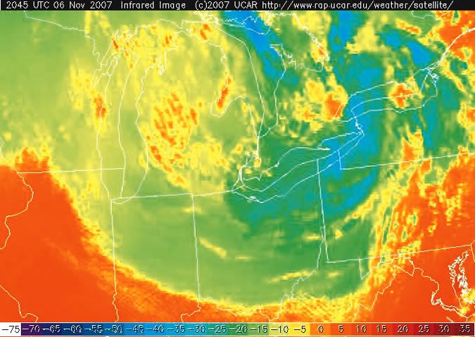
When it comes to avoiding structural icing, the enhanced infrared satellite image (<a href="http://aviationweather.gov/adds/satellite/) is one of the most under-utilized icing diagnostic tools available. Updated every 15 minutes, this satellite product can provide some amazing clues about the potential for structural icing, especially when combined with METARs, TAFs and NEXRAD. As a bonus, the technique also works very well at night.

Gemini Sparkle

Key Takeaways:

  • The enhanced infrared (IR) satellite image is an under-utilized tool for predicting structural icing by identifying cloud top temperatures and heights, especially when combined with forecast soundings and traditional weather reports.
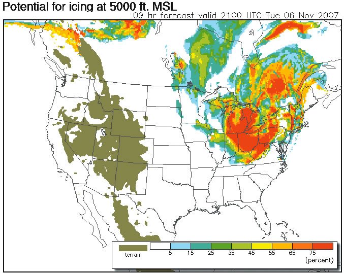
  • Supplemental icing diagnostic algorithms on the Aviation Digital Data Service (ADDS) website, such as the Current Icing Product (CIP) and Forecast Icing Potential (FIP), provide valuable hourly updates on structural icing likelihood.
  • A comprehensive approach to avoiding structural icing involves integrating advanced tools like enhanced IR satellite images, ADDS products, and G-AIRMETs with traditional weather information (METARs, TAFs, PIREPs, NEXRAD) for a complete risk assessment.
See a mistake? Contact us.

Enhanced IR Sattelite

FIP 1

Ready to Sell Your Aircraft?

List your airplane on AircraftForSale.com and reach qualified buyers.

List Your Aircraft
AircraftForSale Logo | FLYING Logo
Pilot in aircraft
Sign-up for newsletters & special offers!

Get the latest stories & special offers delivered directly to your inbox.

SUBSCRIBE

