Replacing text-based area forecasts (FA), the National Oceanic and Atmospheric Administration (NOAA) upgraded its Graphical Forecasts for Aviation product to operational status on Saturday. This service is accepted by the FAA for weather briefings in the continental United States.
NOAA Replaces Text-Based Area Forecasts with Graphical Forecasts
Key Takeaways:
- NOAA has upgraded its Graphical Forecasts for Aviation (GFA) product to operational status, replacing text-based area forecasts, and it is now accepted by the FAA for weather briefings in the continental U.S.
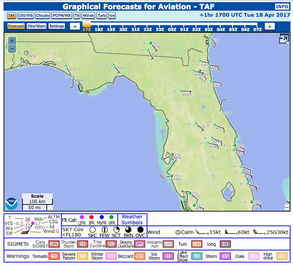
- The GFA offers a comprehensive, interactive web-based view of aviation weather, providing observational data, forecasts, and warnings from 14 hours in the past to 15 hours in the future.
- It includes detailed digital forecast data for clouds, flight category, precipitation, icing, turbulence, and wind, available in 3,000-foot increments from the surface to 30,000 feet, with interactive map features.
Key takeaways sponsored by Aviator Pro | Start Your Training ->
See a mistake? Contact us.
