
Beginning in our December 2015 issue, we shared with readers and explored ongoing efforts at the FAA and the National Weather Service (NWS) to replace the old, familiar text-based area forecast (FA) with a graphics-based product. A follow-up article in our April 2016 issue discussed some of the proposed changes and presented screenshots of the graphical replacement. Now, beginning about the time this issue is in your mailbox, a three-month transition period will begin, ending in October, at which time the text-based FA covering the Continental U.S. (Conus) will be no more.
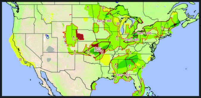
The final timetable comes via an FAA Notice (NOTC7226), dated June 20, 2017, in which the two agencies announced the transition period will begin July 10, 2017. For three months, the textual Conus FAs will continue to be available. On October 10, 2017, however, the Notice advises their production will cease. Importantly, existing FA products for areas other than the Conus (e.g., Alaska, Hawaii) will continue to be available, at least until further notice. A screenshot of the replacement product is below, zoomed out to depict the entire Conus and configured to depict precipitation and convective weather.
