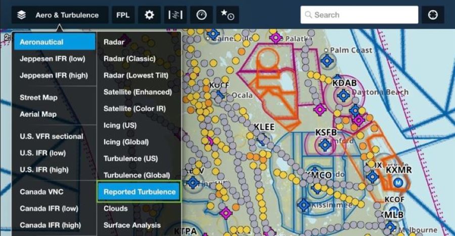
ForeFlight's latest release introduces a Reported Turbulence Map feature, utilizing data from Sentry ADS-B receivers to show where aircraft are encountering turbulence.
This new map layer helps pilots identify the smoothest altitudes by displaying measured turbulence intensity using a color-coded system (from smooth to severe).
The system offers significantly enhanced accuracy and objective reporting, providing an estimated 50 times more turbulence reports than traditional manual PIREPs.
Reported Turbulence is available as an add-on for Pro Plus subscribers, with options for reports up to 14,000 feet or across all altitudes.
ForeFlight’s latest release features a Reported Turbulence Map—allowing pilots to see where aircraft are encountering turbulence using information sourced from the company’s Sentry ADS-B receivers.
“No one enjoys flying through turbulence, whether you’re piloting a single-engine piston or riding in the back of a jet,” said Henrik Hansen, ForeFlight’s chief technology officer.
CREATE A FREE ACCOUNT
Sign up to keep reading
Create a free account to continue. Already a member? Sign in below.
Amelia Walsh is a private pilot who enjoys flying her family’s Columbia 350. She is based in Colorado and loves all things outdoors including skiing, hiking, and camping.