Are Radiosonde Launches Important to Aviation?

With the recent government staffing cuts, there has been a need to indefinitely suspend them at three upper-air stations.

There has been a need to indefinitely suspend radiosonde launches at three upper-air stations. [Courtesy: Scott Dennstaedt]

Question: I heard the NWS is suspending some radiosonde launches. Are these important to aviation?

Answer: With the recent government staffing cuts throughout the National Oceanic and Atmospheric Administration (NOAA) that includes the National Weather Service (NWS), there has been a need to indefinitely suspend radiosonde launches at three upper-air stations. This includes launches at Kotzebue, Alaska; Gray, Maine; and Albany, New York. Further staffing cuts and early retirements will undoubtedly cause more suspensions to occur in the coming months. 

Radiosonde package, balloon, string and parachute being dragged out of the shelter for a launch at 23Z. [Courtesy: Scott Dennstaedt]

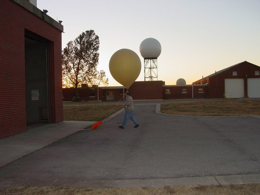
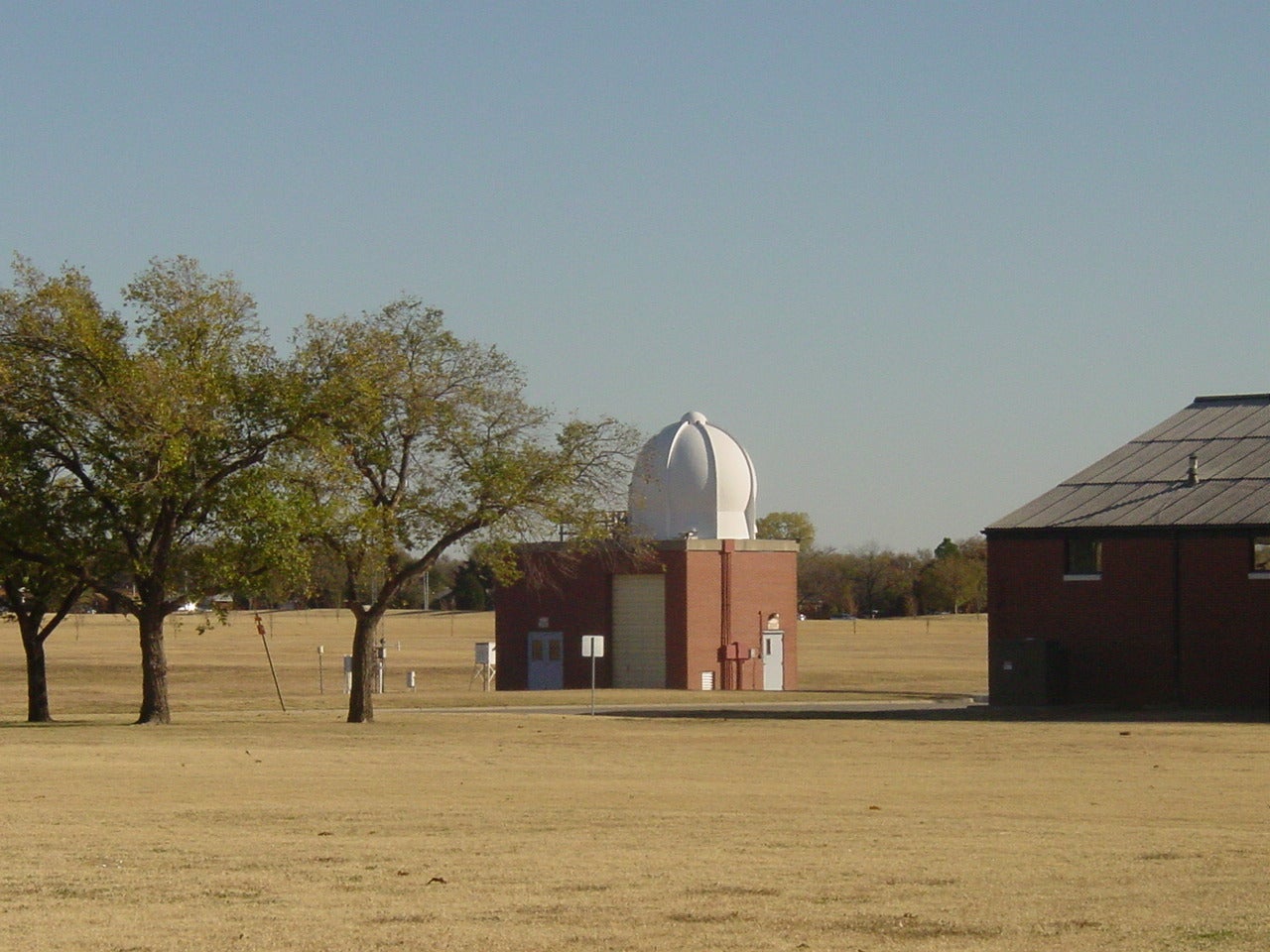
What is a radiosonde? Meteorologists from the NWS launch balloon-borne instruments known as a radiosonde at 102 stations locations (called upper-air stations) throughout the U.S. and its territories (69 in the conterminous U.S., 13 in Alaska, nine in the Pacific, one in Puerto Rico, and 10 other stations in the Caribbean). There are about 1,300 upper-air stations worldwide. 

Radiosondes (also called rawinsondes) are routinely scheduled for launch twice a day at 11Z and 23Z throughout the world. However, it is common that unscheduled launches are done any time of the day or night to assess the atmosphere prior to a severe weather outbreak or to provide more high-quality data for numerical weather prediction models to support landfalling tropical system forecasts, for example.

Before the launch, the forecaster prepares the hydrogen- or helium-filled balloon and instrument package that is temporarily housed in a shelter located at the NWS local field office or WFO. The photo below was taken on the grounds at the Norman, Oklahoma, WFO shows the relative size of the balloon before it is launched. The instrument package must trail the balloon using a very precise length of cord of 75 feet. As the balloon ascends, actual environmental pressure, temperature, and relative humidity are measured and are simultaneously sent back to the ground tracking station where it was released.

Radiosonde package and hydrogen-filled balloon being prepared for launch. [Courtesy: Scott Dennstaedt]

The weather balloon’s position as it ascends is accurately tracked by a GPS sensor that is used to determine the wind speed and direction. Once the data is collected and processed, it is called a RAOB, which stands for radiosonde observation.

Thus, RAOBs of the atmosphere describe the actual vertical profile of temperature, humidity, wind direction and wind speed as a function of pressure from the surface to an altitude where the observation is terminated. These measurements are made at intervals that vary from 1-6 seconds, depending on the type and manufacturer of the radiosonde.

Evening launch of a radiosonde at the Norman, Oklahoma, local Weather Forecast Office. [Courtesy: Scott Dennstaedt]

Radiosondes are essential because they provide vital data from the upper atmosphere that are ingested into weather prediction models that provide guidance to meteorologists that issue severe weather, aviation and marine forecasts, as well as research on global warming, air pollution, and “ground truth” for satellite data validation. The validation of space-based observations is quite important since satellite data is one of the ways numerical weather prediction models get weather information over data-sparse areas such as the vast oceans around the world.

If the satellite wind data is not consistent with radiosonde observations of wind, ingesting them into the model can create significant forecast errors that impact weather guidance used by pilots. Therefore, meteorologists use radiosonde data to calibrate satellite instruments and correct for any systematic errors (biases) in the satellite data.

Data is sent back to a ground-tracking station where it is stored and quality-control checked before it is sent to the National Center for Environmental Prediction (NCEP). [Courtesy: Scott Dennstaedt]

While the radiosonde network has a very low resolution in both time and space, losing a few RAOBs can make a huge difference in the accuracy of forecasts that pilots use every day. Most important, when weather is expected to be severe due to a dangerous outbreak of tornadic thunderstorms or a landfalling tropical system, having less data creates additional challenges for the staff at the NWS, especially now given the recent terminations. 


Ask us anything you’ve ever wanted to know about aviation. Our experts in general aviation, flight training, aircraft, avionics, and more may attempt to answer in a future article. Email your questions to editorial@flyingmag.com.

Scott Dennstaedt, Ph.D

Scott resides in Charlotte, North Carolina, and flies regularly throughout the Mid-Atlantic and Southeast U.S. He is a CFI and former NWS meteorologist. Scott is the author of "The Skew-T log (p) and Me: A Primer for Pilots" and the founder of EZWxBrief.
Pilot in aircraft
Sign-up for newsletters & special offers!

Get the latest stories & special offers delivered directly to your inbox.

SUBSCRIBE