Regard the Jeppesen version of the RNAV (GPS) Rwy 19 approach to Meridian, MS (KMEI). This chart shows the simplest TAA you can have. The limit for a turn based on GPS is 90 degrees, so the maximum allowable turn from a route direct to the IAF to the leg after crossing the IAF is 90 degrees. This means each TAA should contain at least two sectors, divided by courses 90 degrees off the inbound course.
Terminal Arrival Areas (TAAs) were introduced for GPS-based approaches to simplify arrival procedures by defining sectors with minimum altitudes within a 30 NM radius of the IAF, replacing traditional feeder routes and MSAs.
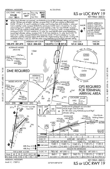
Integrating TAAs into non-GPS approach charts (e.g., ILS/LOC) initially caused confusion due to unclear or inaccurate "GPS required" notes, which often applied only to the TAA entry and not the entire approach, sometimes coexisting with outdated DME requirements.
Charting standards are evolving towards clearer, segment-specific equipment requirements, and the gradual phasing out of traditional VOR navigation aids will likely make GPS a mandatory or sole navigation method for many future approaches, simplifying chart notes.
We pilots trust our cartographers. We must. We may wend our way from waypoint to waypoint, following the magenta pixels, but it’s black course lines and data on the chart that actually keep us out of trouble.
And then some well-meaning ground-dweller tries to simplify the presentation and bollixes up the whole thing.
CREATE A FREE ACCOUNT
Sign up to keep reading
Create a free account to continue. Already a member? Sign in below.