











Despite a falloff in world air traffic since early 2020, Ted Stevens Anchorage International Airport (PANC) in Alaska still represents a stopover point for thousands of airline and business-aviation flights between North America and Asia, as well as thousands of local general aviation and military airplanes. Visitors will notice that many of those local GA aircraft are mounted on floats, so they can freely move between PANC and the nearby Lake Hood Seaplane Base. About the terrain transient pilots can expect, city-data.com says: “The Chugach Mountains to the east have a general elevation of 4,000 to 5,000 feet, with peaks from 8,000 to 10,000 feet. These mountains block warm air from the Gulf of Mexico, keeping precipitation relatively low.”
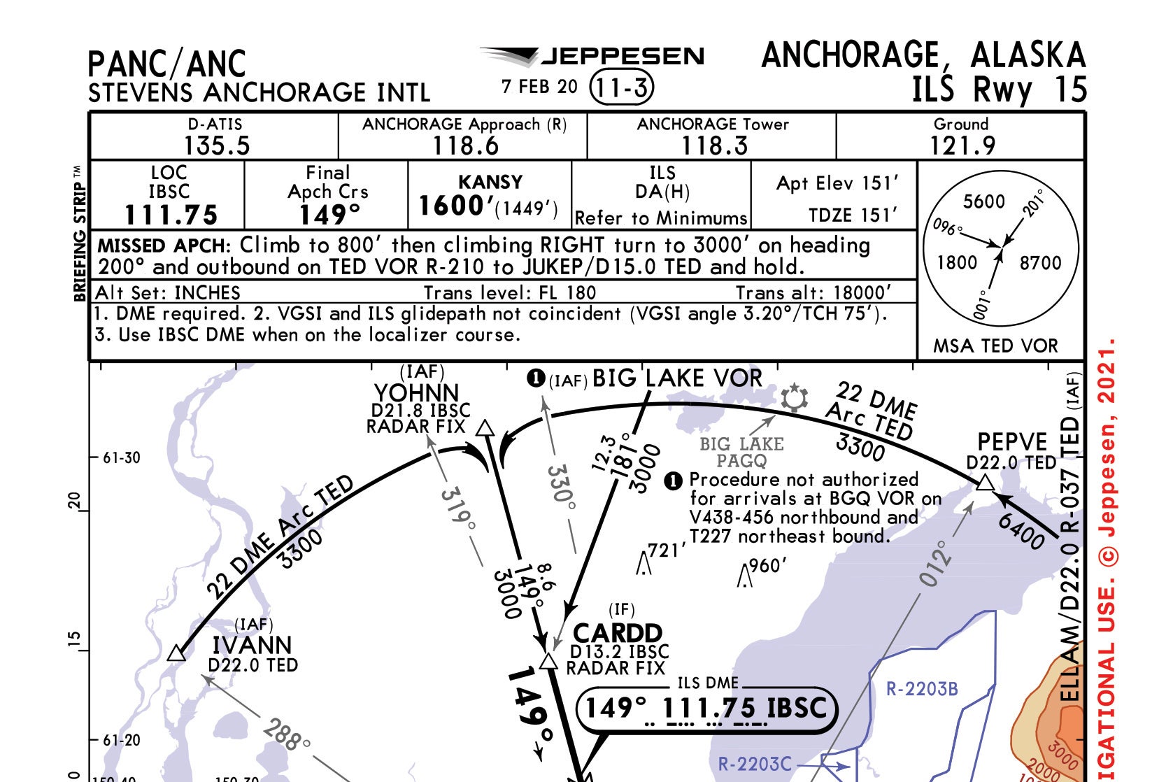
Anchorage ILS Runway 15

Key Takeaways:
- The ILS Runway 15 approach into Ted Stevens Anchorage International Airport (PANC) explicitly requires DME (or a suitable substitute) for final approach fix identification.
- This procedure uniquely employs two DME arcs from the Anchorage VOR (TED) for initial approach, demanding pilots switch from the VOR to the ILS localizer for DME data.
- The approach plate lists both primary and alternate missed approach procedures, which both lead to holding at the JUKEP intersection but rely on different VOR/DME sources.
- Only ILS minimums are published for this approach, preventing its use as a non-precision localizer approach, for circling, or if the glideslope is inoperative.
Key takeaways sponsored by Aviator Pro | Start Your Training ->
See a mistake? Contact us.

