













Register

Mix and Match

Sun, smoke, or night can turn “VFR” effectively into IMC. However, technical VFR offers a chance to borrow procedures from IFR and VFR to get the job done.

Gemini Sparkle

Key Takeaways:

  • The article presents a challenging scenario: flying VFR at night in mountainous terrain with expired GPS navigation data, highlighting the inherent risks and complexities.
  • It details the regulatory limitations of using expired GPS data, especially for instrument approaches, even under VFR, while noting that enroute VFR navigation might allow manual waypoint verification.
  • The text explores various pilot strategies for safe departures and arrivals in such conditions, often blending VFR freedom with the structure of IFR procedures, and emphasizing terrain awareness, local knowledge, and common sense.
See a mistake? Contact us.

By Ryan Koch and Jeff Van West

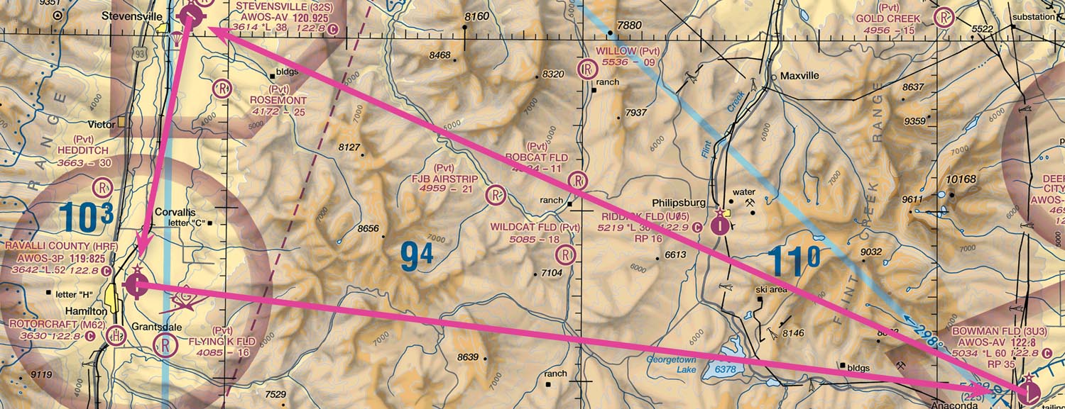
You are part of a flying club with two identical planes based at KHRF. (Pick any plane you’re familiar with that’s capable of mountain IFR.) Since you’re the only instrument-current pilot in the group, the club only needs one GPS data subscription. You usually just swap the cards between planes to make sure you have current data. Except that a club member just took the current data card on a cross-country trip, leaving you with two-year-old data. Fortunately, it’s 17012KT OVC100 10SM over your entire route tonight. Unfortunately, it’s night tonight. (It happens.)


Ready to Sell Your Aircraft?

List your airplane on AircraftForSale.com and reach qualified buyers.

List Your Aircraft
AircraftForSale Logo | FLYING Logo
Pilot in aircraft
Sign-up for newsletters & special offers!

Get the latest stories & special offers delivered directly to your inbox.

SUBSCRIBE