
Jonathan Fay’s present residence is the byproduct of the pandemic’s impact upon his career, as well as his desire to experience aviation in a novel way.
“When the pandemic first hit, my company allowed me to work from home. My wife and I decided we wanted to live where eventually we would hope to retire, in Anacortes, just north of Seattle. We wanted to buy a home on an airpark, and I realized that a lot of that goal was impractical from a standpoint of the places that had airparks—either they were too expensive, inaccessible, or other challenges like that. We really couldn’t find something that would work for us where we wanted to live. But we eventually found a place not too far from an airport, here in this part of Washington,” Fay explained.
“When my wife was first looking for places, she saw this community that had an Anacortes address on it. ‘I found an airpark home in Anacortes,’ she told me, but I knew that that didn’t exist. My guess was that it was actually in one of the San Juan Islands, which turned out to be the case. Out of curiosity, we flew out to take a look at the place that was for sale. While we didn’t buy it, it intrigued me that there was this island community that was basically enabled by the airpark.”
One potential limitation of the community for many operators, Fay noted, is its turf runway’s length.
“I have an experimental Zenith 750 that’s setup for backcountry flying. My family and I built it, starting in 2017, and its first flight was in July of 2019. Center Island Airport (78WA) is a private airstrip with a grass field that’s 1,600 feet long. So, it’s pretty tight for typical GA airplanes, but for a plane that can take off and land in 150 feet, nominally, it’s plenty of room for my aircraft.”
A number of aviators have flocked to the island community with a population of less than one hundred.
“Probably more than half of the people that live here are either pilots, aviation enthusiasts, or past pilots. As a result, we have a lot of people that fly into the island, and it is very active. Whenever I’m there (on a part-time basis), I will see planes flying in and out and it really just opens up an opportunity for the community that’s not available otherwise, with other modes of transport.”
Fay advised that flying into and out of the island community is the most efficient, and as an extension, cost-effective option for residents and visitors alike.

“If you owned your airplane, especially an experimental like mine that’s relatively inexpensive to fly, getting up to the island from Anacortes costs maybe $10 round-trip. It’s a super short flight and then you’re there. A water taxi is almost $100 per person, round trip, after you account for tip and everything. If you have your own boat, it’s maybe $30 or $40 in fuel. But at any rate, we played around with the idea of moving there for a while and eventually found a cabin with a great water view and everything like that. We initially got it as a summer vacation home, so my wife and I could fly up there and spend some time.”
The topography and resulting weather patterns surrounding the fly-in, boat-in community are unique, as well.
“We have weather in the San Juans, where you can be completely fogged in at the inland airports and then have no fog and bright sunlight at Friday Harbor, for instance. While at the same time, some of the islands will have fog around them and others won’t. The weather is variable and changes quickly—and is so local.”
As a result, the community’s HOA (homeowners association) and pilots that fly there wanted a way to better anticipate the sporadic, dense fog that often plagues the area.
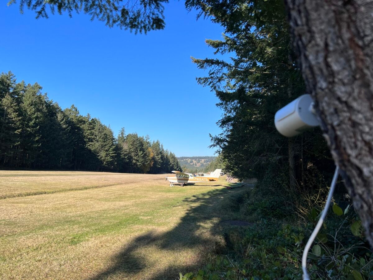
“We wanted to be able to know before we go and all of the state airports, we would probably leave for on the mainland side, have cameras onfield. Every 15 minutes or so, you get a new image from those cameras. When flying in the area, you are sure to check out those cameras, ForeFlight, and some of the other weather. But knowing what’s actually going on at the airport is the best way to tell whether you should make the trip or not,” Fay explained.

“We knew that we wanted to include a weather station with cameras here at the airfield. The homeowners association board was ready to spend somewhere around $3,500 for a service that would just have one camera on the dock, without a weather station or anything like that. I realized that online, you can get a good HD camera for only like $40. Given that I’m in IT and do computer programming, I knew that you could get a Raspberry Pi Pico for about $6. With a little bit of Python code, you can download an image from the camera and immediately upload it to your website. It’s really not that complicated.”
After some light coding and software work, Fay was able to match the quoted service at a fraction of the cost. The implemented visual weather station has been online for several months, yet its impact has already been apparent to those who fly to and from 78WA.
“We first set up a trial for this service and it was absolutely so useful being able to see an image of the airport in near live time. Another positive aspect of having multiple cameras is seeing alternate viewpoints of the weather. For example, the camera on the dock doesn’t tell you what’s happening on the runway. But it maybe tells you more information as a pilot because if you can see the next island over, then you know it’s about a mile and half of visibility. If you can see the hills in between, you know it’s about two and a half miles. And if you can see the peak of Cypress Island, out in the distance, then you know that there’s eight miles of visibility. It really allows you to very quickly see what’s out there.”
Fay expects to soon upload his code to GitHub, so that other enterprising aviators can create a similar low-cost solution for their airfield’s weather reporting needs.