Register

Charts & Plates

Island Hoping [SIC]

You’re the owner, operator, and chief (only) pilot of Totally Legal Charters, flying passengers between the Hawaiian Islands and making questionable decisions. Pick whatever single-engine sim plane you like and base it at Kalaupapa (PHLU). Today’s weather is good enough for some sightseeing, barely, but poor enough that you’ll fly IFR—you know, just for safety. […]


Read More »

Just a Little Different

While no two approaches or departures are alike, most fit a template. Others need just a little more review and planning to be on top of things, and require an open mind (and open eyes) to avoid problems you didn’t expect. Extra Steps After deciding to step up from your Cessna 172, a nice-looking 182 […]

Read More »

Chart Subtleties

Grider Field (KPBF), Pine Bluff Regional Airport, Arkansas, is located approximately 36 NM southeast of Little Rock Airport (KLIT). The airport is named after J. McGavock Grider, an American WWI fighter pilot who flew for the British Royal Flying Corps, later the Royal Air Force. The municipal airport dates back to 1941, built as a […]

Read More »

Flight Plan Route

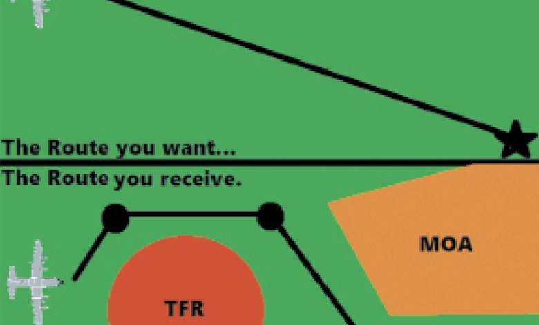
Per reader request; we’ll jump straight to the question. “Who changes—or how does the system change—the IFR flight plans I file?” When filing IFR, you have the option to file the exact route you want. However, in doing so, you might or might not get it. A route in the ATC system depends on a […]

Read More »

Drilling Down

It’s not exactly a bad time of year to fly from Texas to New Mexico, but spring can bring fluctuating ceilings and local winds that like to be unpredictable. But at least it’s before the real heat kicks in. Still, this’ll be a more challenging flight plan in which a weather briefing and charts won’t […]

Read More »

The Airport Diagram

For “land” aircraft, all flights start and end at an airport or airstrip, and an important aspect in planning an IFR flight to an unfamiliar airport is to study not only the approach and departure charts, but also the airport diagram to fully understand the big picture. Typically, we think of airport diagrams as useful […]

Read More »

Paradoxical Minimums

Rocky Mountain Metro (KBJC, “Metro”) is an active general aviation airport located about 21 NM west of Denver International Airport (KDEN) and just outside of the westernmost north-south border of Denver Class B airspace. While the elevation of Metro is 5673 feet MSL, about 10 miles to the west, the Rocky Mountains reach altitudes of […]

Read More »

Tale of Two Approaches

According to recent FAA statistics, there are approximately 1292 “plain vanilla” ILS approaches that are designed to Cat I minimums—usually a DH of 200 feet AGL and visibility of ½ SM. This excludes Cat II and III and Cat I ILS approaches requiring Special Authorization. Most ILS Cat I approaches also provide minimums for a […]

Read More »

Anchorage (PANC)

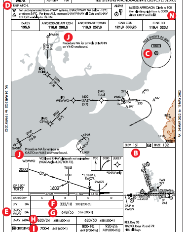
Runway 7R approaches at Ted Stevens Anchorage International airport (including the missed approach portions) [A] overfly Cook Inlet. The inlet stretches about 180 miles from the Gulf of Alaska to Anchorage and was named after explorer James Cook searching for the Northwest Passage. Today the airport is a refueling stop for flights between North America […]

Read More »

Close Look at Joint Use

Upon first glance, the ILS or LOC RWY 23 approach [A] at Westover Air Reserve Base/Metropolitan (KCEF) appears to be a typical ILS approach. But looking closely we notice that the MSA (minimum safe altitude) is based on the Westover (CEF) TACAN [B]. The center of the MSA circle is the symbol for a TACAN, . […]

Read More »
Pilot in aircraft
Sign-up for newsletters & special offers!

Get the latest stories & special offers delivered directly to your inbox.

SUBSCRIBE