
Published by the National Aeronautical Navigation Services Group of the Federal Aviation Administration (FAA), sectional charts are just one of the many charts to help pilots navigate. Sectional charts always include visual “map” features like cities, towns, highways, and railroads, as well as information particular to navigating an aircraft. Pilots can use aviation sectional charts to obtain information about airports, controlled airspace, special use airspace areas, and radio frequencies.
The best way to learn how to read sectional charts is to take the time to become familiar with them – particularly the legend. Information on a chart is of no value if you do not know what it means.
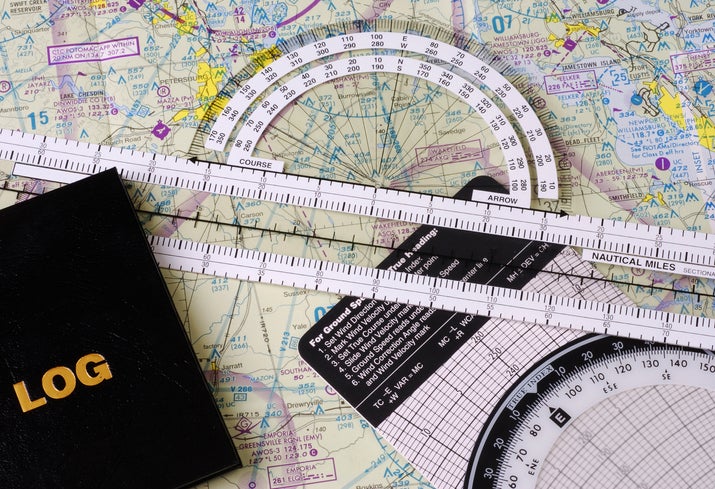
How Does a Sectional Chart Work?
Sectional charts are navigational aids that pilots use to identify terrain, airports, and obstruction. Unlike maps which display topographical information, aeronautical charts also display airspace information, information on various types of airspace, and radio frequencies.
Digital versions of VFR charts are called VFR Raster Charts. Digital versions of sectional charts can be found in Electronic Flight Bag services like Foreflight and Garmin Pilot. They can also be purchased from FAA Approved Print Providers.
According to the FAA, “sectional charts are designed for visual navigation of slow to medium speed aircraft.” Sectional charts are just one type of VFR (visual navigation rules) chart. Other VFR navigation charts include:
- Terminal Area Charts (TAC)
- U.S. Gulf Coast VFR Aeronautical Charts
- Grand Canyon VFR Aeronautical Charts
- Caribbean VFR Aeronautical Charts
- Helicopter Route Charts
Sectional charts are named for prominent city on the chart such as Albuquerque, Chicago, Dallas-Fort Worth, Las Vegas, New Orleans, Salt Lake City, and Wichita. Currently, 56 sectional charts are published.
Pros of a Sectional Chart
- Sectional charts are a VFR pilot’s best prevention tool for a common pilot deviation known as an “airspace bust” – such as entering Class C or Class B airspace without proper communication or consent. It is the responsibility of the pilot to obtain ATC clearance or meet radio communication requirements prior to entry into Class B, Class C, or Class D airspace.
- MEFs (maximum elevation figure) indicate the elevation of the highest geographical feature within an area. This helps pilots avoid a controlled flight into terrain (CFIT) accident, where a pilot flies an otherwise airworthy aircraft into terrain. Typically in CFIT scenarios, the pilot is unaware of impending impact until it is too late.
- The advent of electronic flight bags has allowed pilots to display the digital chart overlaid with a GPS-derived aircraft symbol showing the aircraft’s position to improve situational awareness. Additional features can include flight plans, data such as groundspeed and ground track, and with additional equipment can even display weather conditions and other air traffic.
Cons of a Sectional Chart
- Charts can appear cluttered and have abbreviations and symbology that are not easily decoded or explained. Without review prior to flight or checkride, pilots may struggle to identify less common information.
- Charts are only valid for a short period of time – 56 days for most areas, and one year for some areas of Alaska. Pilots using paper charts must make sure their chart or chart supplement is the most current edition by referencing the Dates of Latest Editions (DOLEs) page on the FAA website. The actual change dates change every year, and sectional charts always become valid and expire on a Thursday.
- Even when a chart is current, information can change. Chart-related Notices to Airmen (NOTAMS) may be issued, or Safety Alerts and Charting Notices may be published regarding charting products currently in effect that may not be NOTAM worthy (common when data or text is missing on a chart)
Types of Charts
The primary difference between the three types of VFR aeronautical charts is the scale.
VFR Terminal Area Charts
TAC charts have a scale of 1:250,000. TAC charts do not cover the entire country. They are intended for use by pilots operating from airports near or within certain Class B and Class C airspaces.
Sectional Charts
Sectional Charts have a scale of 1:500,000 (1 inch = 6.86 nautical miles (NM)).
World Aeronautical Charts
WAC charts have a scale of 1:1,000,000 and cover a larger area of land. These charts are designed for use by pilots operating moderate-speed aircraft and aircraft flying at high altitudes.
5 Steps for Reading Sectional Charts
By far, the best resource to learn how to read sectional charts is the FAA’s Aeronautical Chart Users’ Guide. This 100+ page document is a learning aid, a reference document for students and experienced pilots, and an introduction to other types of aeronautical charts and publications the FAA publishes (like VFR Flyway Planning Charts and Helicopter Route Charts).
Step 1: Using the Sectional Chart Legend
There are numerous non-FAA publications from flight schools and aviation experts explaining the symbols and depictions on Sectional Charts. However, the most available source for reviewing the symbology you’re seeing is the chart legend on the back flap of the chart itself.
Step 2: Know the Latitude and Longitude
Any specific geographical point on a sectional chart can be located by reference to its longitude and latitude. A quadrant on a sectional chart is the area bounded by ticked lines dividing each 30 minutes of latitude and each 30 minutes of longitude.
Step 3: Check the Airports and Airport Information
Airports are some of the most important symbols on a sectional chart. Along with locations, sectional charts will also indicate if an airport has a control tower, how long a runway is and whether it is lit, and if fuel is available. Of course, pilots should always also check for up to date Notices to Airmen (NOTAMs).
Step 4: Navigating Terrain and Obstacles
VFR pilots should review a planned route for terrain and obstacles, and to ensure planned en route altitudes are appropriate for the direction of flight. In addition to the legal requirements for maintaining distances from terrain and obstacles, pilots should also verify the terrain is suitable for safe landings in the event of inflight emergencies.
Step 5: Understanding Airspace Types
Understanding airspace is critical both for student pilots learning to fly and pilots at all stages. Pilots must ensure their route avoids prohibited or restricted airspace, that weather minimums are met, and that their aircraft meet the equipment requirements for certain airspaces.
Tip: If you are studying for an FAA written test or a practical test (checkride), you will be able to reference the chart legend if you do not know a particular symbol. However, you should be familiar with the basics. It is highly recommended you bring a paper chart for the ease of quickly referencing the legend without “losing your place” on a chart.
Always Fly with Current Charts
Code of Federal Regulations 14 CFR 91.103 “Preflight Actions,” states that each pilot in command shall, before beginning a flight, become familiar with all available information concerning that flight. The FAA has said it is not their policy to “violate anyone for having outdated charts in the aircraft” because there is no regulation requiring current charts. However, they have also said that an enforcement action could be brought if not having a chart or using an out-of-date chart contributed to a condition which brought an enforcement investigation (such as utilizing an expired chart while ‘busting’ a newly changed airspace).
FLYING Magazine provides resources for pilots in all stages of flight training and flying. To stay informed on all of the latest in Aviation, subscribe to the FLYING Magazine newsletter today.
FAQ
What is on a sectional chart?
Items of use to pilots operating aircraft visually include public and some private airports, different types of airspace, cities and towns, lakes, topographical data, and obstacles.
What are VFR sectional charts used for?
Sectional charts primarily help pilots navigate while operating under Visual Flight Rules (VFR). To a lesser extent, they help Unmanned Aircraft Systems (UAS) operators to navigate safely in the national airspace.
How big is a sectional chart?
Sectional charts are 20.75 x 59.25 inches and fold neatly into an approximately 10.25 x 5-inch package for ease of stowage. Charts are printed on durable paper that can allow pilots to fold and re-fold them for ease of use during different flights.