fbpx

Enhanced ForeFlight 8 Version Now Available

New data-driven maps and other features come to popular aviation app.

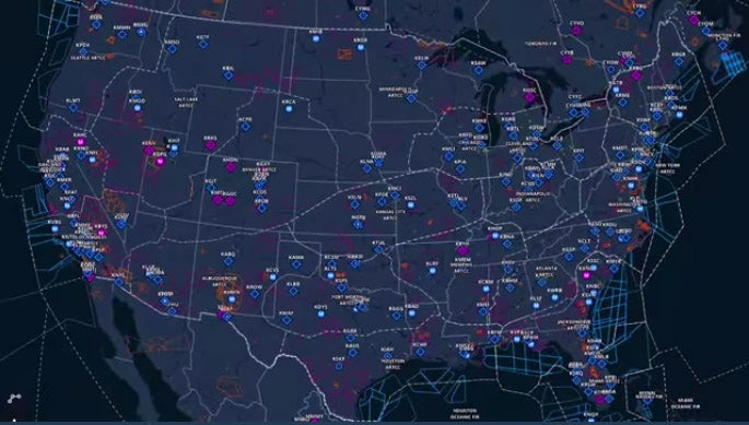
ForeFlight has released its latest version — ForeFlight 8 — which includes a few major modifications. The moving map feature has been recreated from the standard Sectional chart imagery to new global data-driven maps. The maps feature rapid-fire Continuous Zoom capabilities, providing a seamless transition as you zoom, and dynamic decluttering, which removes map features as you zoom out to provide less detail on a cleaner background.

At the lowest level of detail, major airports and Air Route Traffic Control Center boundaries are shown. Smaller airports, VORs, waypoints and other features appear as you zoom in. If you zoom in close on an airport, the runway labels, taxiways and even names of local businesses pop up. Labels on the map automatically move to orient themselves in a readable “up” position when you’re flying track up, adding to the readability of the display.

Some users took to Facebook and criticized the new map program, stating it does not provide enough detail. It is possible that they had not played around enough with the zoom, but those users who prefer the original Sectional chart background can choose to revert to the old maps.

The online features of ForeFlight 8 have also been upgraded. New dropdown menus make flight planning easier, and a flight plan that has been planned, briefed and filed on the Web is instantly transferred to the ForeFlight app.

New useful features have also been added to the logbook section of ForeFlight. One of the most useful new features is the ability to connect remotely with CFIs for logbook entries. The flight sharing feature within the logbook also allows you to send draft flight plans to pilots you may be flying with.

Login

New to Flying?

Register

Already have an account?