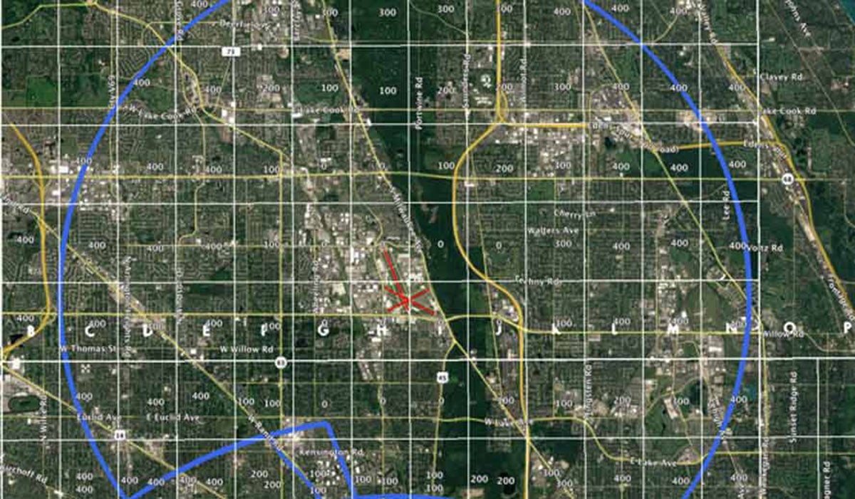
The FAA plans to begin publishing airport grid maps on April 27. The new maps break an airport down into one-mile squares that each contain the maximum altitude a drone may expect to be safely flown at when near an airport. Altitudes that exceed those depicted on the maps will require additional safety analysis and coordination to determine if an application can be approved, the agency said. The new grid maps are expected to help drone operators improve the quality of their Part 107 airspace authorization requests. Improving those requests should help the FAA process applications more quickly.
FAA Says Airport Grid Maps Should Speed Drone Application Approvals
Key Takeaways:
- The FAA will begin publishing new airport grid maps on April 27, which divide airports into one-mile squares showing maximum safe drone altitudes.
- These informational maps aim to improve Part 107 airspace authorization requests and streamline FAA processing, with higher altitudes still requiring additional safety analysis.
- The maps will be released in phases, starting with approximately 200 facilities on April 27, and more to follow over the next 12 months.
Key takeaways sponsored by Aviator Pro | Start Your Training ->
See a mistake? Contact us.
