
Area navigation using GPS has been around (for us) for about 30 years. Before that we did mostly the same thing using LORAN for a while. But, the National Airspace System was designed around VHF Omni- Range navigation stations, VORs, that long preceded GPS.
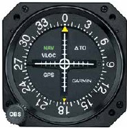
Technically, there are three types: VORs that just provide azimuth information, VOR-DMEs that include a DME station, and VORTACs (VOR plus the military tactical air navigation system) that, for our purposes, are the same as VOR-DMEs. Regardless of the type, though, the actual navigation is via azimuth information using the VOR.
