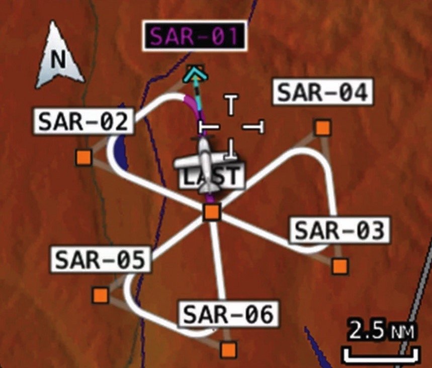

I read Mike Hart’s article “The Transactional Pilot” in April’s issue with much interest, especially regarding his night-flight concerns since I really enjoy night flying in familiar territory; it is those flights over the unfamiliar space that raises concerns. Enter the EFB app and its ability to locate possible emergency sites during the daylight leg(s), by entering those locals as custom or user waypoints.
I tap on a location I observe to be free of obstructions, offering a clear approach corridor and suitable landing surface, and after I get the dot on my app’s chart, I change its “name” to an approach course, e.g., like F17, or G18, and use those designators (you can make up any letter/number you wish), as Field/Approach 170 degrees, or for the other as Grass/Approach 180 degrees. The letters can be for road, crop, highway or water, or whatever looks better—as always, the closer to roads, the better for emergency services access.
