fbpx

Mastering the Metar

With a little practice, you can decode aviation weather reports like the pros.

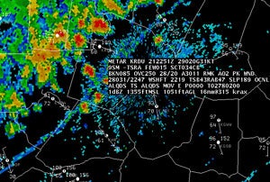
I was surprised when I read recently that many new airline pilot job applicants struggle with decoding basic metar weather reports. It would seem to me that if you’ve done enough flying to reach the interview stage with a commercial carrier, you would have interpreted hundreds if not thousands of metars along the way.

Maybe it’s the invention of software that can translate metars into “plain English” that has caused such befuddlement among would-be airline pilots. Still, with a little practice metars aren’t hard to grasp – and being able to do so could save your bacon if you’re staring down an un-translated report and need to make a go/no-go decision in marginal weather.

First things first: A metar is a weather report issued near the end of each hour, while a SPECI is a special metar that alerts pilots of new hazards, such as thunderstorms or low ceilings and visibility that arise during the hour.

Metar information is always given in a specific order, and that’s key to understanding how to read one, especially when they get complicated. (It’s also important to realize that if data is missing, such as the altimeter setting, for example, it will simply be omitted.)

The order in which metar data is given is: Where; When; Wind; Visibility; Significant Hazards; Clouds; Temp/Dew Point; Altimeter Setting; and Remarks.

Let’s break down each of these in the following Metar:

METAR KABC 121755Z AUTO 21016G24KT 180V240 1SM R11/P6000FT -RA BR BKN015 OVC025 06/04 A2990 RMK A02 PK WND 20032/25

Where

KABC is the airport identifier. All controlled airports in the continental U.S. begin with the letter K.

When

All dates and times are UTC using the 24-hour clock. The first two digits are the day (sorry, you have to know the month) and the last four are the time, followed by a Z to indicate UTC (“Zulu” time). In this example, it’s the 12th day of the month and the time of the observation was 17:55 UTC.

(NOTE: The word AUTO simply tells us this is an automatic observation with no human intervention. If it said COR instead, that would mean it is a corrected observation. If a human performed the observation, it wouldn’t say anything.)
**
Wind**

The wind is given in tens of degrees from true north with the next two digits telling us is the speed in knots. G means gusts to whatever max speed, and V means variable by 60 degrees or more for winds that are greater than 6 knots (the term VRB will be used for variable winds 6 knots or less). So in this example, the wind is blowing from 210 degrees at 16 knots with peak gusts to 24 knots. The winds are also variable from 180 degrees to 240 degrees.

Visibility

Visibility is given in statute miles and fractions, with spaces between numbers denoting fractions. In our example the vis is 1 statute mile. If the visibility is 1 mile or less or the runway visual range is 6,000 feet or less, the RVR will also be given. In this example, the RVR for Runway 11 is reported as 6,000 feet (an M or P will be affixed to tell us whether the value is lower or higher than reportable RVR; a V will be used if the RVR is variable, e.g. 2000V4000).

Significant Hazards

Next, we’ll be given info about flight hazards. In this case, we have reduced visibility caused by -RA for light rain (a minus sign indicates light and a plus sign heavy) and BR for mist.

This is where pilots often get lost, since the descriptors for the various weather phenomena can be so weird. For instance, why the heck is the weather descriptor for hail “GR”? Well, the French word for hail is “grêle,” so there you go.

Have no fear, most weather descriptors make sense, such as HZ for haze, FZ for freezing, and TS for thunderstorm. Then there are those that don’t – all the fault of the French – which we’ve listed here (you should memorize them):

BC = patchy (used only with FG “fog”)
BR = mist
PO = well-developed dust/sand whirls
GS = small hail or snow pellets
GR = hail
MI = shallow (used only with FG)
FU = smoke

Clouds

This section of the metar specifies cloud amount, height and type. In our example we have broken clouds at 1,500 feet and an overcast layer at 2,500 feet.

Cloud height is reported in hundreds of feet. When clouds are composed of towering cumulus or cumulonimbus, TCU or CB will follow cloud height. The clouds are categorized based on eighths (octas) of the sky:

SKC = sky clear
FEW = 1-2 octas
SCT = 3-4 octas
BKN = 5-7 octas
OVC = 8 octas

VV may be listed here for indefinite ceiling such as “VV004” for Vertical Visibility 400 feet.

Finally, Temperature/Dew Point are listed in degrees Celsius. When temperatures are below zero degrees Celsius, they are preceded by “M” for Minus (e.g., 10/M06 for temperature 10 degrees C, dew point Minus 6 degrees C). This is followed by the altimeter setting, with “A” indicating the setting in inches of mercury for the United States. So in our example, the temperature is 6 degrees C, the dew point is 4 degrees C and the altimeter setting is 29.90.

Remarks always come last in the report. In our example, A02 is the type of ASOS/AWOS (the other type is A01) and PK WND 20032/25 tells us there was a peak wind of 32 knots detected at 25 minutes after the hour.

This primer won’t allow you to read every metar you ever come across, but it covers the basics, and then some. Spend a little time practicing decoding metar reports and you’ll be surprised how quickly you catch on.

Read more Flying Tips here.

Login

New to Flying?

Register

Already have an account?