











Register

Garmin Adds FIS-B Weather to the GTN 650/750 Series
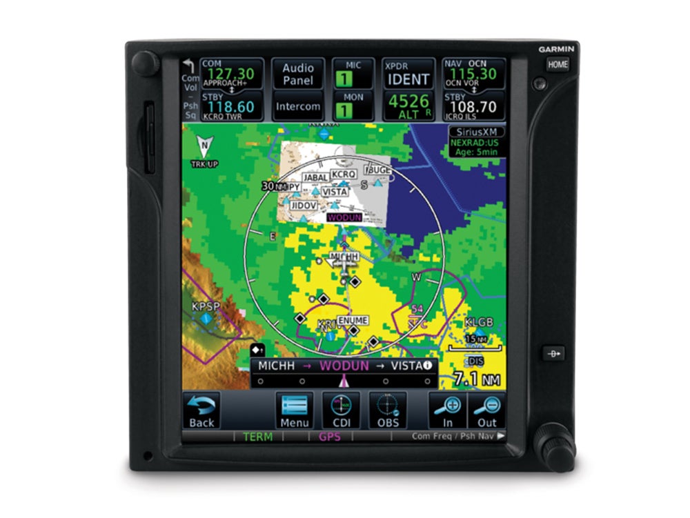
FIS-B weather products such as lightning, cloud tops, turbulence, icing, graphical AIRMETs and center weather advisories are now available on the GTN650/750. Courtesy Garmin
Gemini Sparkle

Key Takeaways:

  • The latest Garmin GTN 650/750 software update introduces new FIS-B weather products like lightning, cloud tops, turbulence, and icing when used with a compatible ADS-B In receiver.
  • Pilots can now view a selected altitude intercept arc on the moving map when paired with a Garmin Primary Flight Display (PFD).
  • The update provides enhancements for SiriusXM aviation weather customers, allowing alternation between base and composite reflectivity NEXRAD imagery.
  • Additional features include VFR flight plan editing for G3X Touch users and advisory vertical guidance (LNAV+V) for LNAV approaches at non-SBAS airports.
See a mistake? Contact us.

When pilots install the latest Garmin software update and use a compatible ADS-B In receiver, they can view new FIS-B weather products on the moving map display of the GTN 650/750. The new weather products include lightning, cloud tops, turbulence, icing (current and forecasted), graphical AIRMETs and center weather advisories (CWA).

When these Garmin units are paired with a G3X Touch flight display in experimental/amateur-built aircraft, pilots can also edit VFR flight plan information. Additionally, the GTN 650/750 can display a selected altitude intercept arc on the moving map when installed with a Garmin primary flight display (PFD), such as the G500 TXi/G600 TXi, G500/G600 or G3X Touch. When pilots input a preselected altitude on the PFD, the selected altitude arc will indicate where the aircraft will arrive at that particular altitude.

For SiriusXM aviation weather customers, pilots have the option to alternate between base reflectivity and composite reflectivity NEXRAD weather radar imagery. When SiriusXM aviation weather or FIS-B weather cannot be displayed on the GTN 650/750, the “no coverage” area of weather is transparent so pilots can still view airports, base map information and more. Pilots operating into airports not served by satellite-based augmentation system (SBAS) can receive advisory vertical guidance (LNAV+V) while flying LNAV approaches with the GTN 650/750.

The GTN software upgrade is available immediately from Garmin authorized dealers for hundreds of aircraft makes and models at no charge. However, a dealer installation charge may apply.

Rob Mark

Rob Mark is an award-winning journalist, business jet pilot, flight instructor, and blogger.

Ready to Sell Your Aircraft?

List your airplane on AircraftForSale.com and reach qualified buyers.

List Your Aircraft
AircraftForSale Logo | FLYING Logo
Pilot in aircraft
Sign-up for newsletters & special offers!

Get the latest stories & special offers delivered directly to your inbox.

SUBSCRIBE



