











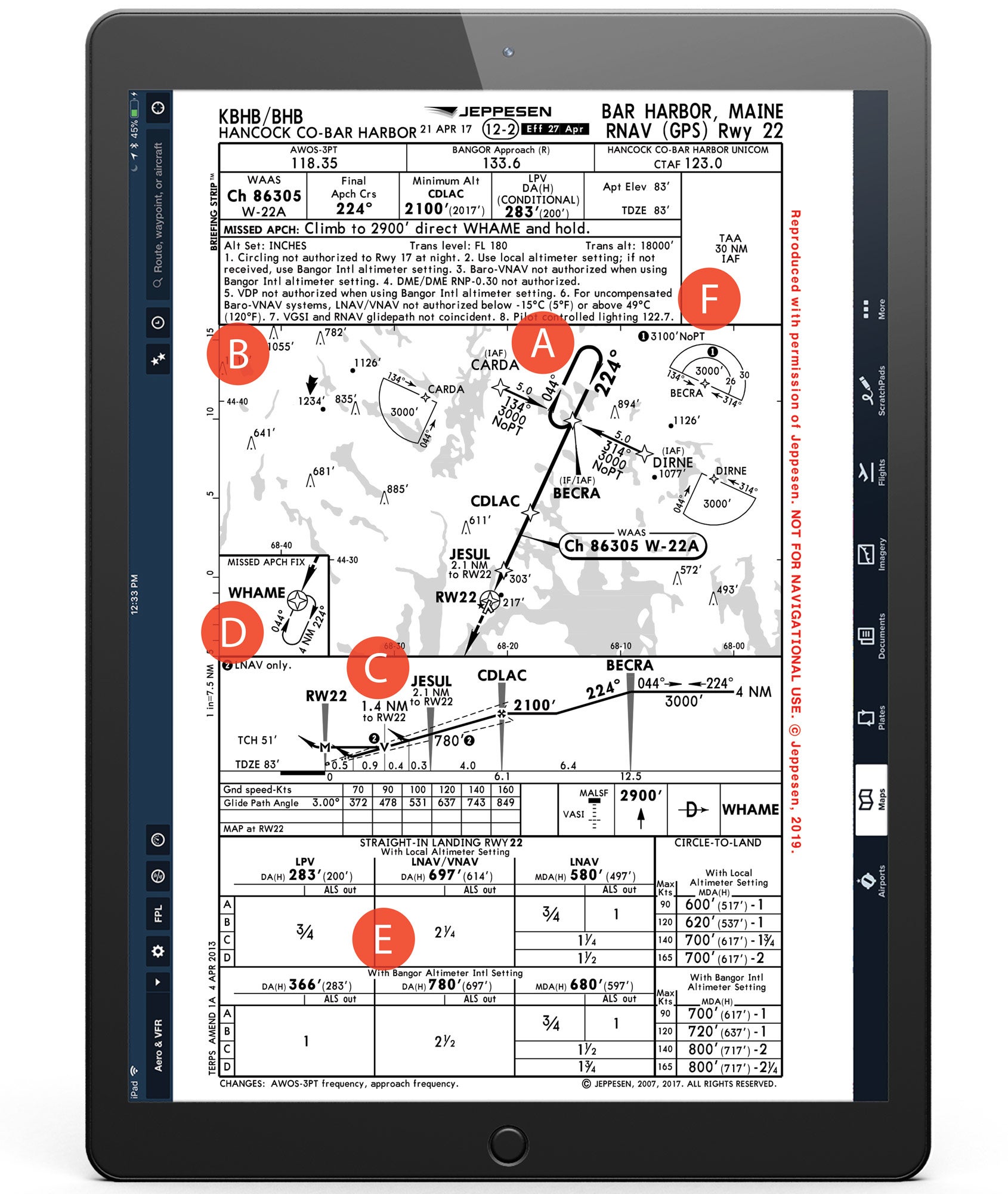
Whether you’re flying to the Maine coastline to add your name to the list of the 3 million annual visitors to Acacia National Park or to try to decide which restaurants really are the 10 best for lobster in the region, you might come face to face with the RNAV (GPS) Runway 22 for an approach into Hancock County-Bar Harbor Airport (KBHB).
Chart Wise: Bar Harbor RNAV (GPS) RWY 22

Key Takeaways:
- The RNAV (GPS) Runway 22 approach at KBHB uses a T-Bar design for initial fixes and features 4-nm legs for missed approach holding patterns, common in modern GPS approaches.
- Pilots must be aware of crucial distinctions, such as non-coincidental visual and instrument glideslopes, and differing step-down minimums applicable only to LNAV (non-precision) approaches.
- Key operational considerations include a significant increase in landing minimums if the local altimeter setting is unavailable, and using a specific frequency (122.7) for pilot-controlled lighting.
Key takeaways sponsored by Aviator Pro | Start Your Training ->
See a mistake? Contact us.