











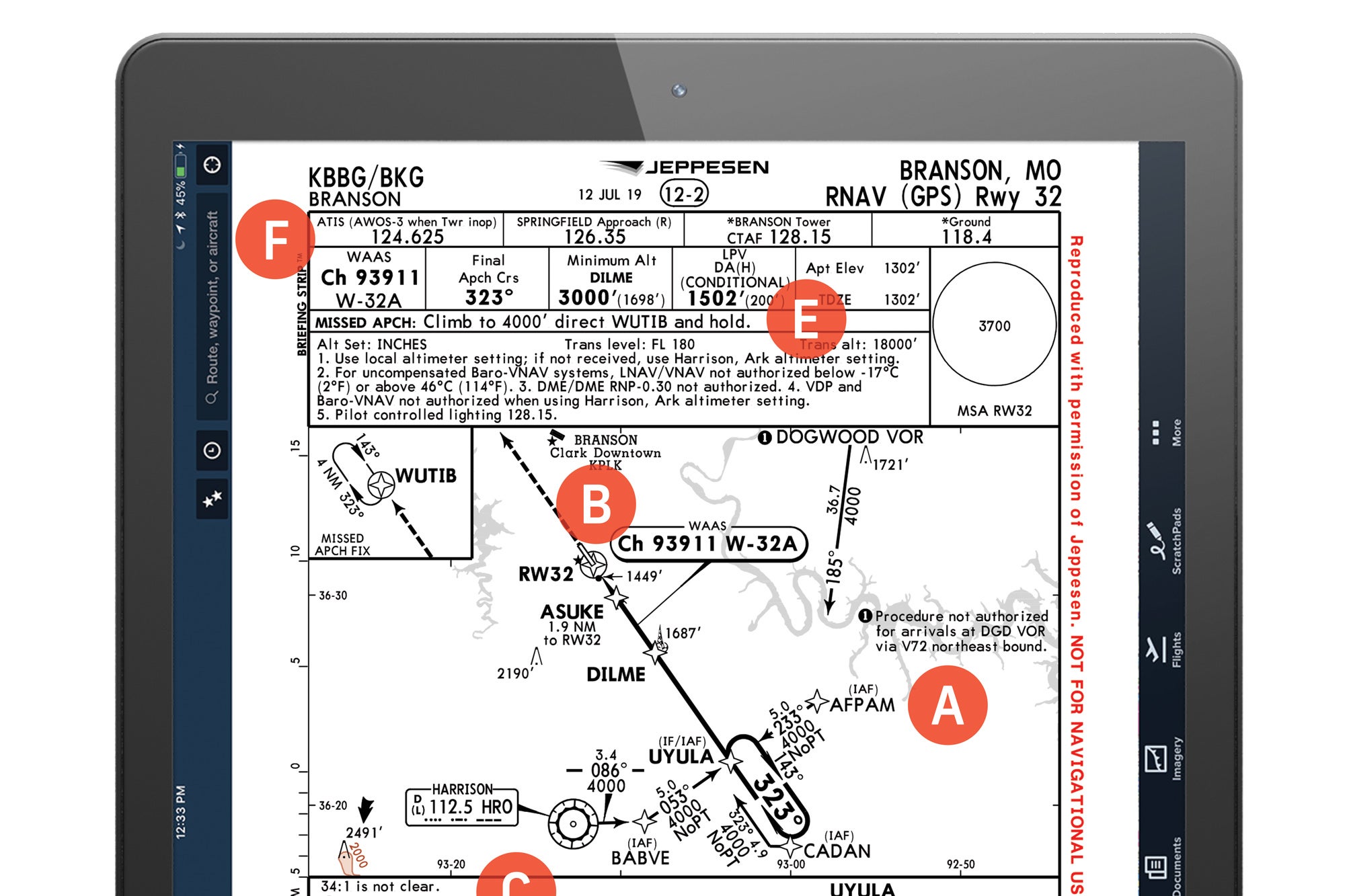
Until the recent slowdown in travel because of the COVID-19 virus, Branson, Missouri, was a top destination in the Ozarks for families with kids, boasting a host of live shows, restaurants, golf courses, museums, hiking trails and much more. While everyone hopes the lull in flying to getaways such as Branson will be short, the current downtime offers pilots a perfect opportunity to tune up their IFR chart-reading skills. This time, we offer up the RNAV (GPS) Runway 32 approach into Branson’s privately owned, public- use airport (KBBG), sporting a 7,140-foot runway where most of the traffic is itinerant, not local flight training.
Chart Wise: Branson RNAV (GPS) RWY 32

Key Takeaways:
- Pilots should leverage initial approach fixes (IAFs) for potentially more efficient or lower altitude arrivals and meticulously identify KBBG to avoid accidental landings at the similarly aligned M. Graham Clark Downtown Airport (KPLK).
- For non-WAAS aircraft, strict adherence to LNAV MDA minimums and specific step-down altitudes is critical, as a "suggested glideslope" can lead below obstacle clearance.
- The approach mandates calculating precise descent rates based on groundspeed to maintain the 3-degree glidepath, rather than assuming a standard 500 feet per minute.
- Pre-planning ATC frequencies and understanding the straightforward, straight-ahead missed approach procedure are key components for a smooth KBBG approach.
Key takeaways sponsored by Aviator Pro | Start Your Training ->
See a mistake? Contact us.