











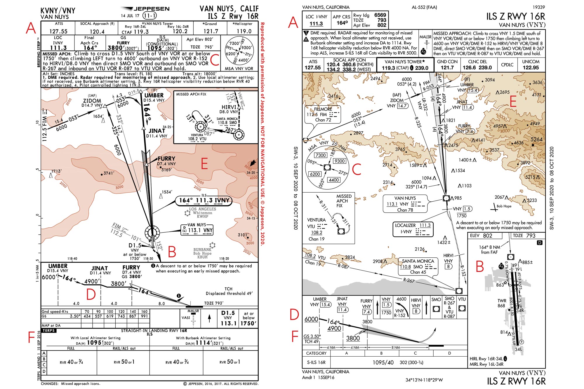
If you’re an active IFR pilot or training to become one in the US, you have a choice of two instrument approach-plate providers. One is Jeppesen (now within Boeing Global Services), and the other is the US government, which provides plates known as digital terminal procedure publications—and often known to pilots by two outdated terms: National Aeronautical Charting Office or National Ocean Service plates, named after the offices that once produced them. Most airline and corporate pilots tend to use Jeppesen plates rather than the d-TPPs, though, these days, either can be made available on iPads, tablets and other airborne flight management systems. A Jeppesen subscription costs more than access to comparable d-TPP content. Generally, the majority of necessary IFR approach information is contained on a single Jeppesen chart, whereas the government plates require the pilot to check a few different locations, for example, when it comes to obstacle departure procedures. This month, we’re taking another look at the Van Nuys ILS Z Runway 16 Right chart as presented by these two different providers.
Two Kinds of Instrument Approach Charts

Key Takeaways:
- IFR pilots in the US primarily use either Jeppesen or government-provided d-TPP instrument approach plates, with Jeppesen typically being more expensive but often consolidating key information more effectively.
- The two plate types differ significantly in layout and data presentation, including the structure of briefing strips, placement of airport diagrams and Minimum Sector Altitudes (MSAs), graphical depiction of step-down altitudes, terrain information, and approach speed categories.
- While pilot choice often comes down to personal preference, it is critical for pilots to thoroughly understand the distinct features and data organization of each plate type before an approach, especially if regularly switching between providers.
Key takeaways sponsored by Aviator Pro | Start Your Training ->
See a mistake? Contact us.

